Get Lost Mountaineering
You are here: Ireland » South West » Iveragh Peninsula
MacGillycuddy's Reeks - Full Traverse
MacGillycuddy’s Reeks – Full Traverse from Cronin’s Yard
Start/Finish
Cronin’s Yard at the start of the Hag’s Glen. From Killarney, take the road towards Killorglin. Take the first left after the Fossa camp site, signposted Gap of Dunloe, and follow the meandering road. Do not turn off for Gap of Dunloe. When a crossroads is reached with petrol pumps and Kissane's store, the turning for Cronin’s Yard is within 200 m on the left. It is signposted. There is a small parking fee, 2 Euro in 2012. There is a cafe which is not always open but if it is, it is worth going in after the walk. The café has toilets and showers which are not available if the café is closed. The family running the café are very friendly and often have satellite TV on.
Distance/Time
19 km Approx 12 - 13 hours
Peaks
Cruach Mhor, 932 m, V 841 847 (Irish National Grid System)
Big Gun, 939 m, V 841 845.
Cnoc na Peiste, 988 m, V 836 842.
Maolan Bui, 973 m, V 832 838.
Cnoc an Chuillin, 958 m, V 823 833.
Caher, 1001 m, V 7931 838.
Caher NW Top, 975 m, V 790 840
Carrauntoohil, 1039 m, V 803 844.
Knockoughter, 959 m, V 801 847.
Beenkeragh, 1010 m, V 801 853. Irish OS Discovery Series Map 78 (1:50000)
Introduction
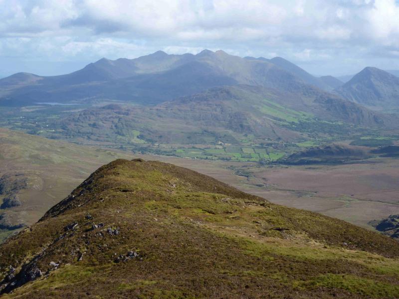
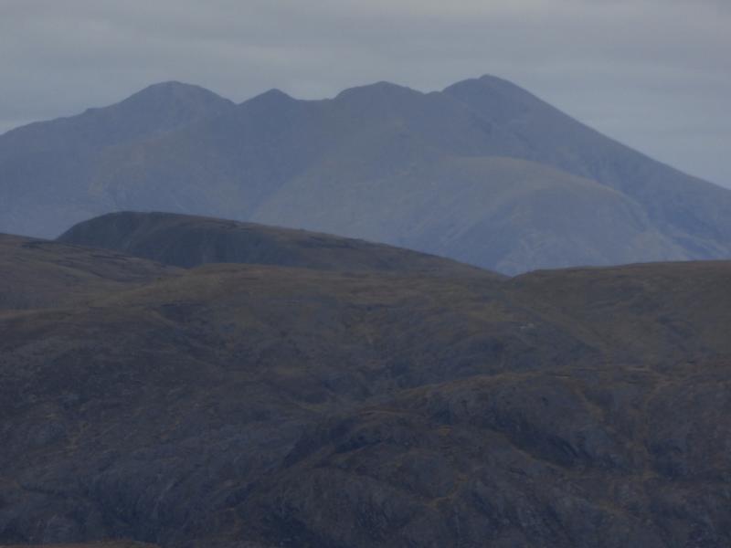
MacGillycuddy’s Reeks are the highest mountain range in Ireland and may well be the longest ridge over 3000 feet in the British Isles. The reeks are essentially “Y” shaped with Carrauntoohil (highest peak in Ireland) at the junction. This walk takes in all of the Reeks tops above 3000 ft (914.4 m) which are often called “The Irish Munros”. There are 13 Irish Munros of which 10 feature in this walk. There is some sensational scrambling (mostly avoidable) between Cruach Mhor and Cnoc na Peiste and on the Carrauntoohil to Beenkeragh ridge Choose a good day as the Reeks can often be in cloud. Navigation is relatively straightforward apart from the descent from Beenkeragh at the end of the day but if you need to, you should be able to easily reset your GPS to the Irish National Grid System.
Route
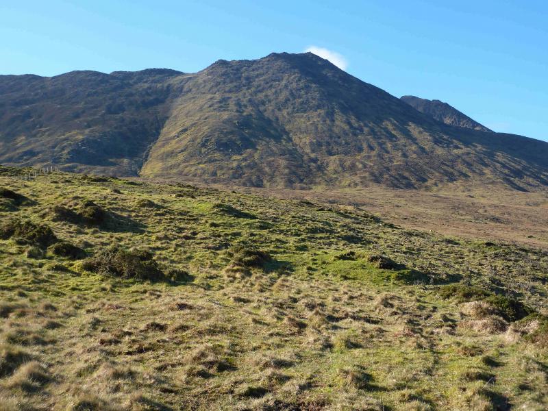
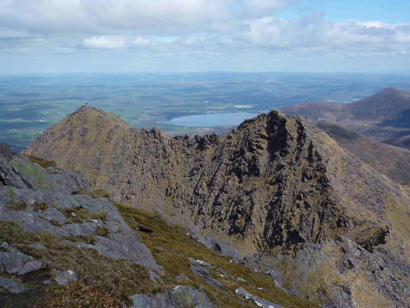
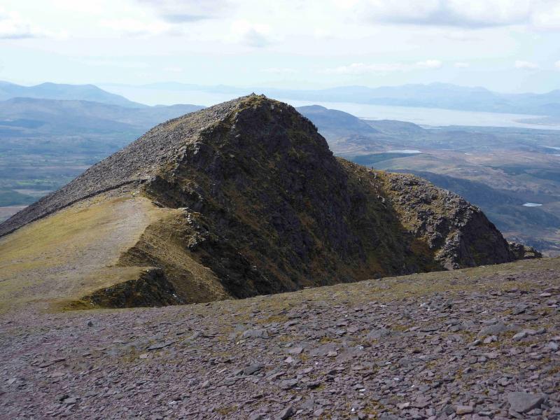
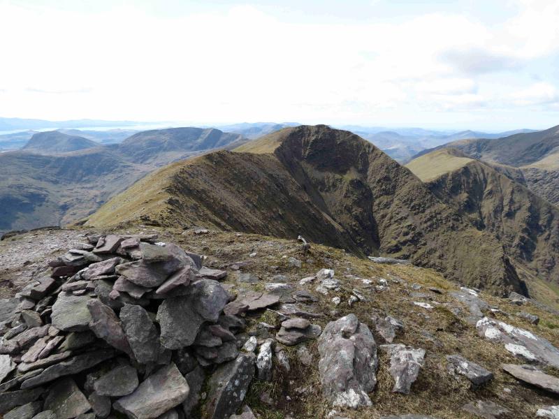
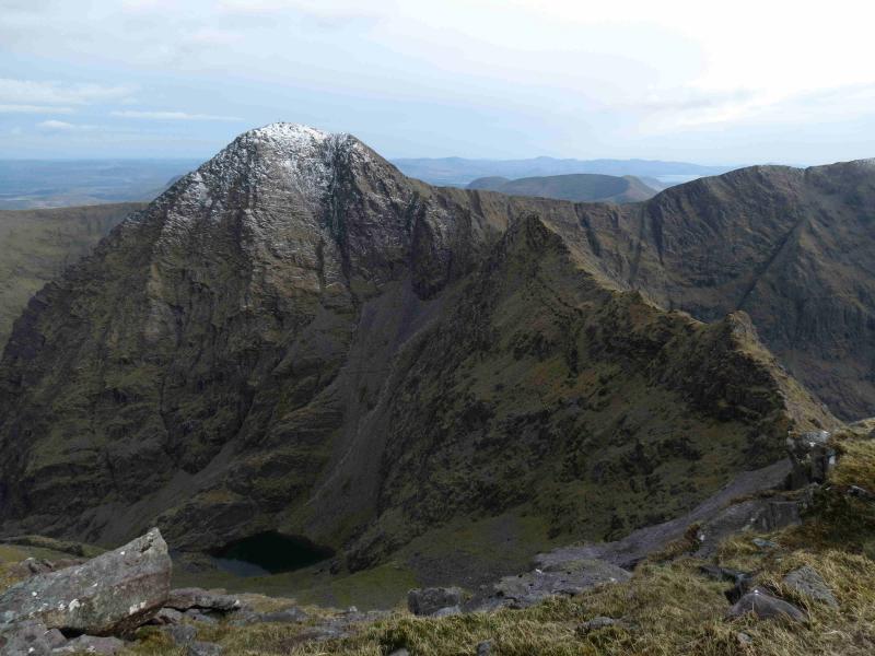
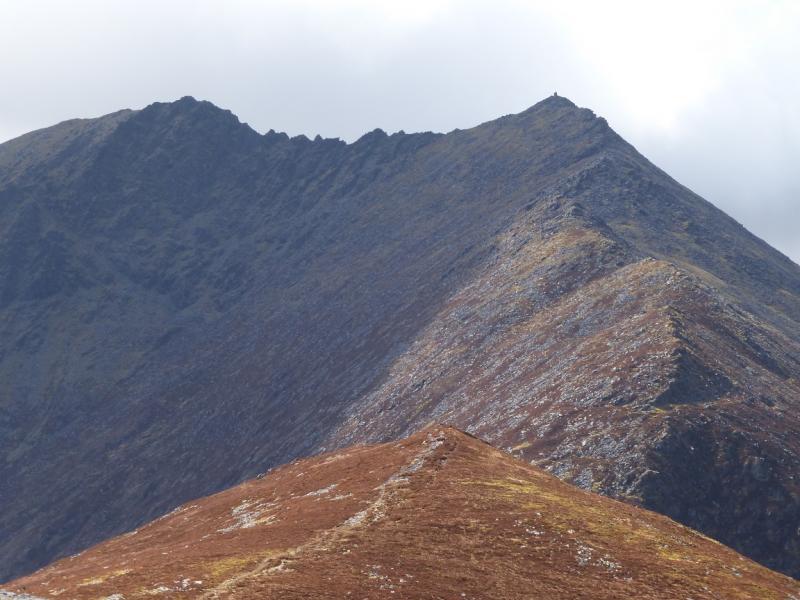
(1) From Cronin’s Yard walk back along the road for about 150 m and turn right, following the road up the hill then right. Go to the end of the road. Go through the gate directly in front, into a field, with a fence on your right. Keeping the fence on your right, walk ahead, then left along the edge of the field. Cross into the next field then exit on to open land. Aim for the fence ahead, on a level ridge, and follow it up a moderately steep grassy gully to emerge on a col. Turn right, W, up a path on a well defined ridge, over the shoulder of Cruach Bheag, then up more steeply, with scrambling opportunities to the huge “square” summit cairn of Cruach Mhor, 932 m. It is not really a cairn at all but a tall structure which contains a small religious grotto on its N side. This “cairn” is visible from the start on a clear day, making the summit very distinctive.
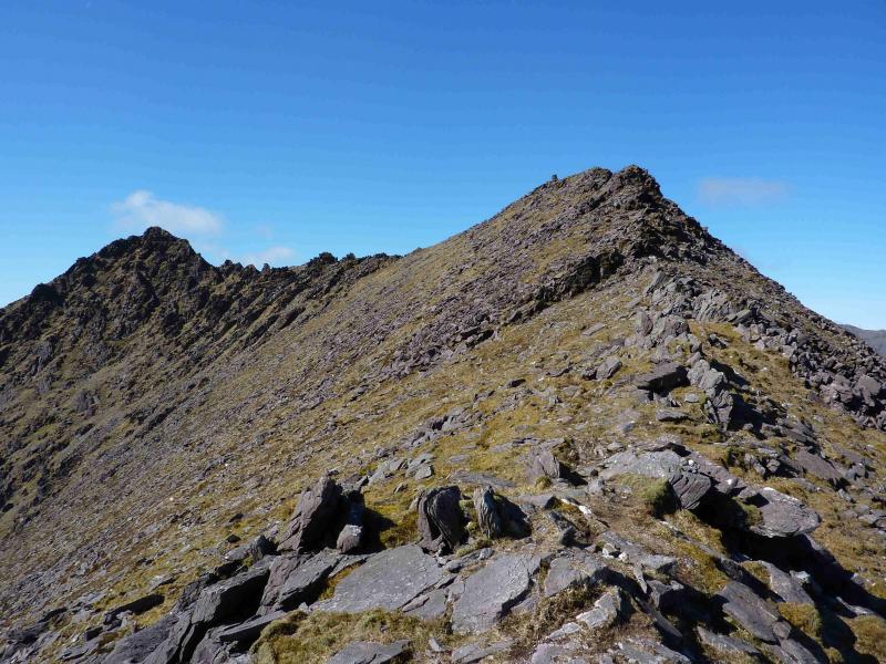
(2) Descend S to a col then ascend N. This section of ridge is very rocky. If the crest is adhered to, there are towers and hard scrambling sections but most of these can be avoided, often on the right, N. Eventually reach the summit cairn of the Big Gun, 939 m, which is essentially a large rocky pinnacle.
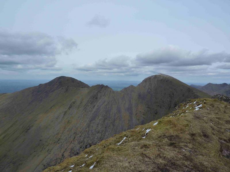
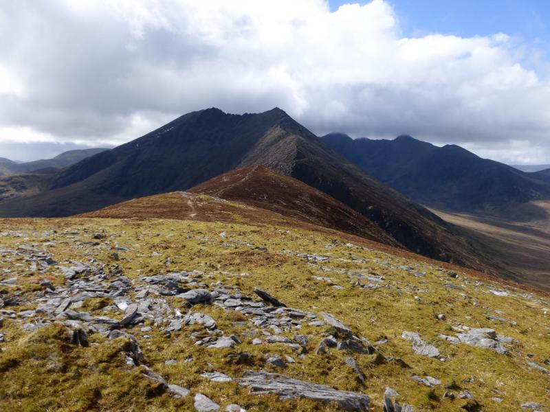
(3) From here to the next summit, the ridge is still very rocky. Descend SW on a path to a col then ascend to the large summit cairn of Cnoc na Peiste. The rocky difficulties are now virtually over.
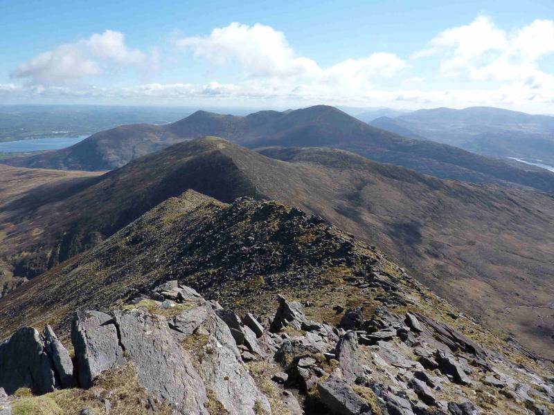
(4) Descend grassy slopes, SSW, on a good path to a col then ascend SW to the summit cairn of Maolan Bui, 973 m.
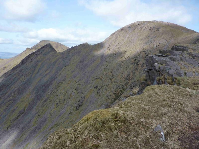
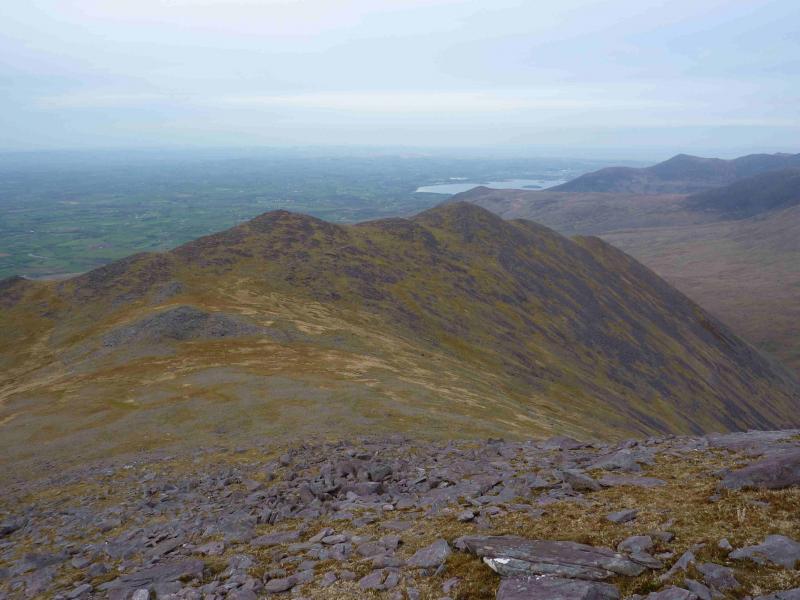
(5) Descend SW on a good path to a grassy col followed by a short ascent to an unnamed top, 926 m, with a small cairn. Descend a little way SW then ascend, also SW but gradually curving around to NW, to reach the summit cairn of Cnoc an Chuillin, 958 m.
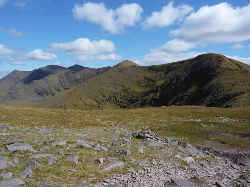
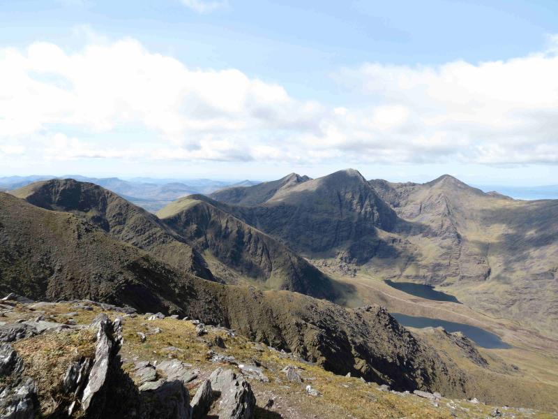
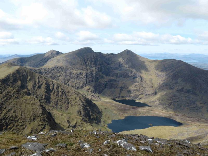
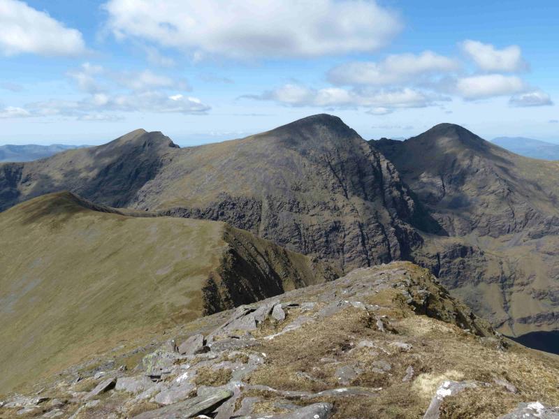
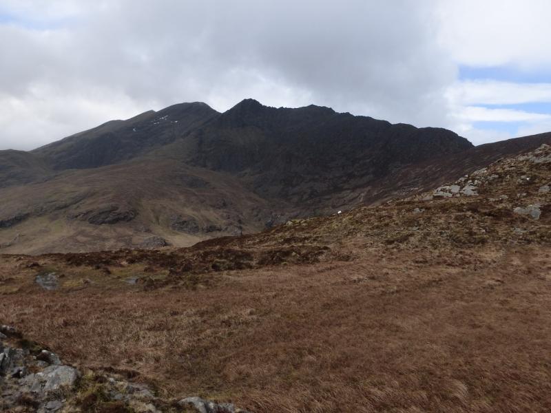
(6) Continue, descending WNW, on a good path, to the col at the head of a gully due S of Lough Callee. From here, the edge on the right, N, can be followed up to a fence and onto a flat top or the more obvious path which traverses to the S of this top. On the flat top, the grassy ridge turns WSW, dipping slightly. Continue to follow the edge (now to W). At a slight dip is a cairn. Continue on the ridge and descend roughlt NW off the end on an obvious but peaty and boggy path to reach a col which is the top of the badly eroded Devil's Ladder. If necessary, this can be descended, with great care, to the Hag's Glen. However, if one is going to cut the day short, a better descent is from the cairn on the previous flat topped ridge which is a well defined path which zig-zags down to the Hag's Glen track. To continue the route, ascend the very obvious path above the col which is the “tourist route” to Carrauntoohil. Leave this path when the pointed prow of Caher comes into view, at about 900 m and traverse W, on easy slopes, to join the Carrauntoohil to Caher path close to the col between the two. In mist, it may be necessary to aim to join the above path nearer to the summit of Carrauntoohil. Once on the path, follow it along the edge of the corrie and up to the small cairn which marks the summit of Caher, 1001 m.
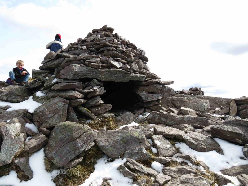
(7) Descend roughly NW on an obvious path to a col then ascend up to medium cairn which marks the summit of Caher NW top, 975 m. There is also a stone “igloo” next to the summit cairn.
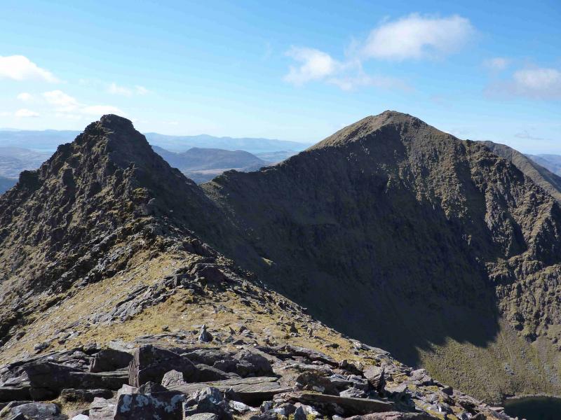
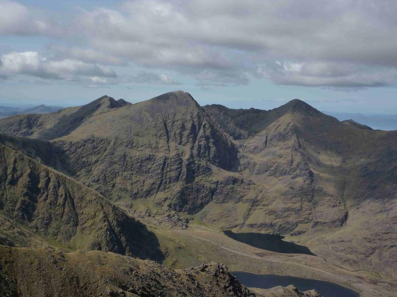
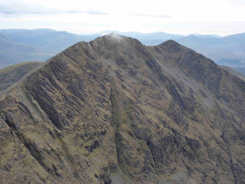
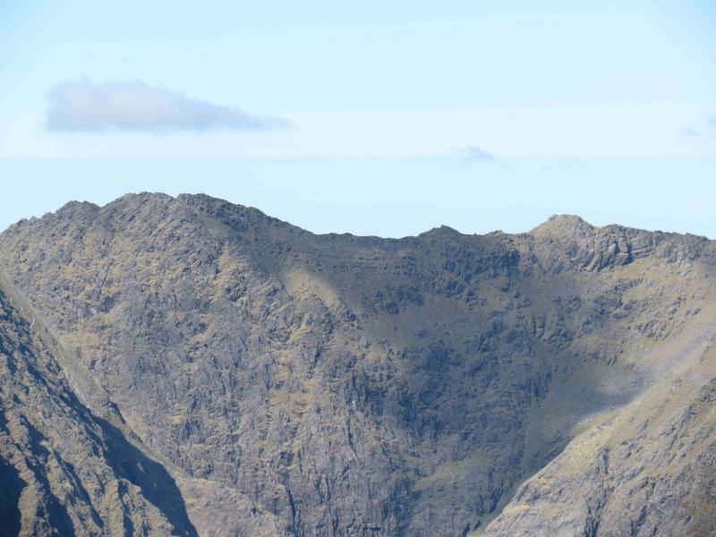
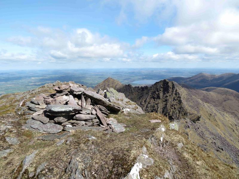
(8) Retrace back over Caher to the col below Carrauntoohil following the same path which then climbs, swinging NE, up mainly grassy slopes towards the summit of Carrauntoohil. The path follows the left hand edge and turns right just after an obvious cairn (but before a much flatter cairn on a flat spot) about 100 m before the summit of Carrauntoohil, 1041 m, the highest point in Ireland, where there is a large cross made of girders and a walled shelter plus a trig point. There can be no doubting where you are!
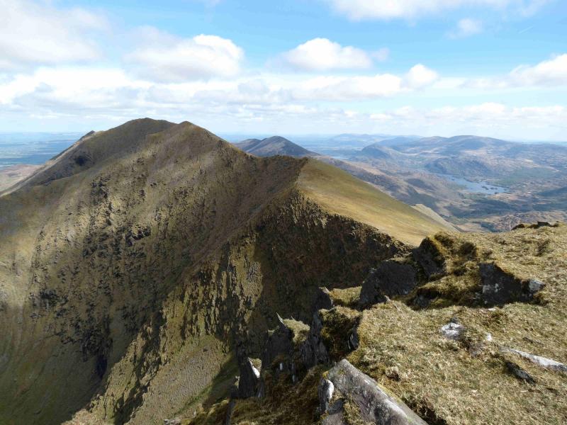
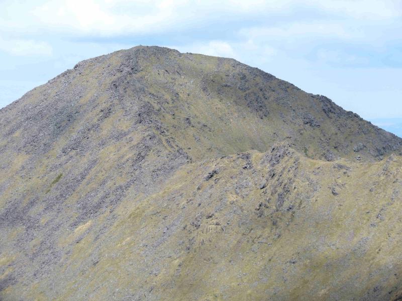
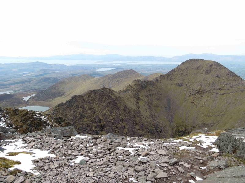
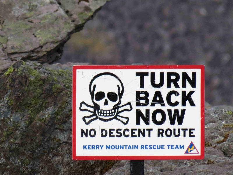
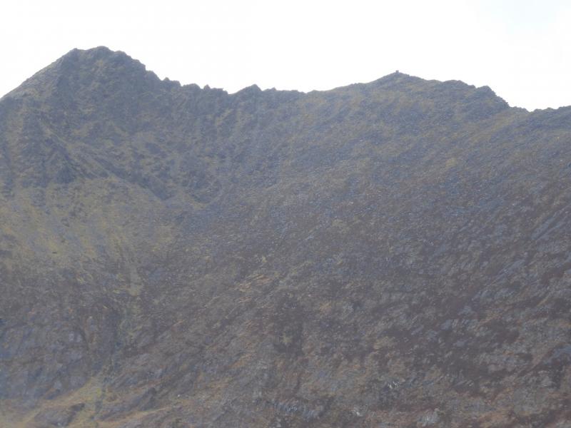
(9) This is the part which can catch many people out but it is quite straightforward if you keep your wits about you! Retrace the 100 m and go to the flatter cairn (right at the turning as opposed to returning to Caher which is left) near to which there are two distinctive paths going down. Follow either down (more appear), descending about 100 m until the paths converge and level off along a grassy ridge where there is a very distinctive path going down a grassy gully into a corrie with a small lake. This gully path is Brother O’Shea’s Gully. It is not your route today. Note that you may well have encountered another short level section (shoulder) just before this one but there is no path down a grassy gully here. The top of Brother O’Shea’s Gully is a small grassy col. Beyond the top of O’Shea’s Gully is an obvious peak called Knockoughter, 959 m. Follow the path along the narrow ridge, NW to Knockoughter (no cairn) then swinging round to NE to climb Beenkeragh. The narrow ridge is very rocky but there is a path to follow although some easy scrambling cannot be avoided without descending some way down on W side. The path criss-crosses the crest of the ridge. There are quite a few tops. Knockoughter is slightly nearer to Carrauntoohil than Beenkeragh. If in doubt, ascend each top! After about 2 km, the ridge starts to climb and becomes less rocky to reach the large summit cairn of Beenkeragh, 1010 m, which is on the first flat spot after the climb and just before a boulder field. In clear weather, the ridge from Carrauntoohil to Beenkeragh is very obvious.
(10) The descent from Beenkeragh is long and tedious and goes through many boulder fields. Initially, head roughly NE, through the summit boulder field, aiming for the wide bealach SW of Knockbrinnea. Once on the grassy slopes, there is a faint path which goes to the summit cairn of Knockbrinnea. From here, head roughly NE then E, down stony and bouldery slopes on a reasonably well defined, but rough, ridge. When this gets very steep and craggy (not shown on the maps) then pick a way down on the right, S, of this ridge over much stony and bouldery ground, to reach the track in the Hag's Glen. Follow this back to Cronin's Yard, remembering to take the right fork at the the track junction
Notes
(a) This walk took place on 15th April, 2012.
(b) The Fossa camp and caravan site, at V 910 923 is very good and very well situated for the Killarney mountains, especially Macgillycuddy's Reeks and Purple Mountain as it is only about 3 miles from Kate Kearney's Cottage. At Fossa, there are camping and caravanning facilities as well as a hostel and static trailer vans can also be hired. For campers, there are excellent showers (small extra charge) and there is a good campers’ kitchen with tables, sinks and cooking area if you have your own cooker and pans. Gas rings are available (small extra charge). There is also a TV room. Reception is open quite late in the high season and the staff are very helpful. A computer is available for hire and there is a freezer in reception. There is a bus stop outside the site for Killarney. There is a 24 hour Tesco which is off the northern bypass (turn right at 4th roundabout then right at next). Out of high season, it can be better for 2 people to rent a trailer van than to camp separately.
Photos - Hover over photo for caption. Click on to enlarge. Click on again to reduce.