Get Lost Mountaineering
You are here: Scotland » 13 Applecross, Coulin and Torridon » Loch Torridon to Loch Maree
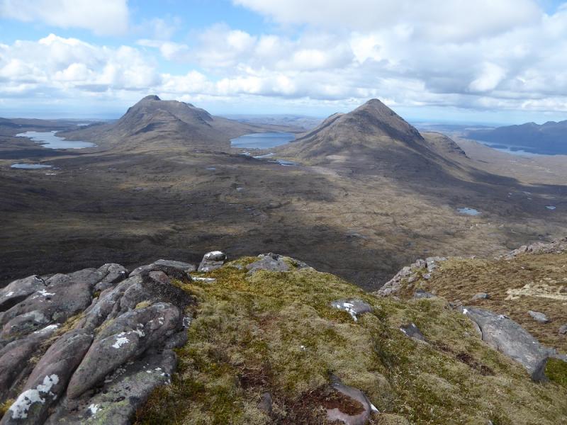
Beinn an Eoin & Baosbheinn from Green Shed by Loch Bad an Sgalaig
Beinn an Eoin & Baosbheinn from Green Shed by Loch Bad an Sgalaig
Start/Finish
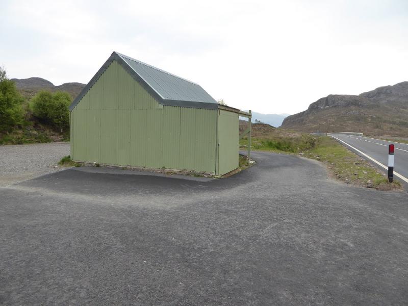
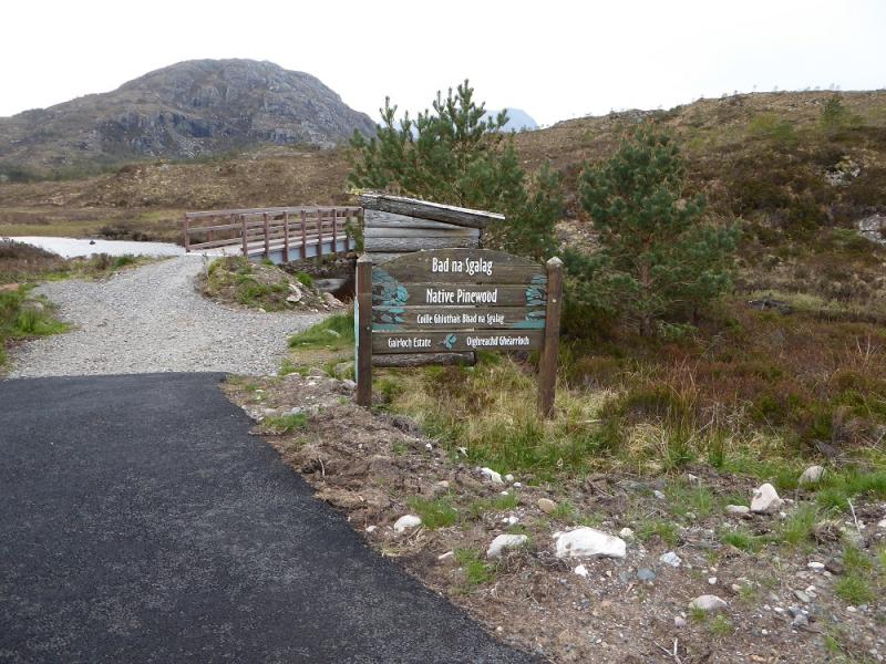
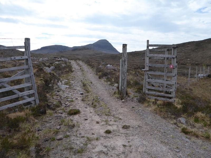
Green Shed by the small loch just to the east of the large Loch Bad an Sgalaig where there is now plenty of good parking. This is on the Kinlochewe to Gairloch A832 road. It is a fairly unmistakeable land mark! Opposite is a footbridge and information hut.
Distance/Time
25 km. About 11 hours.
Peaks
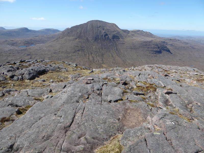
Beinn an Eoin, 855 m, NG 905 646.
Baosbheinn, 875 m, NG 870 654. OS sheet 19: Gairloch & Ullapool
Introduction
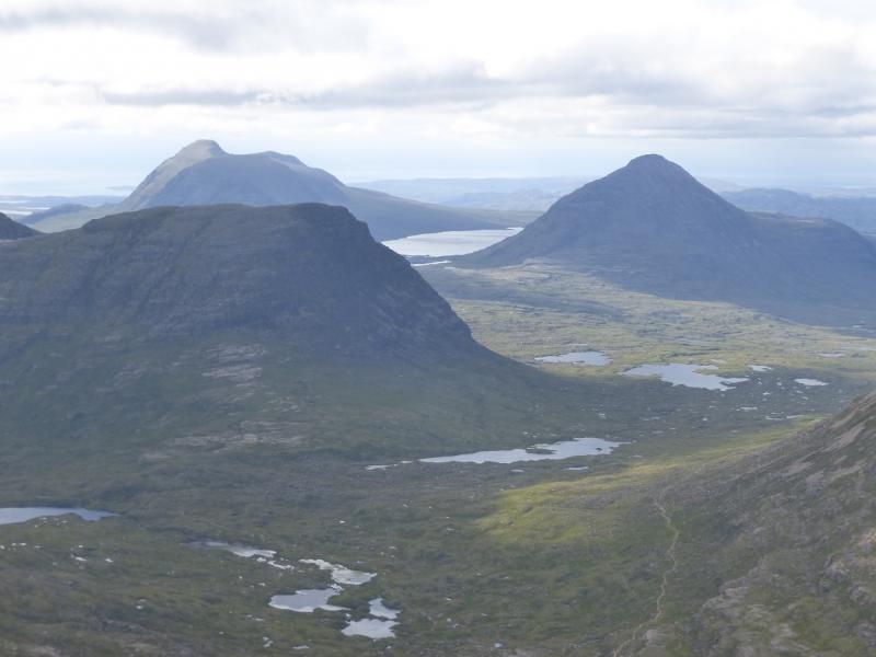
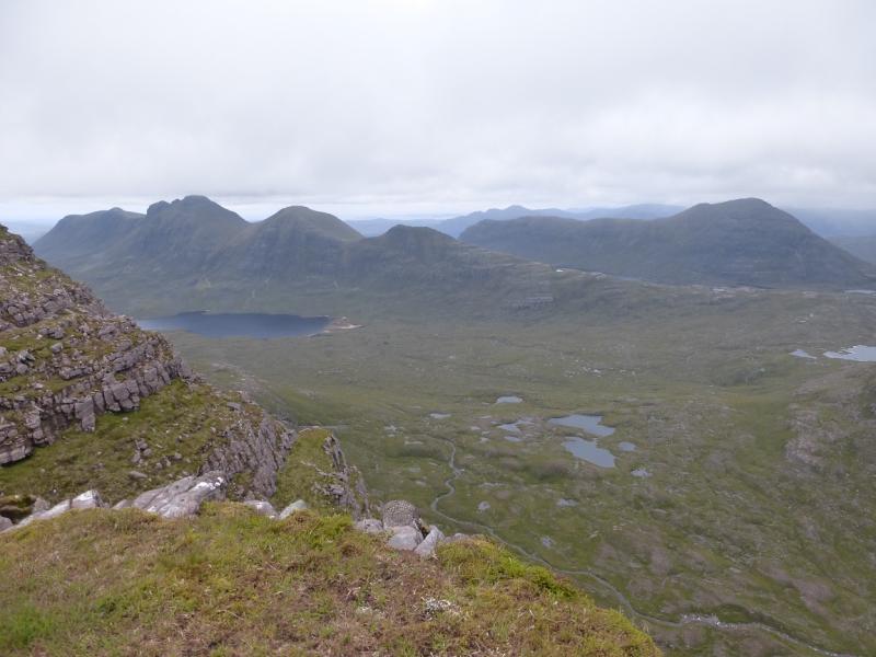
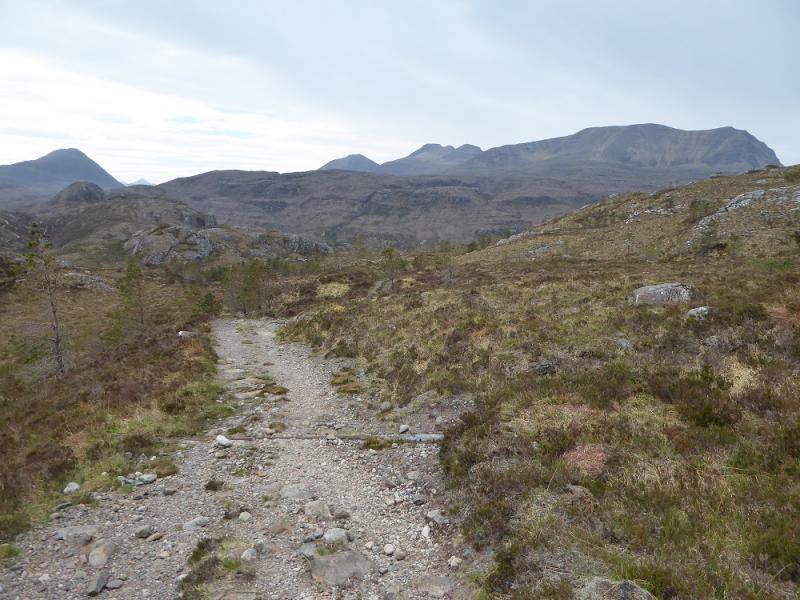
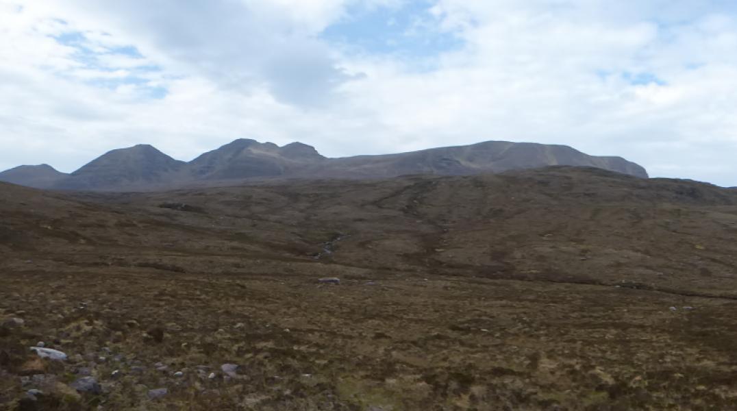
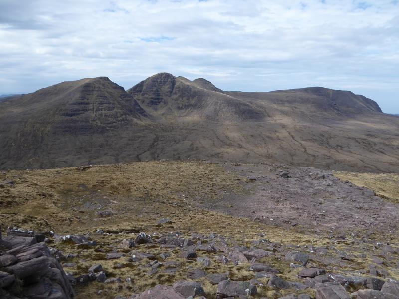
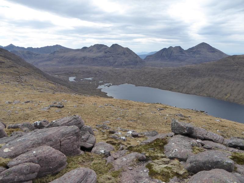
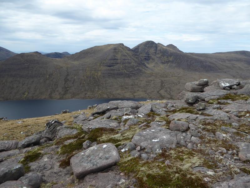
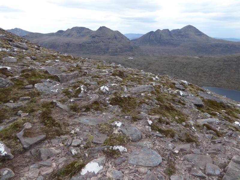
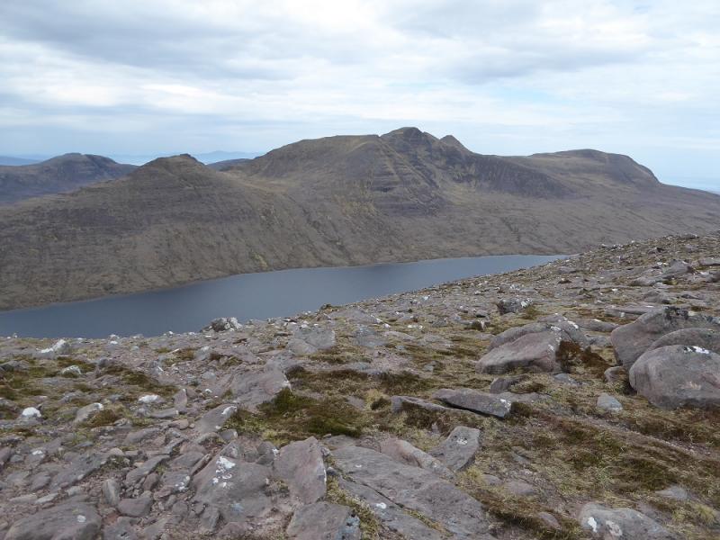
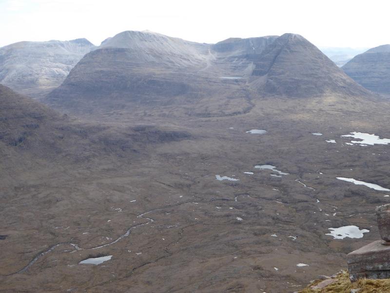
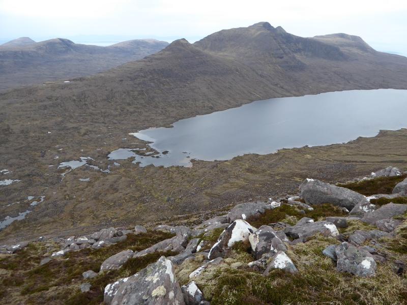
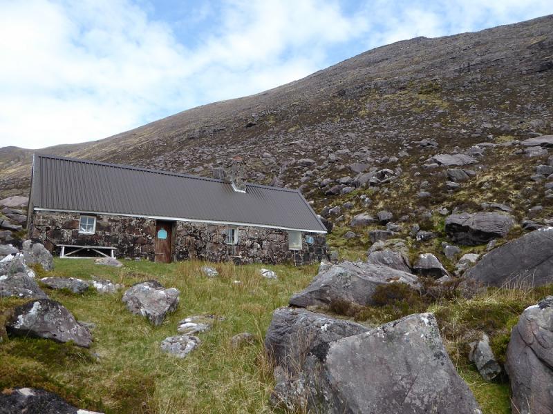
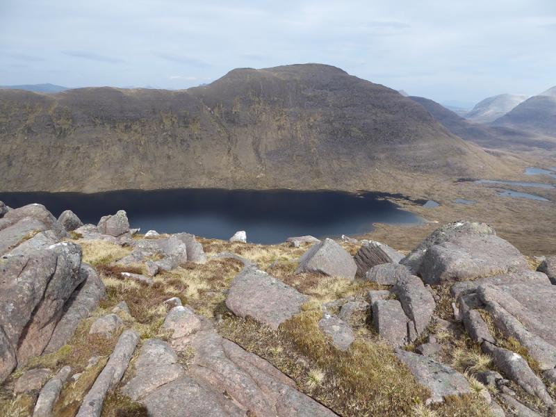
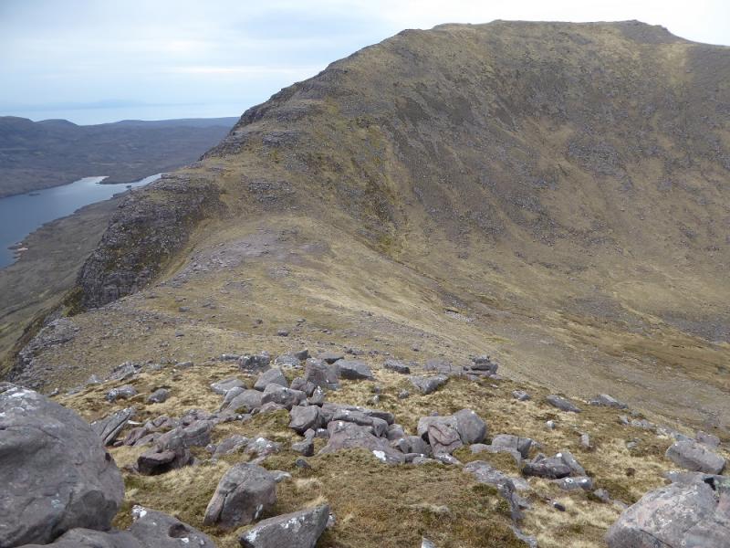
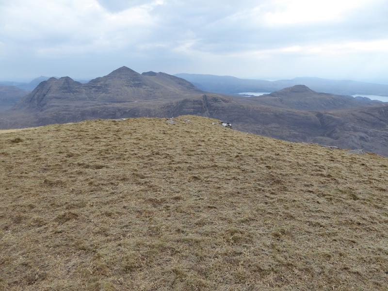
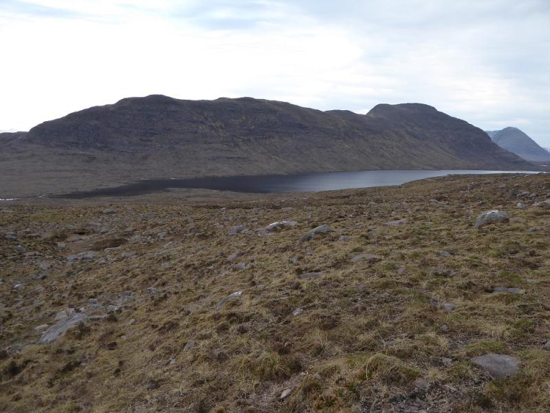
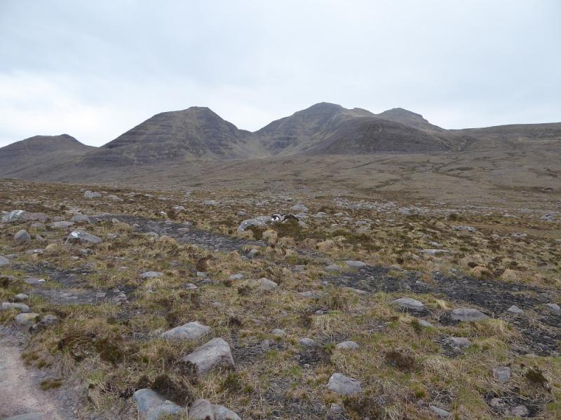
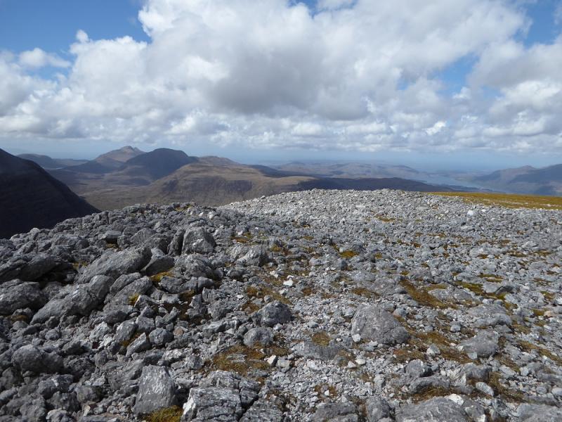
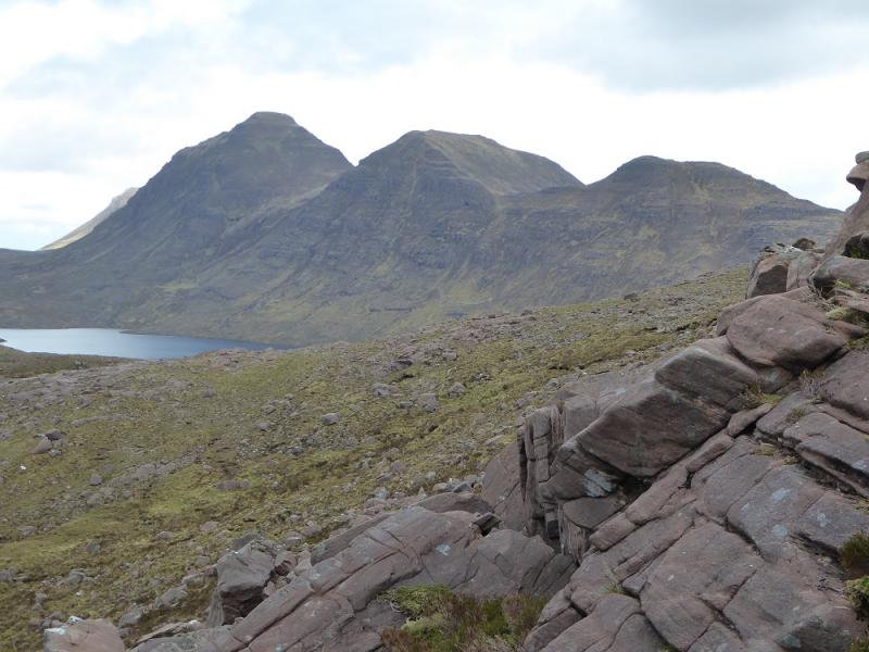
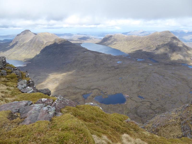
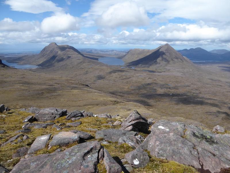
These are attractive mountains but many will find this route over strenuous and unpleasant. The track into the hills is particularly rough and stony for much of its length. 6 km each way. The descent of Beinn an Eoin is very steep and involves weaving through broken buttresses. The ascent of Baosbheinn can be soul destroying as one first ascends to top 707 before a significant loss of height to a col then a steep ascent to top 806 followed by an even greater loss of height before the final ascent up steep slopes to Baosbheinn. There are not many obvious paths on these mountains, especially lower down where the terrain can be rough and boggy. A stream on the track is crossed by stepping stones which can be under water after rain. Many guide books refer to “bridges” but they have now all been washed away! One has to cross the river below the outflow of Loch na h-Oidhche to return from Baosbheinn and this is only easy in a dry spell. The bothy at the south end of the loch, Poca Buidhe, is no longer open to the public following alleged “misuse”. An alternative less unpleasant route will be given in the notes below. Given all the negatives of this route, the views to Torridon are outstanding with Beinn Eighe, Beinn Dearg and Beinn Alligin all being close.
Route
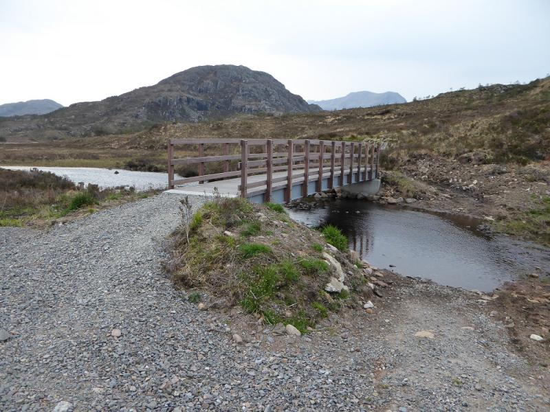
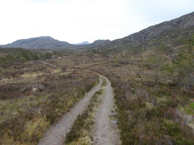
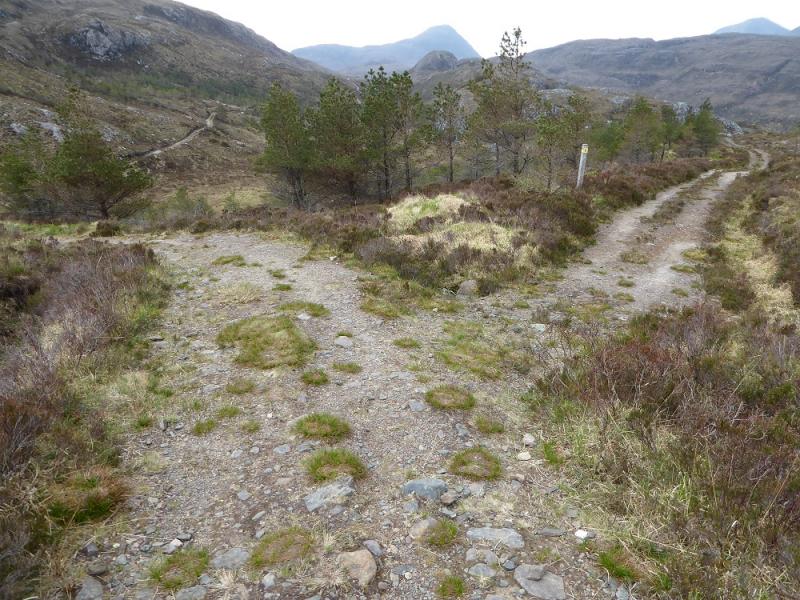
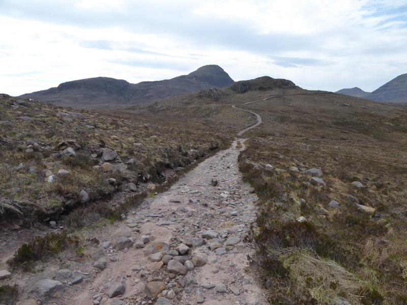
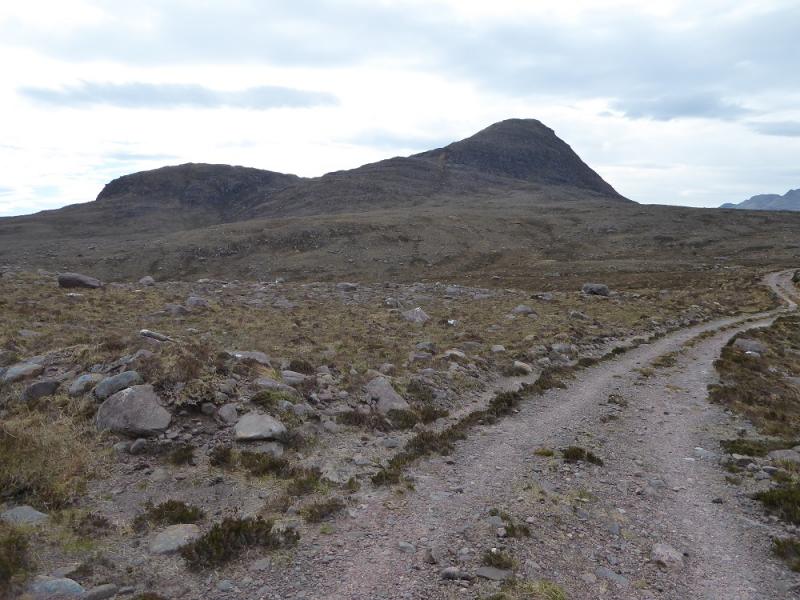
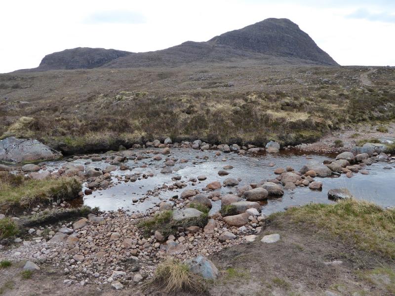
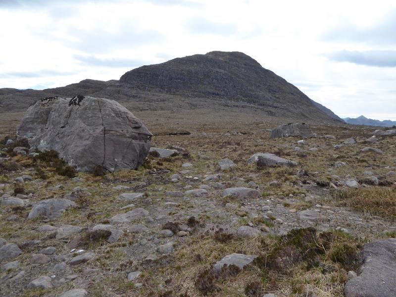
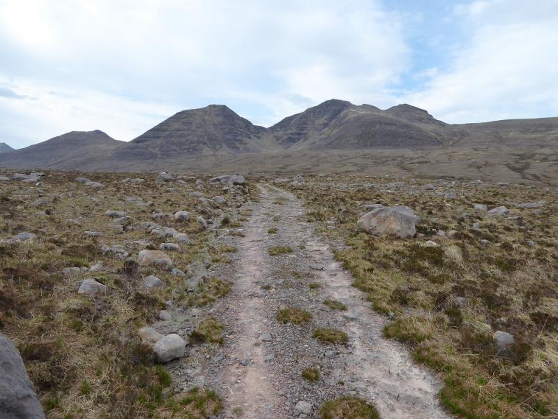
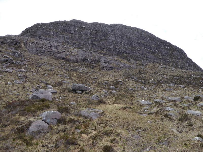
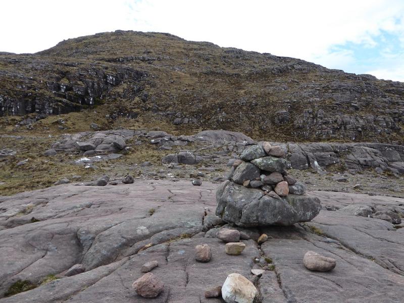
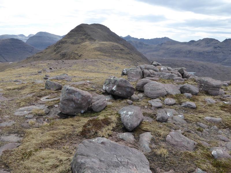
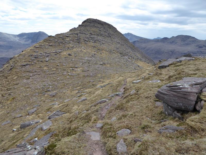
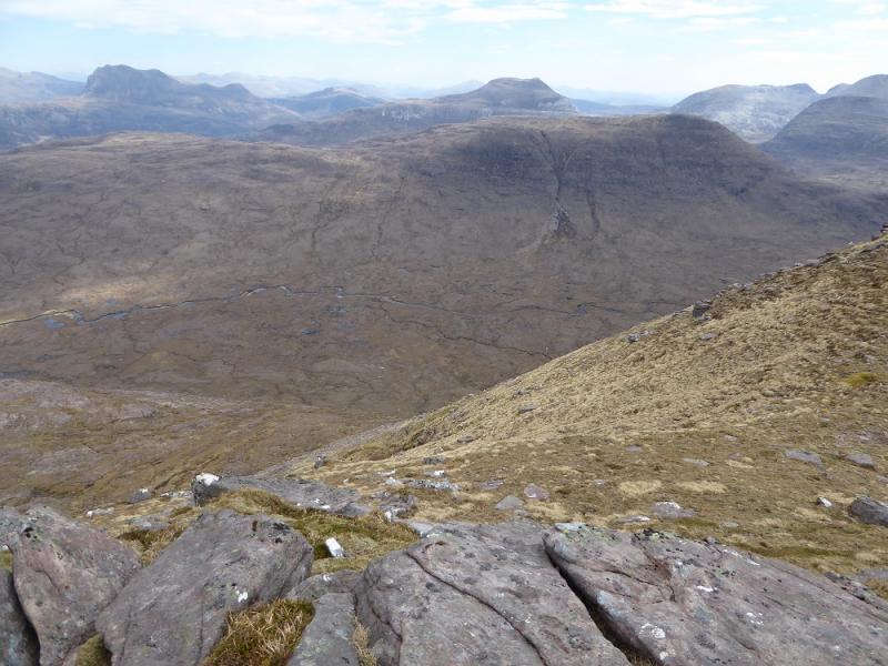
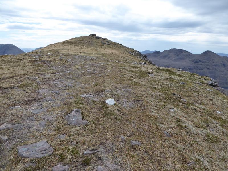
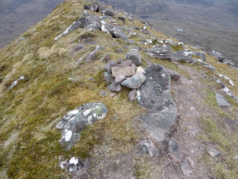
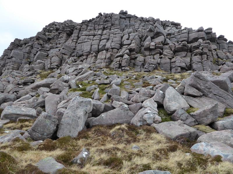
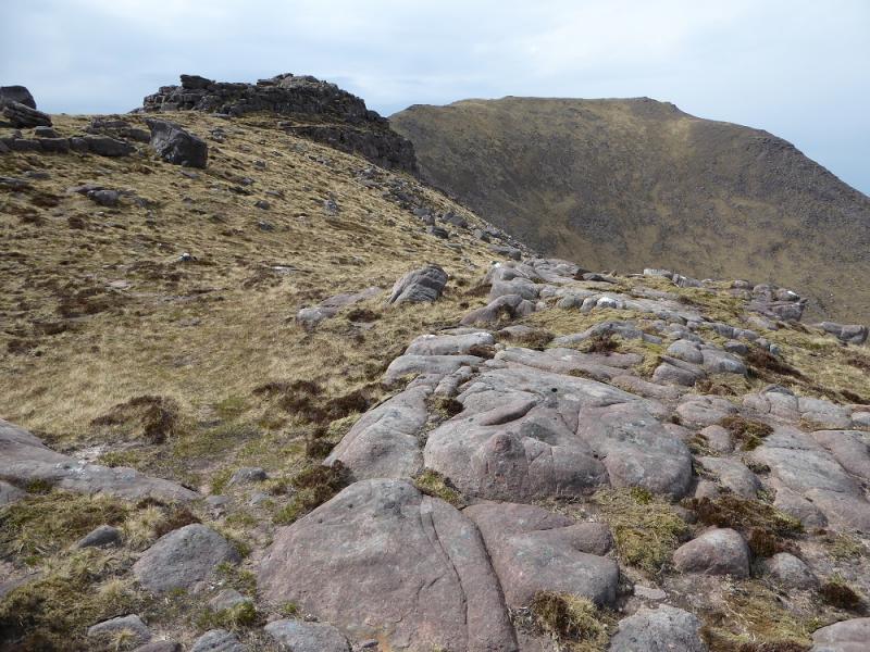
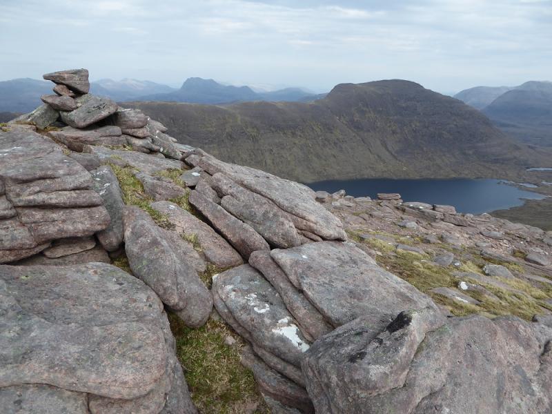
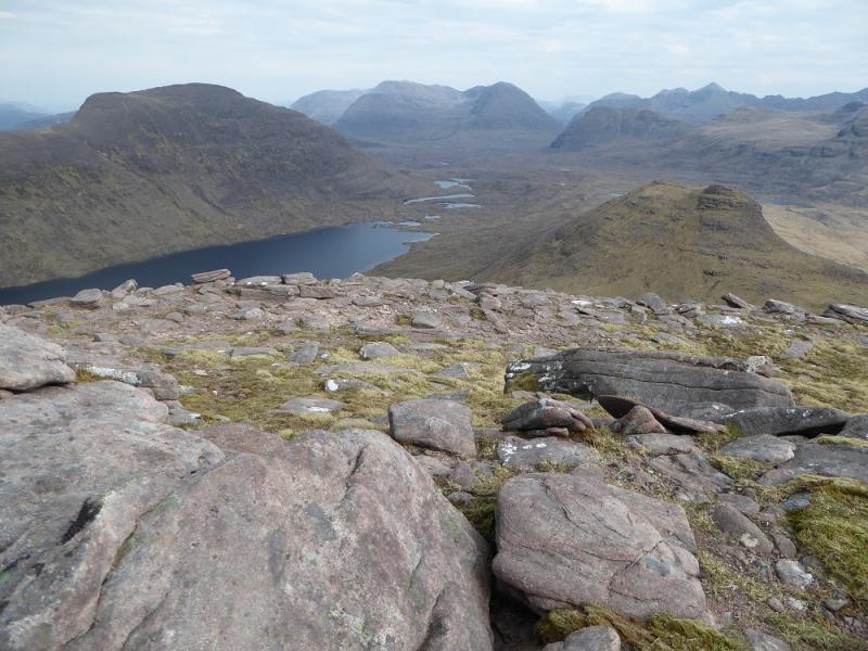
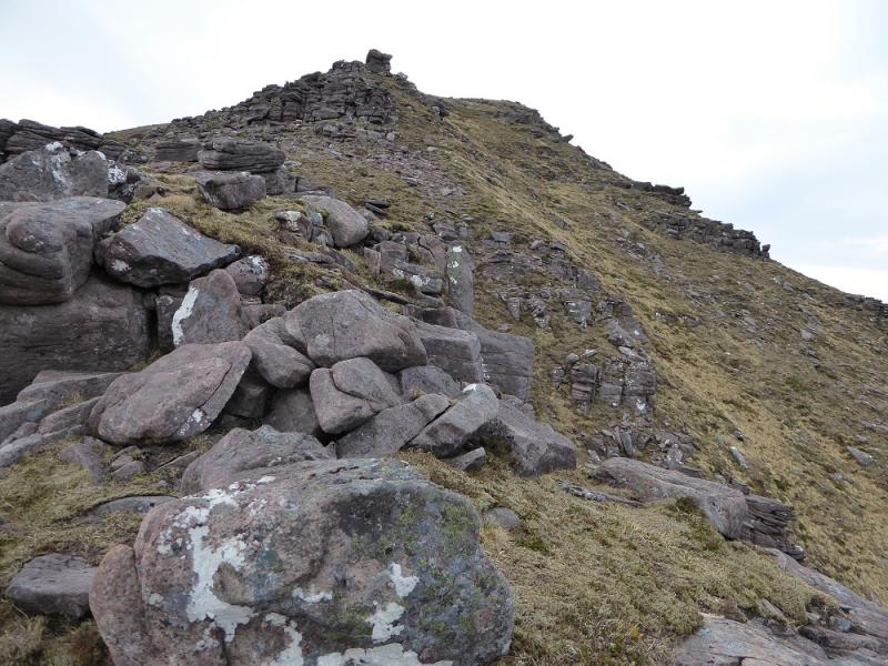
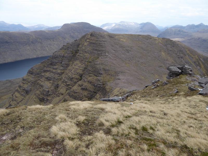
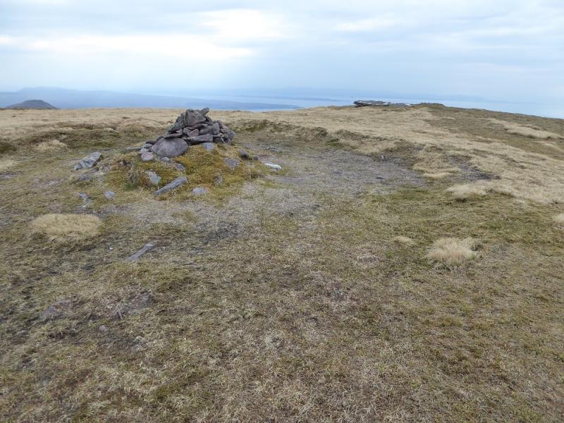
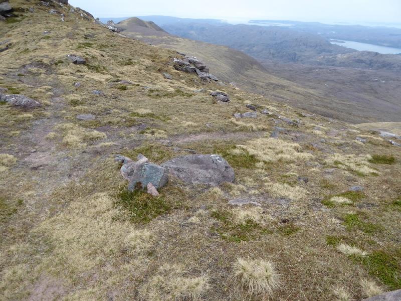
(1) Cross the bridge opposite the Green Shed and follow the track around the back of the small loch. Later on, the track splits. Take the left fork and continue on the rough and undulating track. Soon a river is apparent on the right and the track shadows this up to Loch na h-Oidhche. Cross a side stream (where water has been diverted from the main river) by stepping stones and continue to the next brow where there are two prominent boulders. Leave the track here and head for the lower ridge of Beinn an Eoin keeping well to the left of the prominent buttresses. There is little in the way of a path but there is a cairn on a large slab just across the ridge. From here, cut back, aiming for the crest above the buttresses, up steepish grass in places but with faint paths here and there. Gain the crest as soon as possible and walk along it heading SE. The crest undulates but not much and certainly not on the scale of Baosbheinn later. There is a steepening and narrowing for the final ascent but no difficulties under summer conditions. A semi-circular shelter cairn is reached with a tiny cairn a little further which is the summit of Beinn an Eoin, 855 m.
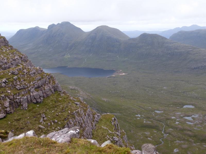
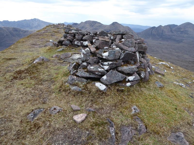
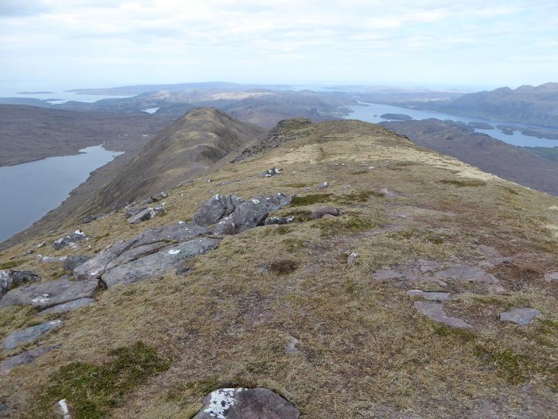
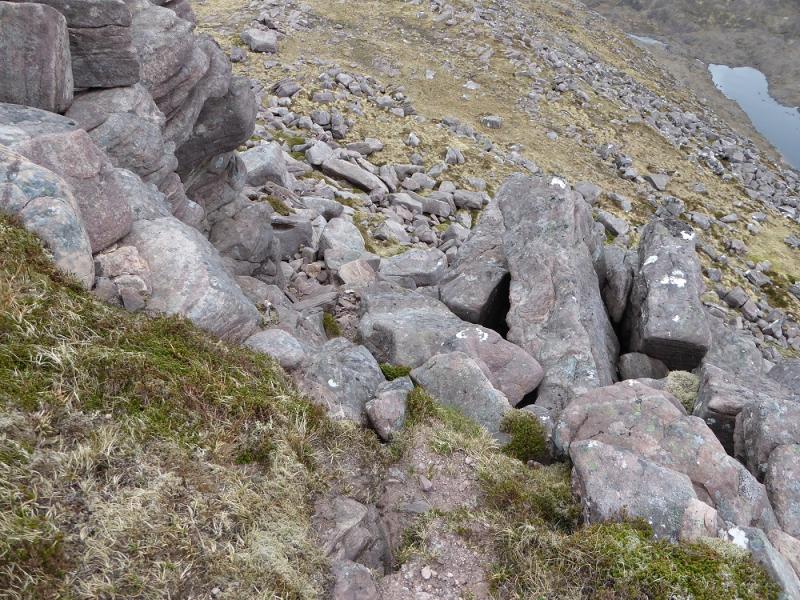
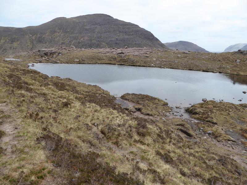
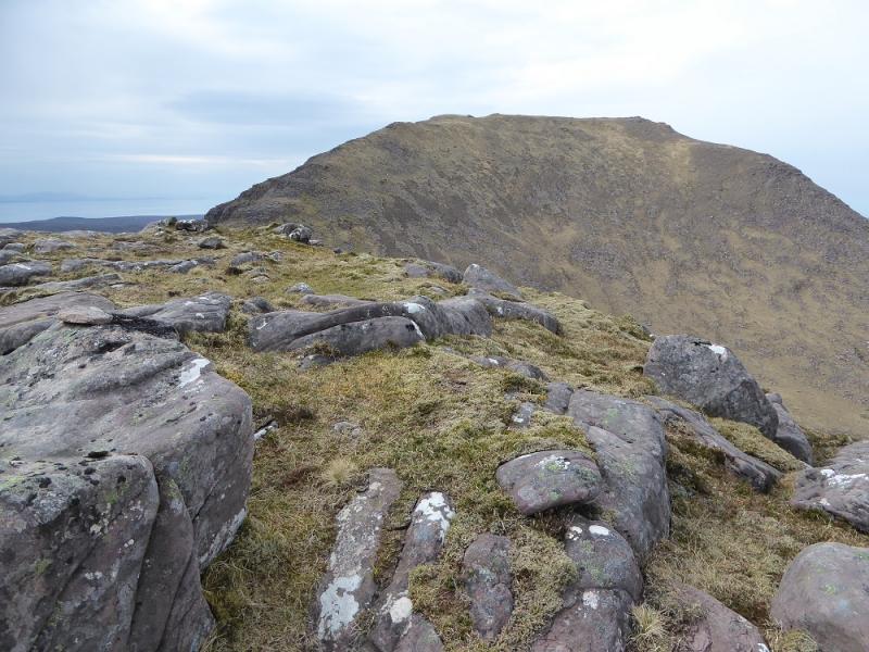
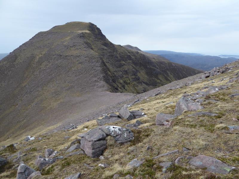
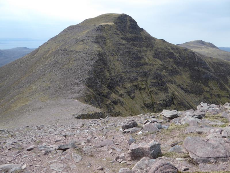
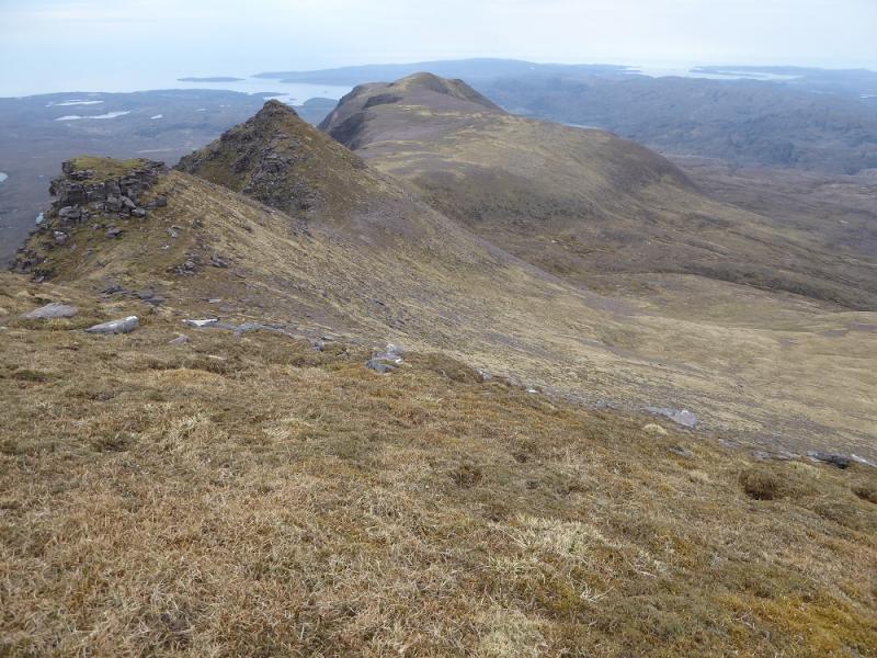
(2) Continue along the obvious crest but soon reach the first of many broken buttresses. The easiest route seems to go right then down the side of a wall to reach easier ground. This pattern is repeated much of the way down and good route finding skills are essential to avoid any down scrambling or even down climbing. Progress will be slow. Aim for the bothy of Poca Buidhe. Eventually the buttresses are left behind and one just has deep heather! Reach the now locked bothy where there is an outdoor seat. Head SE, across pathless ground which can be very boggy, between the two lochans closest to Loch na h-Oidchre, then aim for the SE ridge of Baosbheinn which is largely pathless. Head up the ridge to Top 707. Descend significanntly on the other side then ascend to Top 806 whose highest point has a small cairn on an outcrop. Descend again, losing about twice the height of before, then start up the E ridge of Baosbheinn where there is a path higher up. It looks very rocky with a formidable tower but the path avoids the difficulties by going left. Eventually, reach the grassy top and a circular depression in which there is a medium cairn marking the summit of Baosbheinn, 875 m.
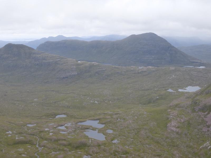
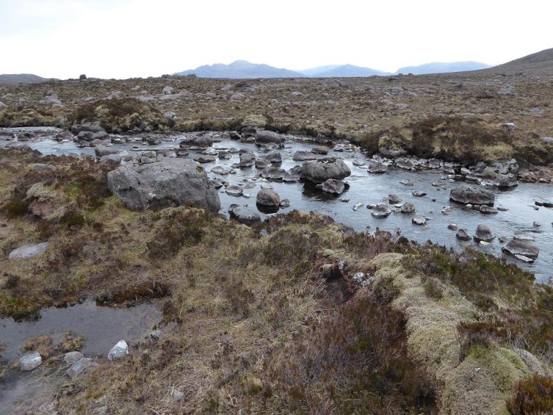
(3) Continue along the crest and descend to the first dip just before a minor pointed top. A path leaves the crest here, going right. Follow this down a mainly grassy ridge on a faint path. When this peters out, drift left towards the grassy corrie to the left. This is to avoid the steep end of the ridge. Gradually converge with the main stream and follow it down to the outflow of the loch. Look for a rock with a small cairn on it which indicates the best place to cross the river. Cross over and walk over rough and boggy ground to rejoin the outward path back to the start.
Notes
(a) This walk took place on 12th May, 2017, and about 15 years earlier.
(b) For those who just wish to ascend the two Corbetts with the minimum of effort and hassle then it seems easier to ascend Beinn an Eoin as described above then retrace back to the track. This avoids the slow and steep descent to the bothy. Cross the loch outflow and follow the stream up the corrie before joining the NE ridge to the crest and then on to the summit. This is the reverse of the descent route given above. This option avoids the bogs around the bothy and the significant loss of height after tops 707 and 806 without any loss of views. There is no loss of height by retracing as the loch is at the same level at both ends!
Photos - Hover over photo for caption. Click on to enlarge. Click on again to reduce.