Get Lost Mountaineering
You are here: Scotland » 03 North-west Argyll, Appin and Glencoe » Glencoe
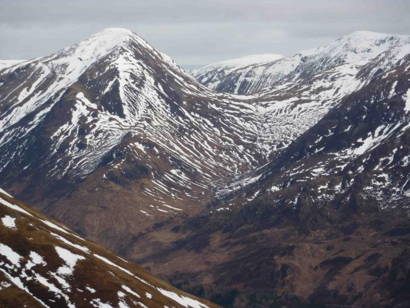
Garbh Bheinn, Kinlochleven
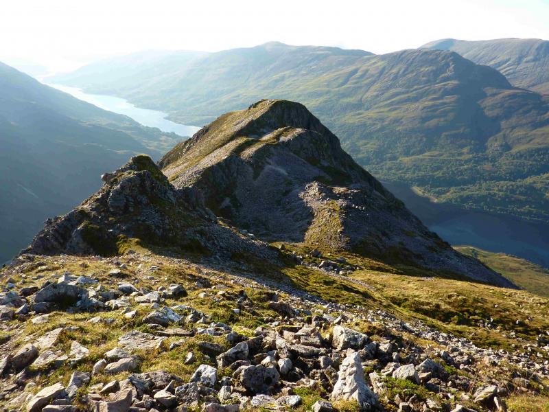
Garbh Bheinn from Kinlochleven
Start/Finish
Caolasnacon, by a bridge at NN 143 607, about 5 km W of Kinlochleven on the B863 along the S side of Loch Leven. There is usually ample parking either side of the bridge or one can take the service bus from Kinlochleven for 80 p (on 17/9/10).
Distance/Time
8 km Approx 4 hours.
Peaks
Garbh Bheinn, 867 m, NN 169 601. OS sheet 41.
Introduction
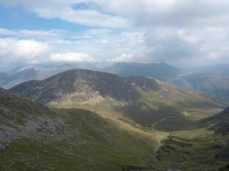
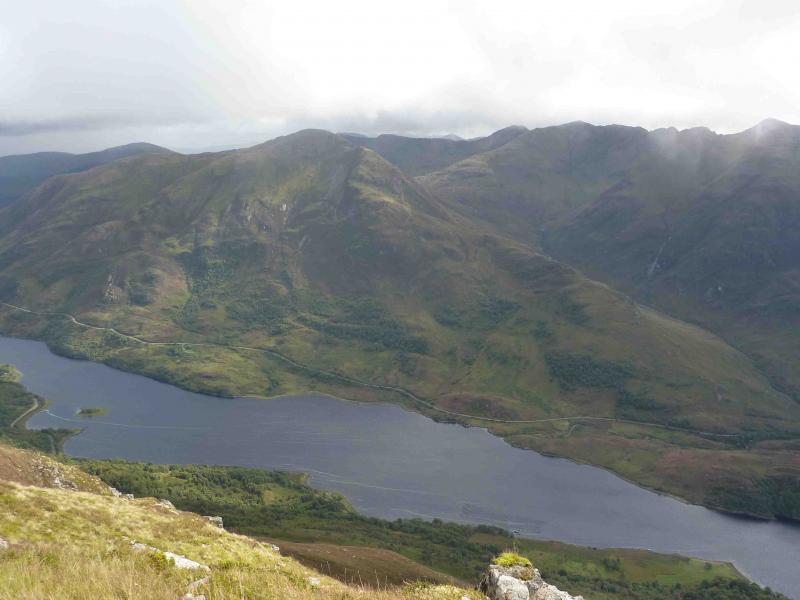
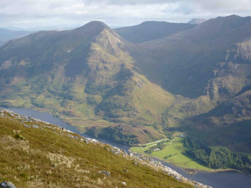
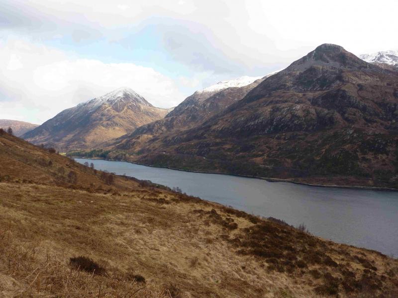
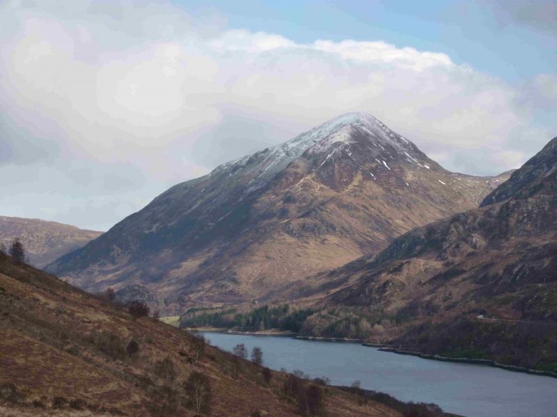
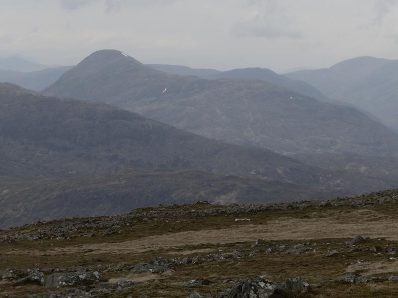
This Corbett gives a good ascent on a reasonably sharp edge with excellent views especially to the Mamores, the Aonach Eagach, Blackwater Reservoir and even as far as Ben Alder and Schiehallion.
Route
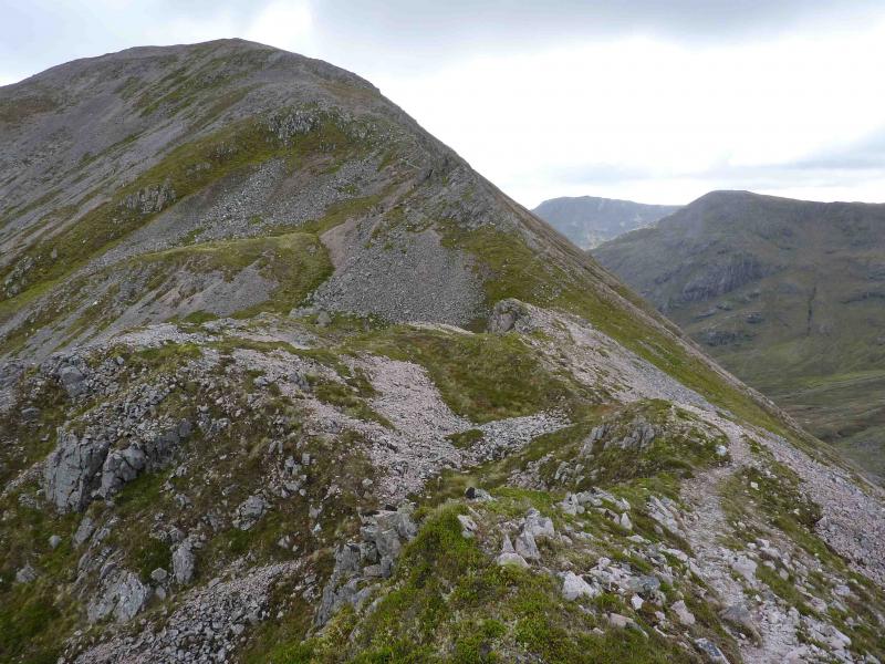
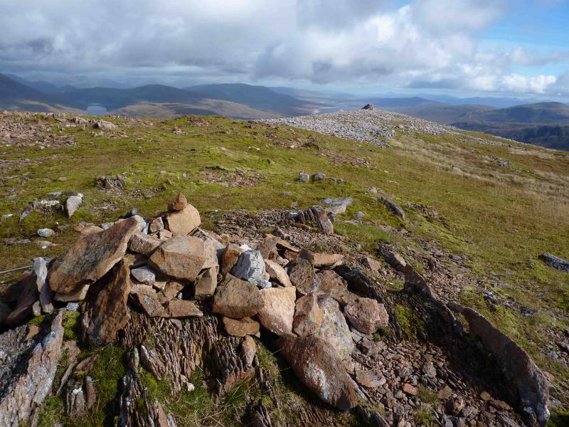
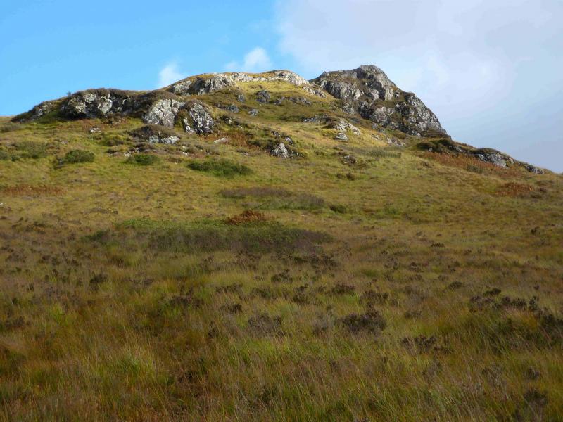
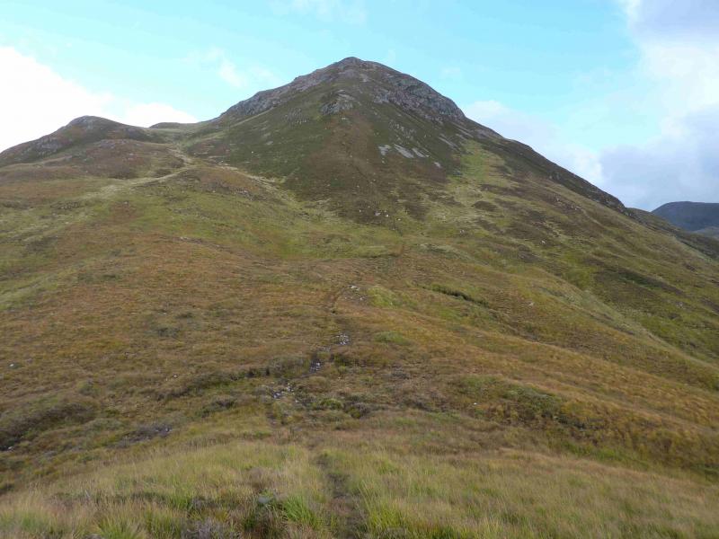
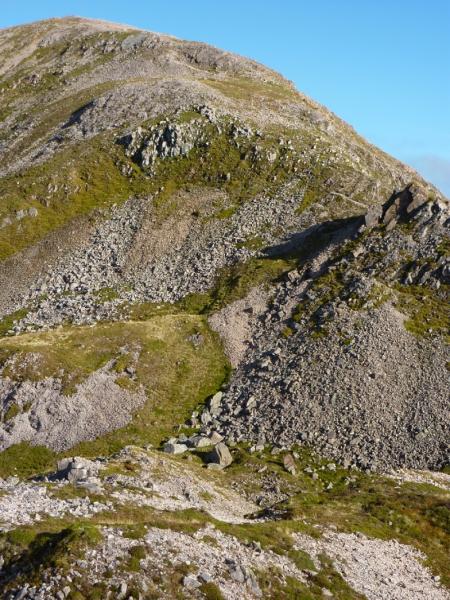
(1) A few metres E of the bridge is the start of a gravel path which may look quite boggy initially. This climbs up gently and soon there are three choices of route but not all at the same time! One is a good track to the right which soon follows the Allt Gleann a’ Chaolais but do not take it.. The path most to the left is a muddy footpath which goes left, up the nose, towards the first crags. The middle option is a muddy path/track which drifts to the right and continues for some distance before a faint path cuts off left just below the first crags and slants up a grassy ramp below a crag to join the left hand option on the crest. The better option is probably the left hand path. Once on the crest, continue up the distinct path. Once past the crags, the gradient eases before a steep heathery/rocky nose appears ahead. This is much easier than it looks and a good path picks its way up this nose with some good scrambling opportunities higher up on fractured quartzite (good when dry, lethal when wet) but all difficulties can be avoided. Descend slightly, crossing a narrow grassy ridge (no difficulties) with a hollow on the left. Ahead lies a final steepening up a straightforward nose to emerge on the summit plateau. There are three cairns. The first is small, made of red stones, and seems to be the highest so this is the summit of Garbh Bheinn, 867 m. To the left is a larger, but lower, cairn, also of red stones, towards the N edge. About 100 m beyond the summit cairn is a larger, but again lower, cairn, made of white stones, which gives excellent views to the E.
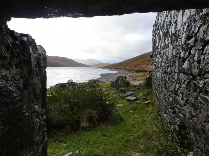
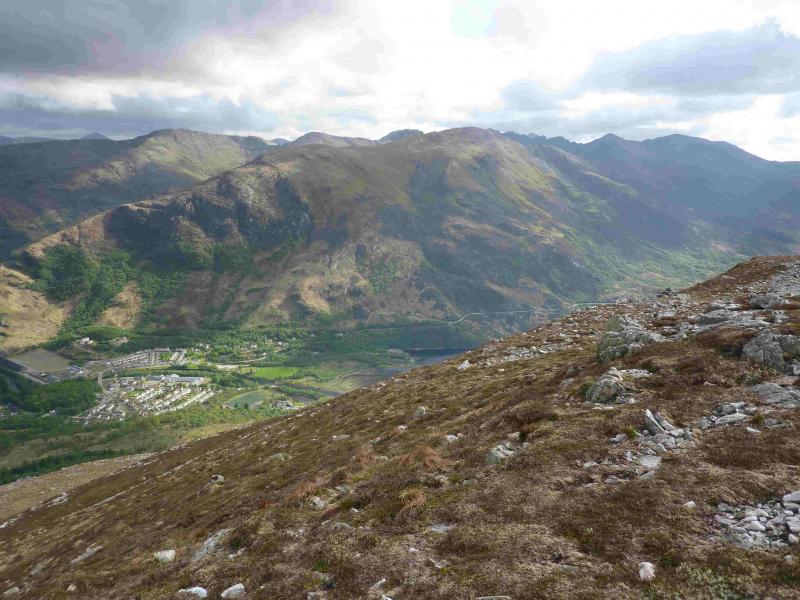
(2) Descend either by the route of ascent or continue the traverse towards Kinlochleven by walking E then NE to pt 734, following a line of rusty old fence posts part of the way. Continue NE then E to follow the ridge heading towards about NN 196 613 where the West Highland Way track converges with the pipeline bringing water from Blackwater Reservoir to Kinlochleven power station. This ridge is not as straightforward as it may seem as there is a large crag at about NN 192 612, well seen from Kinlochleven, blocking the way. This makes this descent inadvisable in thick weather, especially in winter. From above the crag, descend carefully to the right, SE, picking a way down steep grassy/rocky ground to reach safer ground below from where one can safely walk to the West Highland Way track. The further right you traverse from the crag, the easier the ground gets but the deeper the ferns are below! Once on the West Highland Way, follow the track down, ignoring any signs to a footpath near the village, to walk past the power station (a long stone building with the pipelines going into it), the bunkhouse (looks very cosy) and the Ice Factor to reach the centre of Kinlochleven.
Notes
(a) This walk took place on 23rd October, 2000, 17th September, 2010, 28th September, 2012, and 23rd September, 2013.
(b) It is possible to descend S from Garbh Bheinn to the bealach between it and the Aonach Eagach but this involves much steep and pathless ground before the track, visible from above, is reached which leads back, boggy in places to the start. If one strays too far east on the descent to the bealach, the ground becomes craggy especially if one is on the E side of a narrow, but prominent gully. There is actually a pleasant ledge path across this gully, fairly well down, which then contours along the S flank for some distance. If this path can be found then the best route back is to follow it as far as it goes then contour around to the outward path as the ground below is often wet and overgrown and slows progress. The views are far inferior to those from descending the W ridge.
Photos - Hover over photo for caption. Click on to enlarge. Click on again to reduce.