Get Lost Mountaineering
You are here: Scotland » 04 Loch Leven and Loch Linnhe to Loch Ericht » Mamores to Corrour
Cow Hill, by direct route, from Braveheart Car Park in Glen Nevis
Cow Hill, by direct route, from Braveheart Car Park in Glen Nevis
Start/Finish
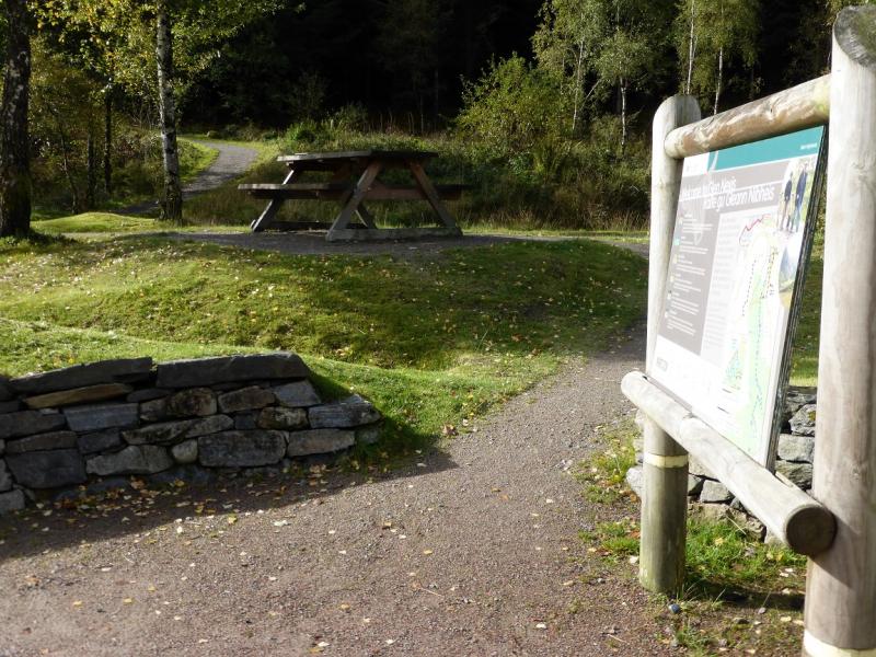
Braveheart car park which is the first car park on the right down Glen Nevis. From the railway station in Fort William, follow the A82 north (Inverness) until Glen Nevis is signposted off a roundabout. On 9/10/15, parking was free.
Distance/Time
4 km About 2 - 3 hours
Peaks
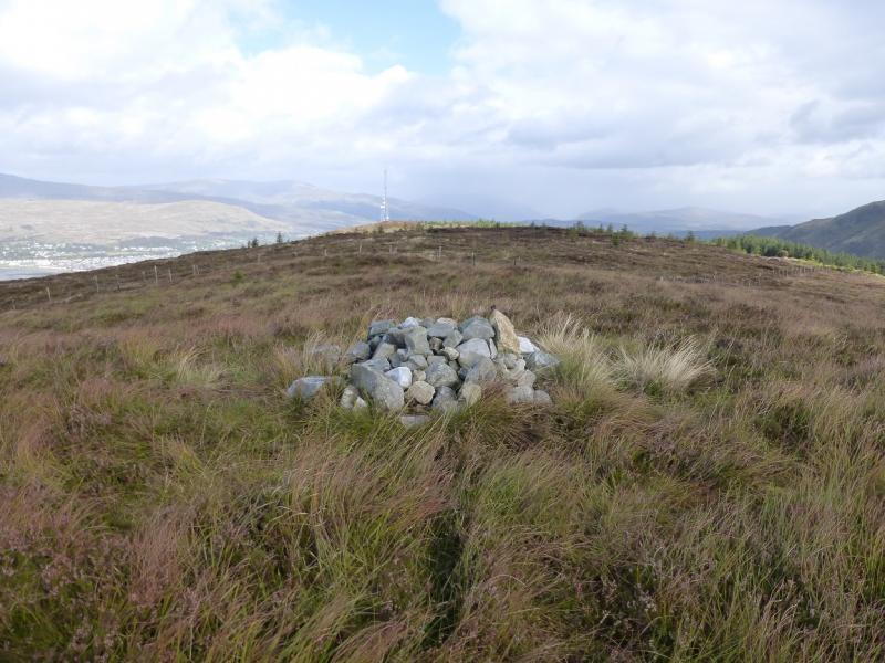
Cow Hill, c 290 m, NN 111 729. OS Sheet 41.
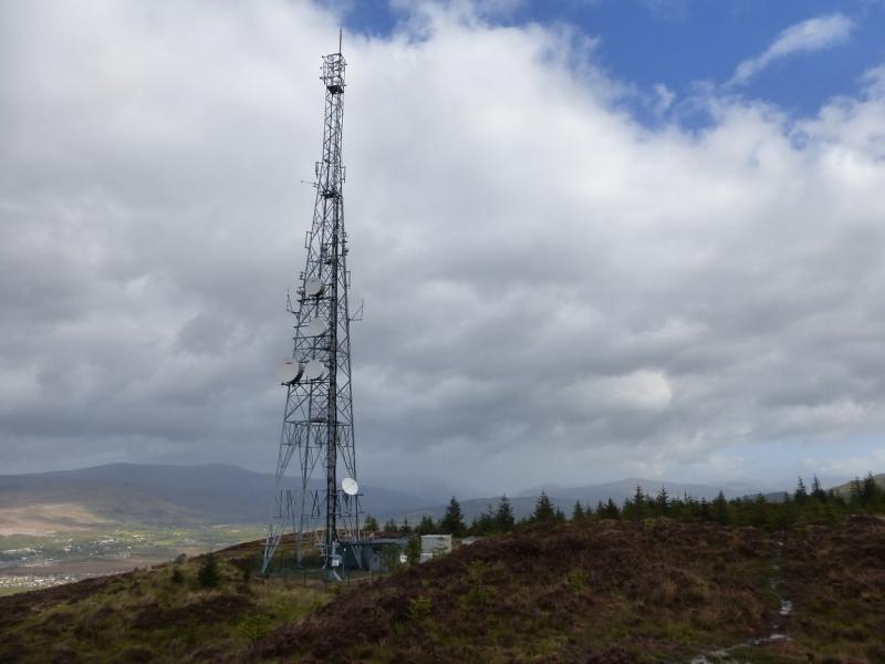
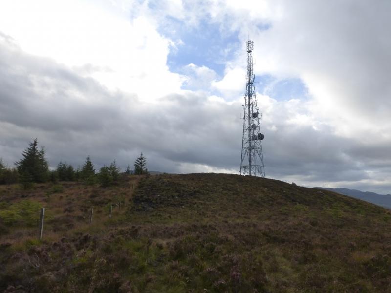
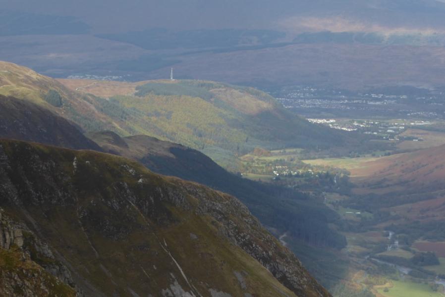
On the 1991 map, Cow Hill is shown slightly further north than this at 287 m. This is the location of the obvious aerial which is clearly lower than the point above to the south.
Introduction
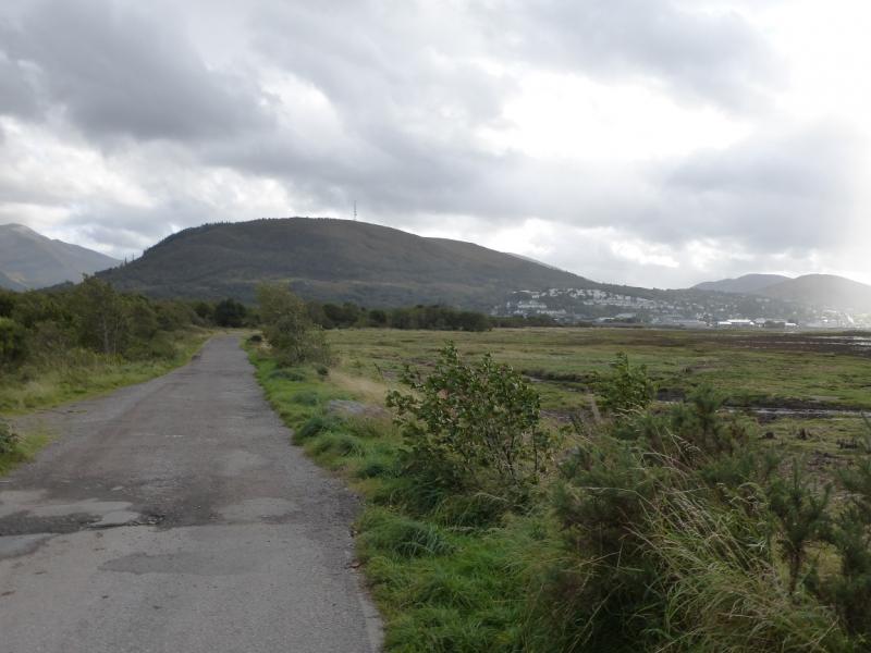
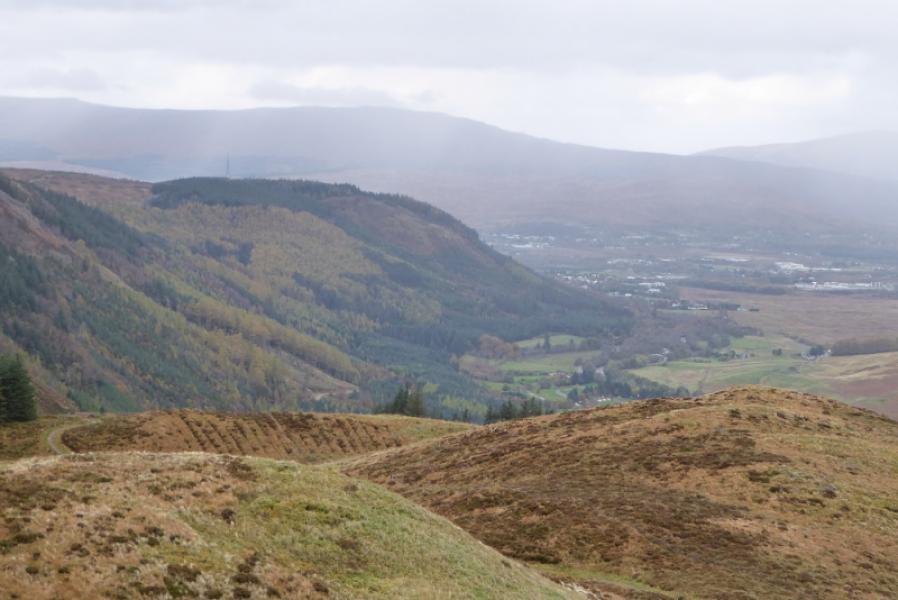
This is the more direct version of a straight forward walk with fine views up Glen Nevis to Meall an t-Suidhe, Ben Nevis, Sgurr a' Mhaim, across Loch Linnhe to Meall an t-Slamain, Stob Coire a' Chearcail and Druim Fada. and many more. Even Beinn a' Bheithir (Ballachulish can be seen). It is an excellent viewpoint. This route goes directly up the steep and overgrown north west flank and descends the steep and boggy fence line down its eastern side. A barbed wire fence has to be climbed over.
Route
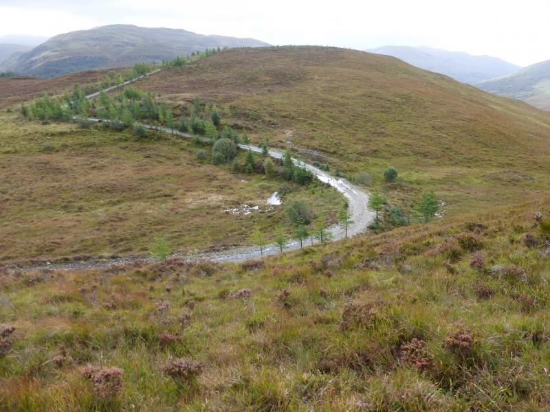
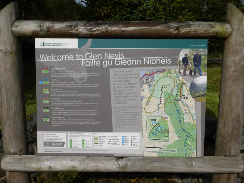
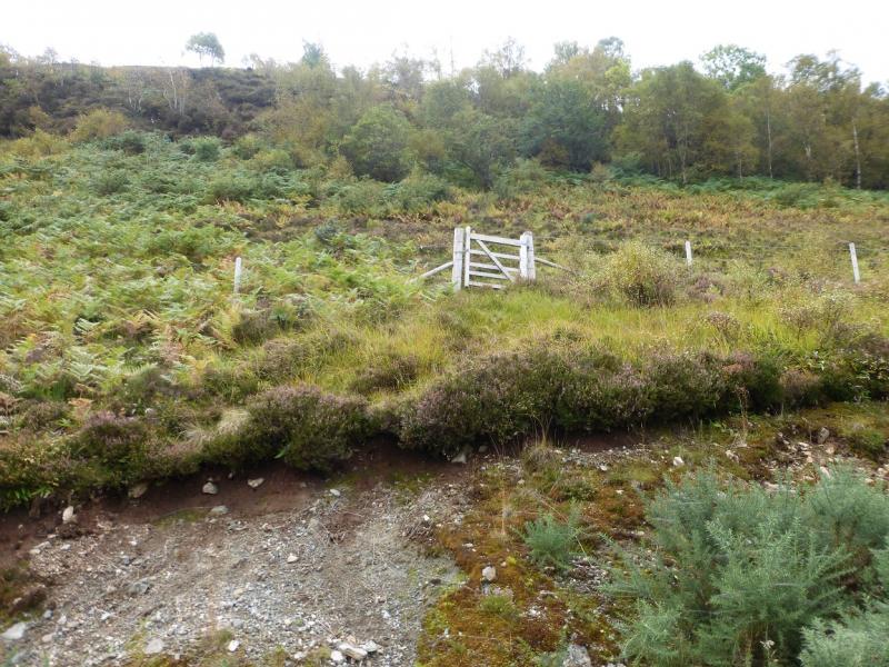
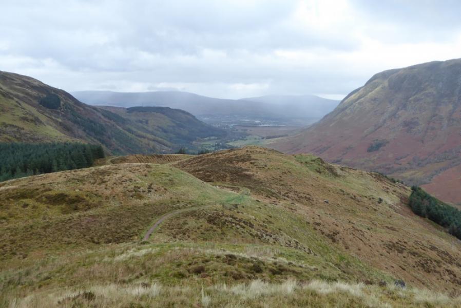
(1) Looking at the information board, there is a path to the left which goes off to the right from where it starts in the car park. Follow this good path which goes around the front of Cow Hill and gives good views across Loch Linnhe. Pass the sign post for the Cow Hill Link and continue, passing a bench on the right. Further on, there is a pedestrian gate on the left which is not that easy to get at being up a bank. Go through the gate and pick a way up steep and overgrown terrain with ferns, heather and birch saplings having to be negotiated. There are hints of a path here and there but the ground is very steep. You are likely to reach the crest with the aerial over to the right which is easily reached once the gradient eases. From the aerial, look roughly S and the area where the actual summit lies seems to be the top about 1 km S although the top next to the aerial is of very similar height. However, only the S Top has a cairn. To reach it go along the access track from the aerial and leave it on a crest. Go right on to the rough ground then turn left, S, and pick a way (no path) to the highest point where a small cairn marks the highest point on Cow Hill, c 290 m.
(2) Return to the track and follow it back to the aerial. Follow the fence which descends roughly E by the side of a plantation. There is a faint path which can be boggy. Lower down the vegetation is overgrown in places and it may be necessary to go left away from the fence line before returning to it. Lower down, the angle finally eases but a barbed wire fence has to be climbed over to reach the Cow Hill Link path. Follow this left to the junction with the circuit path then turn right to return to the start.
Notes
(a) This walk took place on 9th October, 2015.
Photos - Hover over photo for caption. Click on to enlarge. Click on again to reduce.