Get Lost Mountaineering
You are here: Scotland » 13 Applecross, Coulin and Torridon » Loch Torridon to Loch Maree
Beinn Eighe - all Munro Tops from Coire Dubh car park in Glen Torridon
Beinn Eighe - all Munro Tops from Coire Dubh car park in Glen Torridon
Start/Finish
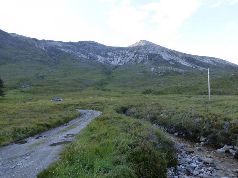
Car park in Glen Torridon at about NG 957 568. This is about 6 miles from Kinlochewe on the A896 road to Shieldaig. It is a fair sized car park but can quickly fill up on busy days. It is the main access car park for Ruadh-stac Mor on Beinn Eighe but is also used for Liathach by those wanting to get around to its north side.
Distance/Time
23 km. About 10 - 11 hours.
Peaks
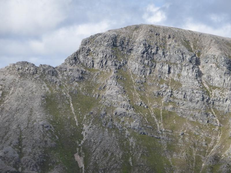
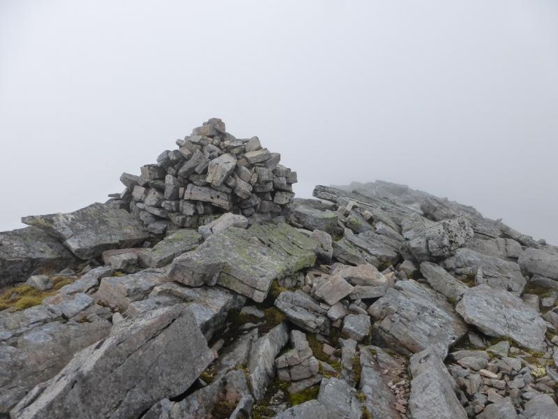
Sail Mhor, 980 m, NG 938 605.
Coinneach Mhor, 976 m, NG 944 600.
Ruadh-stac Mor, 1010 m, NG 951 611.
Spidean Coire nan Clach, 993 m, NG 966 597.
Sgurr Ban, 970 m, NG 974 600.
Sgurr nan Fhir Duibhe, 963 m, NG 981 600. OS sheets 19 & 25.
There is an Outdoor Leisure Map, OL 8, for Torridon with the Cuillin on the other side which may be more useful as Beinn Eighe is “split badly” between sheets 19 and 25.
Introduction
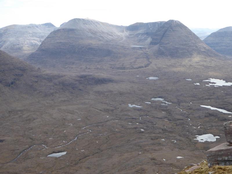
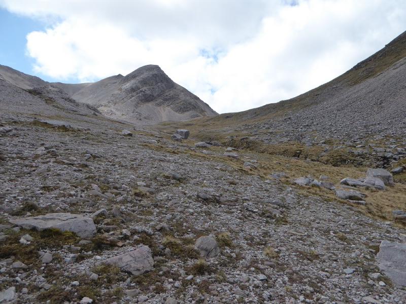
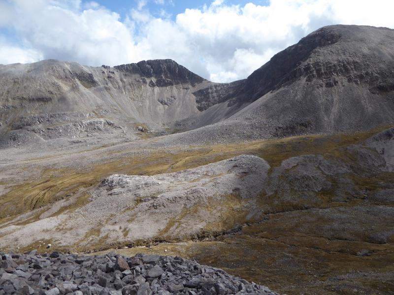
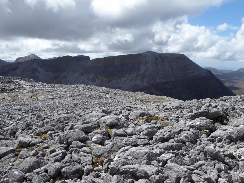
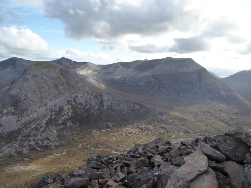
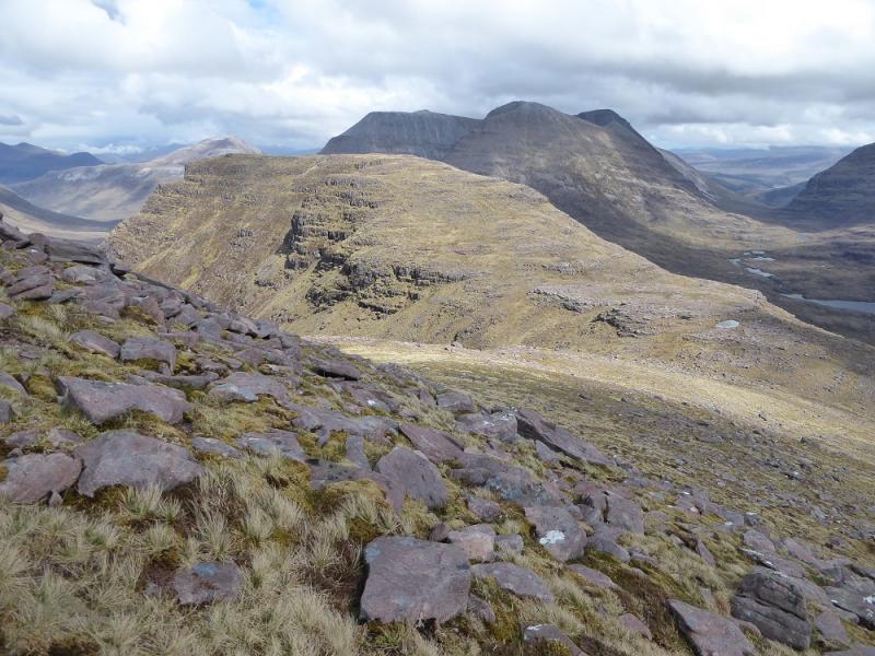
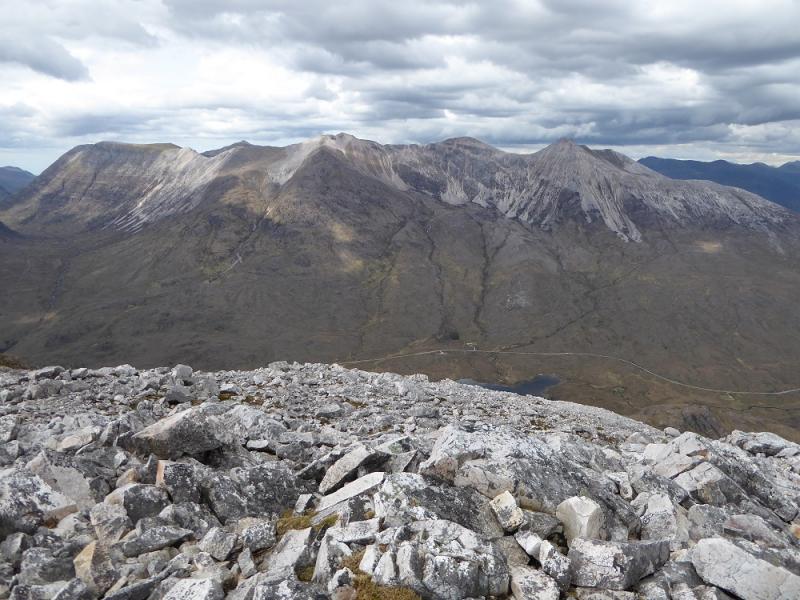
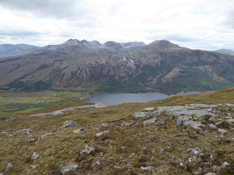
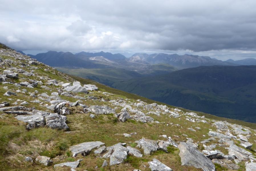
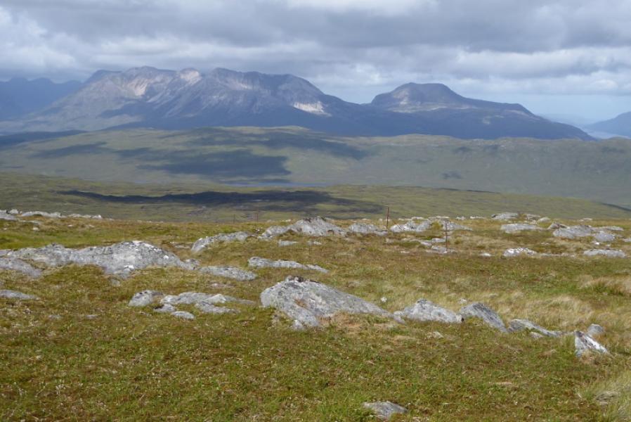
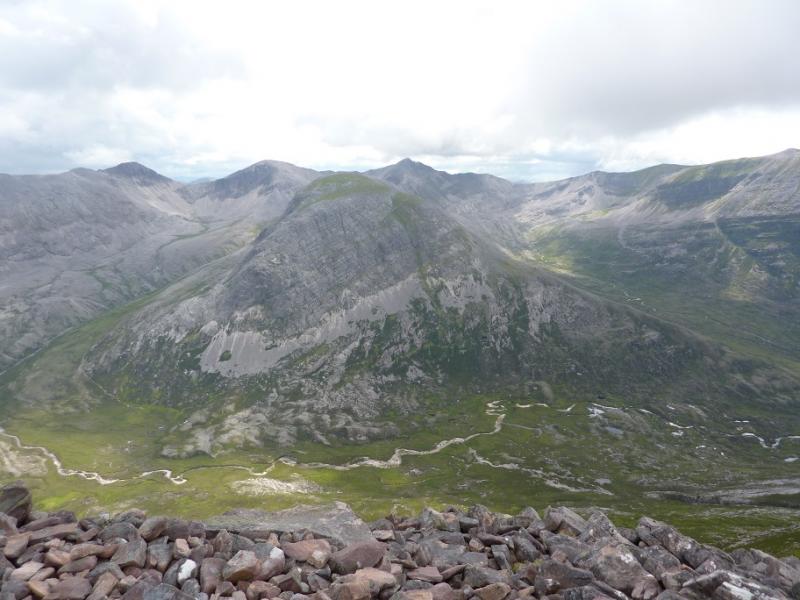
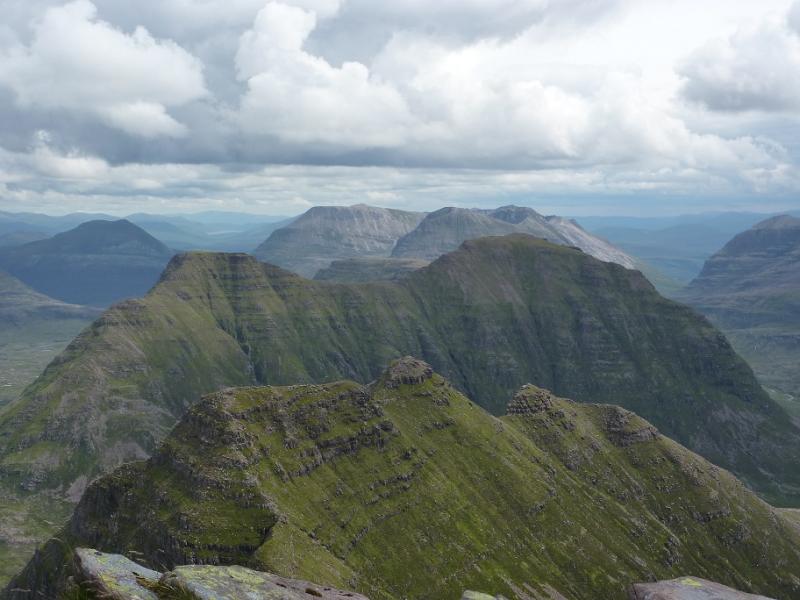
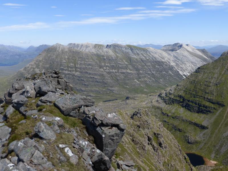
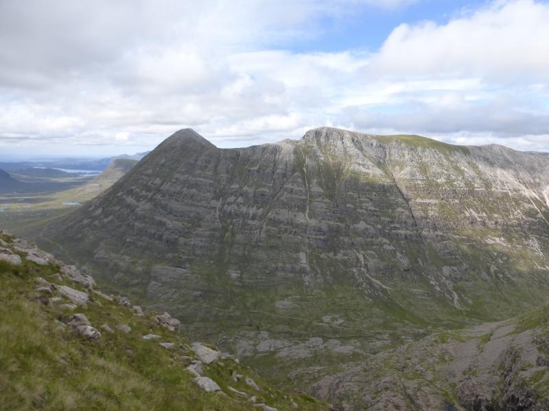
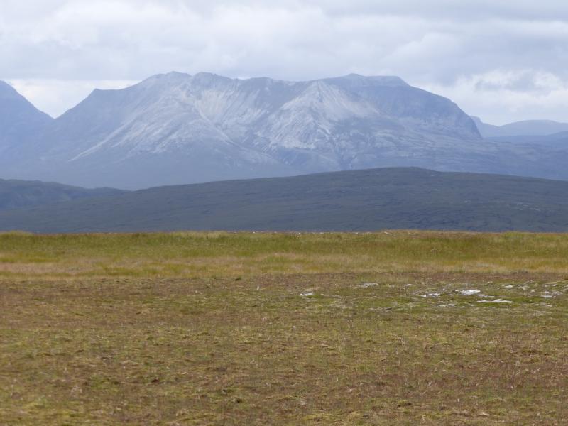
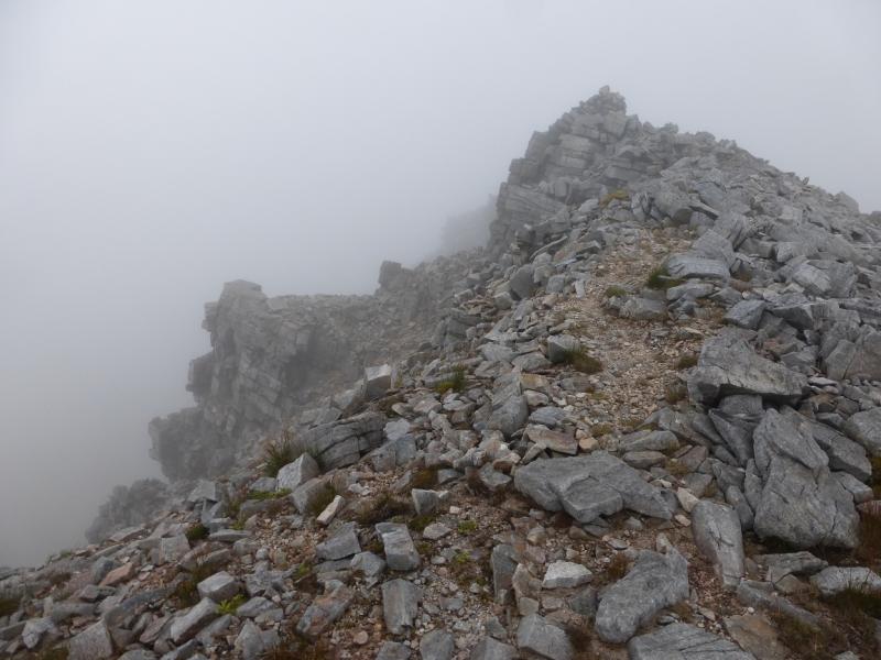
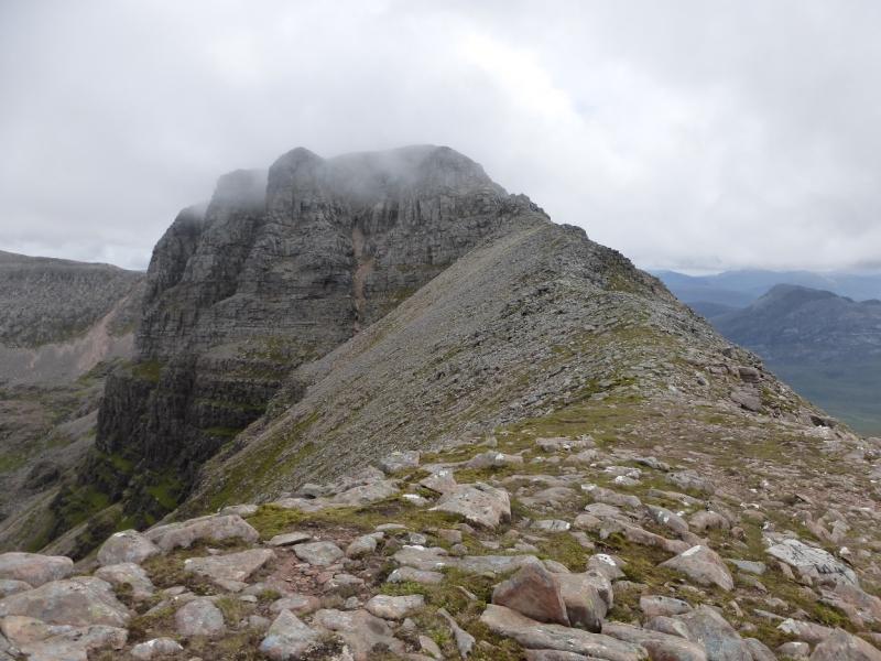
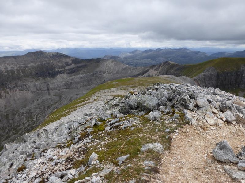
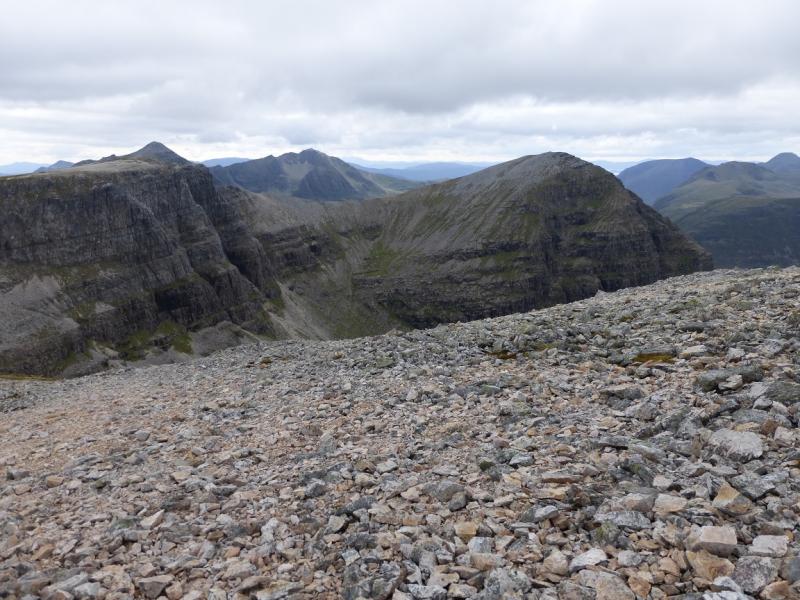
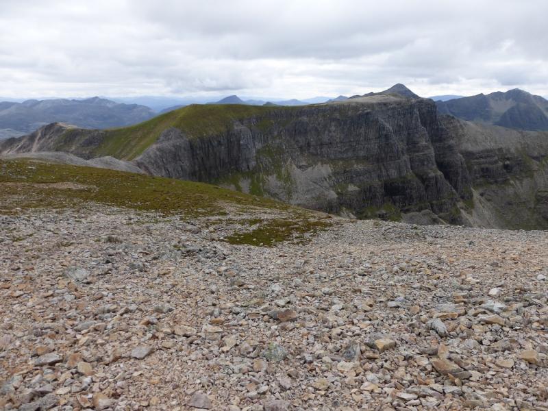
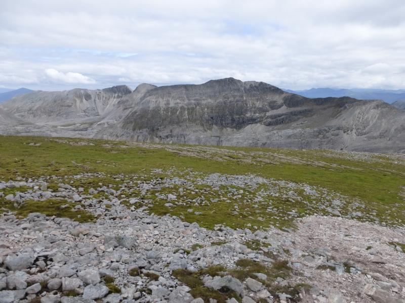
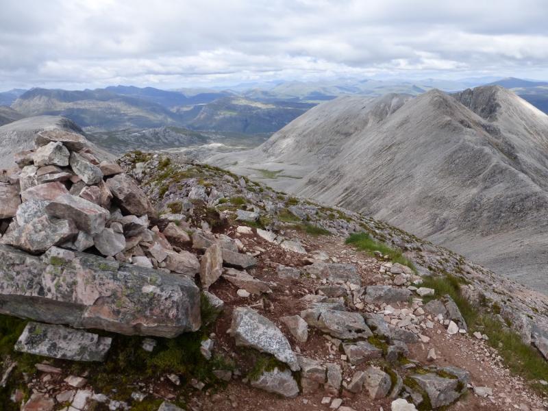
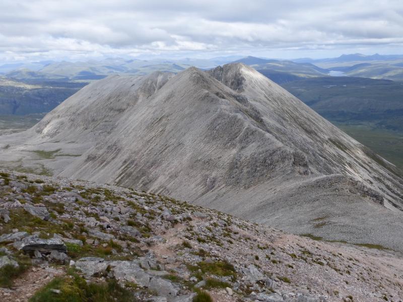
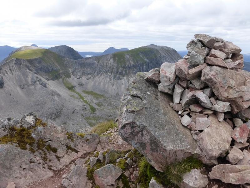
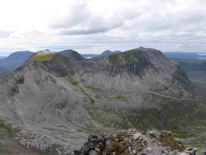
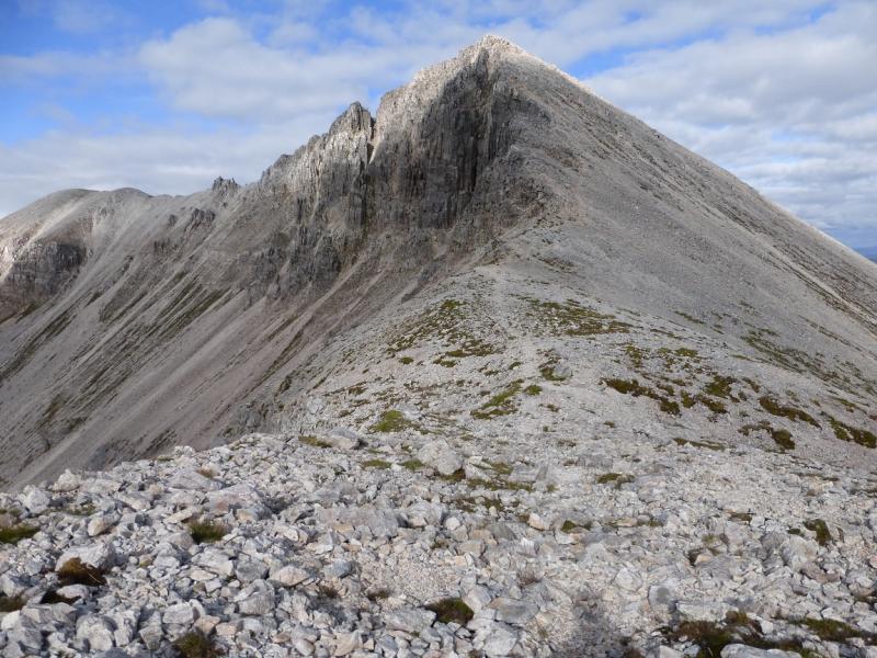
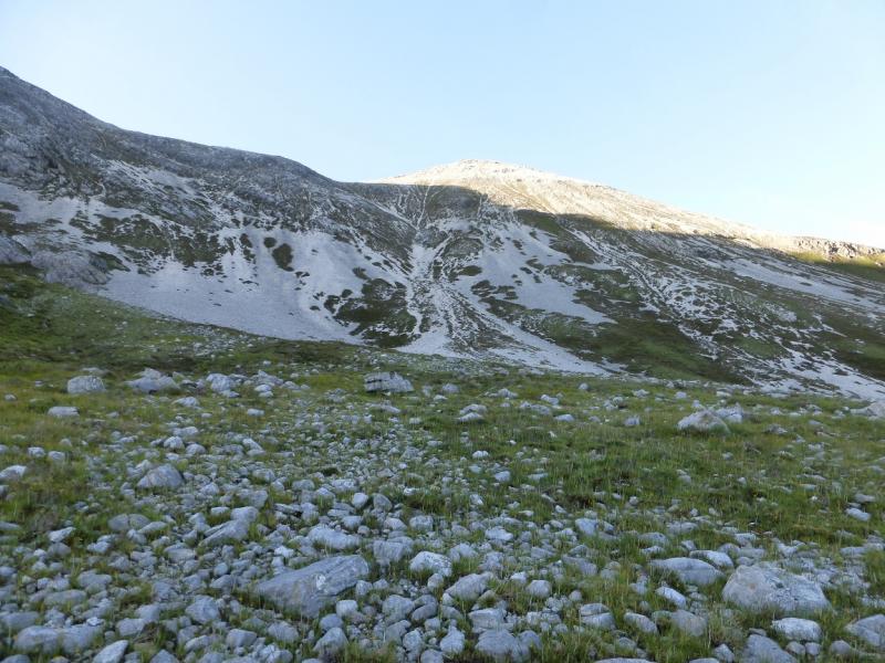
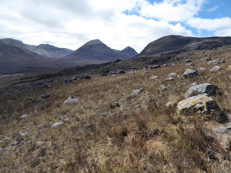
Beinn Eighe is probably the largest mountain in Torridon and it can be a long day to traverse all its Munro Tops. There is a good path into Coire Mhic Fhearchair and a good path along much of the crest, especially between Ruadh-stac Mor and Spidean Coire nan Clach. The going from Spidean Coire nan Clach over Sgurr Ban to Sgurr nan Fhir Duibhe is quite rough and is essentially over a steep quartzite boulder field. The ascent up Coire Mhic Fhearchair has a faint path which can be difficult to locate low down but does lead to the dip between Sail Mhor and Coinneach Mhor. Ascending Coinneach Mhor from this dip is rocky and exposed but not particularly difficult and the exposure is very short lived. There seems to be an avoiding path on the S (Liathach) side of the crest. This traverses for some distance before suddenly ending with no apparent easy route up to the crest. In fact, trying to reach the crest from this path involves negotiating loose vegetated rock with much exposure and is a far worse option than holding to the crest from the dip so it is strongly not advised. The best descent path, at the end of the day, is from the trig point below Spidean Coire nan Clach but as this route continues to Sgurr nan Fhir Duibhe, to descend this way would mean returning over Sgurr Ban and re-ascending Spidean Coire nan Clach and that seems impracticable and too time consuming. The descent given involves descending very steep scree from the bealach between Sgurr nan Fhir Duibhe and Sgurr Ban. This may be intimidating for some leaving the return to the trig point as the only option unless transport is arranged in Kinlochewe which would allow one to walk down the easier east ridge – this has not been checked out. It goes without saying that Beinn Eighe probably offers the best views from any mountain in Torridon, especially to Liathach and the mountains to the north including Slioch.
Route
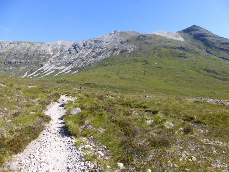
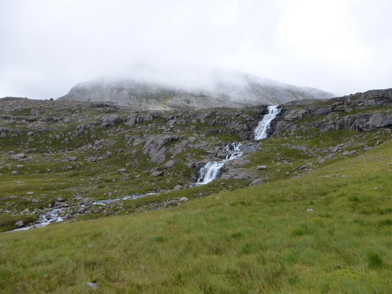
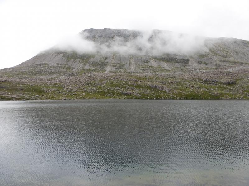
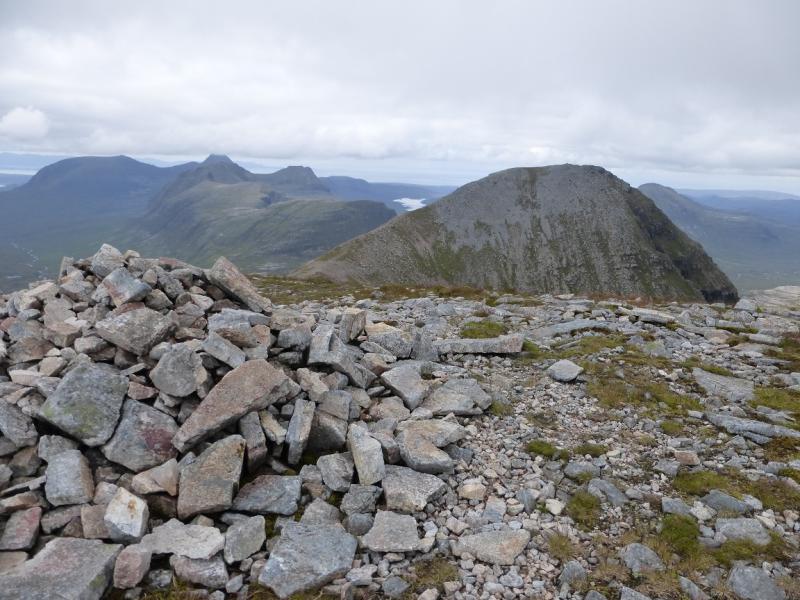
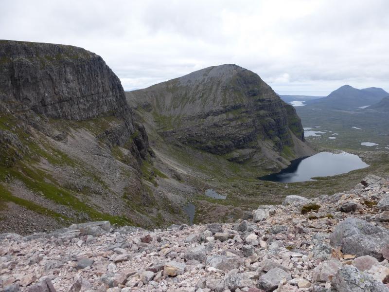
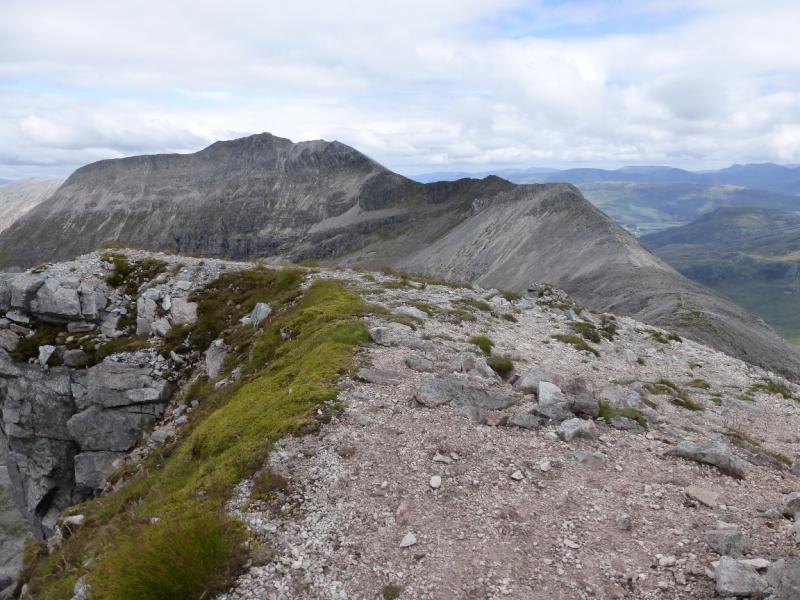
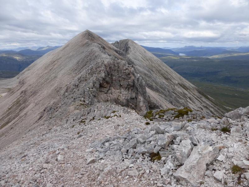
(1) Walk to the entrance to the car park where the path starts. Do not be tempted by a path from the car park itself as it is quite boggy. Follow the path for about 3 km to where it splits at a cairn. Take the right fork and follow this around Sail Mhor and into Coire Mhic Fhearchair passing a waterfall en route. Go around Loch Coire Mhic Fhearchair on its N side where there is a path. Leave the path when past the loch and cross its inflow below the Triple Buttress. Pick a way SW, up steep grassy and rocky slopes. There is a faint path but it is not that obvious from low down but it does lead to the dip on the crest between Sail Mhor and Coinneach Mhor. Once on the crest, go right, NW, and follow a path, crossing a small boulder field, to reach the medium cairn of Sail Mhor, 980 m.
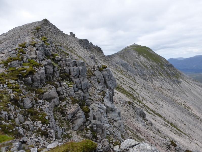
(2) Retrace to the dip and continue along the crest towards Coinneach Mhor. Soon the way ahead looks increasingly rocky but it is best to stay on the crest or as close to it as possible. There is some exposure but it is short lived. Do not be tempted by the traverse path on the S side as it leads to worse situations. Once the rocky part of the crest has been crossed, a simple walk leads to the medium cairn of Coinneach Mhor, 976 m. If the rocky crest seems too much then the only safer alternative is to descend back into Coire Mhic Fhearchair and take the path up to the S bealach of Ruadh-stac Mor then ascend Coinneach Mhor as a short detour en route to Spidean Coire nan Clach.
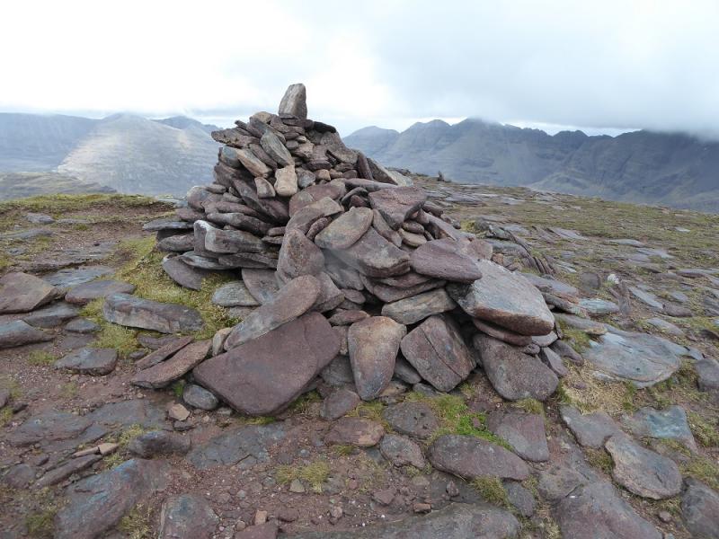
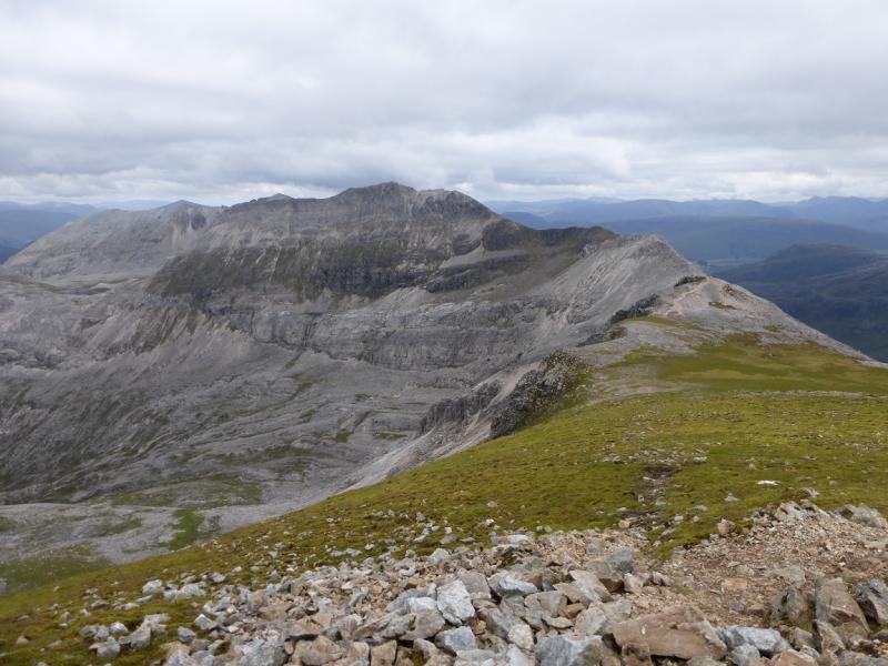
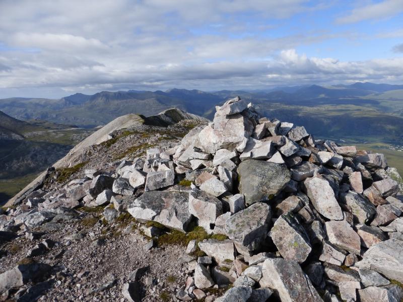
(3) From Coinneach Mhor, walk E to a minor top with a cairn on it then descend N on a distinctive path to the S bealach of Ruadh-stac Mor which is reached by those ascending directly from Loch Coire Mhic Fhearchair. Continue N along the crest to reach a large cairn which is the summit of Ruadh-stac Mor, 1010 m.
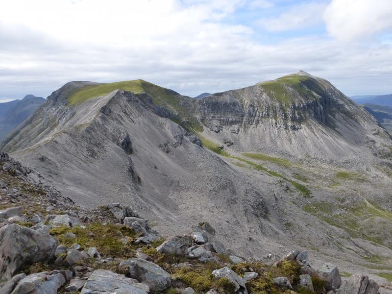
(4) Retrace to the S bealach and start to reascend the minor top but soon notice a traverse path going off to the left which avoids a full re-ascent and leads to the crest between Coinneach Mhor and Spidean Coire nan Clach. The stony crest goes SE before curving around to NE and has a distinctive path. It passes over a few shoulders before reaching a substantial stone trig point just before the final ascent to the medium cairn of Spidean Coire nan Clach, 993 m. For those not going on to Sgurr Ban, the easiest descent is to return to the trig point, descend its S ridge to a dip then take the recently restored path down Coire an Laoigh, E side of the ridge.
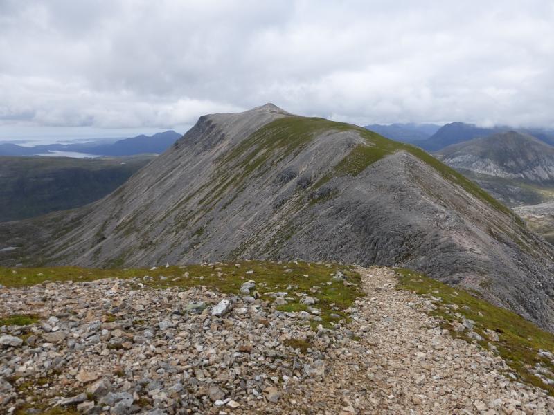
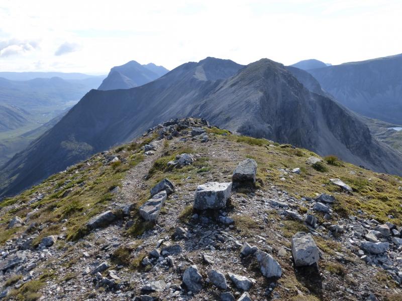
(5) Continue ENE, descending a long stony ridge to a bealach. A shorter and steeper descent leads to the medium cairn of Sgurr Ban, 970 m.
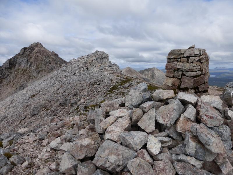
(6) This last section on the crest is even rougher. Again the descent from Sgurr Ban is longer than the steep and loose ascent to the medium cairn of Sgurr nan Fhir Duibhe, 963 m. There is some compensation for the increased roughness in that there are some interesting rock features on the N side of the crest, including some very steep gullies and headwalls.
(7) Return to the bealach before Sgurr Ban then walk down scree slopes to the S. These soon start to steepen considerably and are not for those without experience on steep scree. The only alternatives are to return to the trig point or walk off the E ridge of Sgurr nan Fhir Duibhe and descend towards Kinlochewe. The scree is steep, loose and variable in quality for some distance so descend slowly and carefully until the grassier slopes below are reached then pick a way over rough terrain to the small wood seen just below the road to the due S. There is a small “car park” by the wood with a short track to the road. Once on the road it is just over 2 km back to the Coire Dubh car park.
Notes
(a) This walk took place on 25th May, 1992, 1st August, 2005, and 17thJuly, 2014.
(b) The SYHA at Torridon is very well placed and a lovely place to stay. It is a modern purpose built building which is very well managed. It's only fault is that it is extremely popular so, if planning to stay there, book well in advance!
Photos - Hover over photo for caption. Click on to enlarge. Click on again to reduce.


 & Sail Mhor from Beinn a' Chearcaill.JPG)
 & Sail Mhor from Beinn a' Chearcaill.JPG)