Get Lost Mountaineering
You are here: Scotland » 01 South of Oban to Stirling and Fife » Loch Earn to Stirling
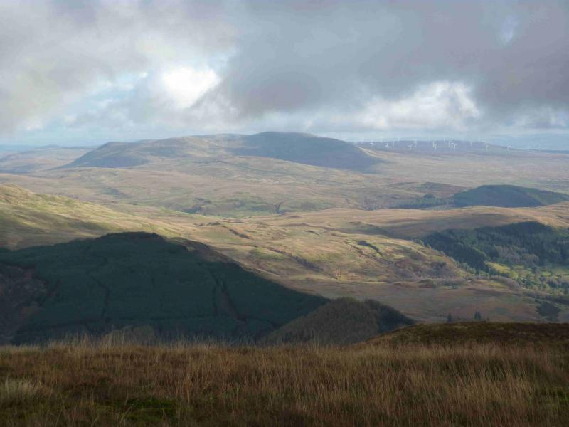
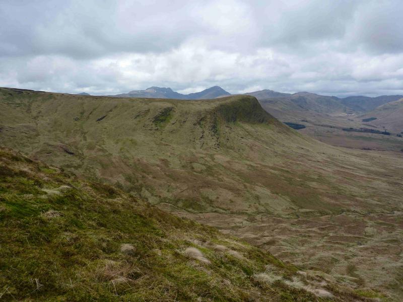
Uamh Bheag Range
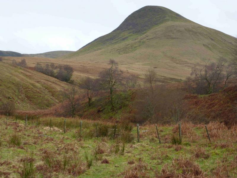
Uamh Bheag Range from Glen Artney Church
Start/Finish
Car park opposite Glen Artney Church. Glen Artney is a minor road off the B827 Comrie to Braco road.
Distance/Time
14 km About 6 - 7 hours
Peaks
Meall Clachach, 621 m, NN 688 125.
Uamh Bheag, 664 m, NN 691 118.
Uamh Bheag East Top, 664 m, NN 696 119.
Beinn Odhar, 626 m, NN 714 127.
Beinn nan Eun, 631 m, NN 723 131. OS sheet 57.
Introduction
Technically, all these hills are Donalds or Donald Tops as they lie, just, south of the Highland boundary fault. Uamh Bheag is also a Graham but it has a twin top, its East Top of the same height which ought to be visited as well if one is to claim the Graham “tick”. The ascent of Uamh Bheag and its twin is relatively straightforward although the ascent of Am Beannan is on steep grass which would be tricky in winter conditions. The continuation from Uamh Bheag to Beinn Odhar to Beinn nan Eun involves crossing much rough ground including numerous peat hags and bogs. Some fences, without stiles have to be crossed. These are not as high as deer fences but not low enough to step over.
Route
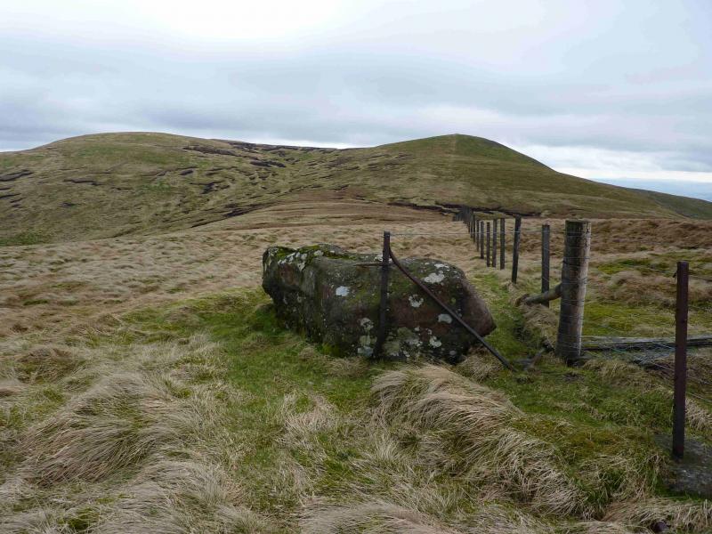
(1) From the car park, walk along the road up Glen Artney to where it crosses the Water of Ruchill at a stone bridge. Leave the road here and follow a path along the E side of the river. The path improves with distance. After just over 1 km, a large tributary is reached. Follow a faint path up its N bank past a series of waterfalls. When the burn starts to level off, look for a bridge across it. Cross carefully as it has no handrails. On the other side is a path but it soon peters out so head roughly S, passing an old stone walled sheep enclosure, for the obvious steep ridge of Am Beannan. Ascend on steep grass to reach a gentle grassy/heathery broad ridge. There is a path up this gentle ridge which leads through some peat hags then converges with a fence to reach the top of Meall Clachach, 621 m. Another fence joins at this point next to a boulder. Observation on the ground suggests that the highest point is not where the fences meet but, perhaps, about 100 m up the second fence near a substantial iron post.
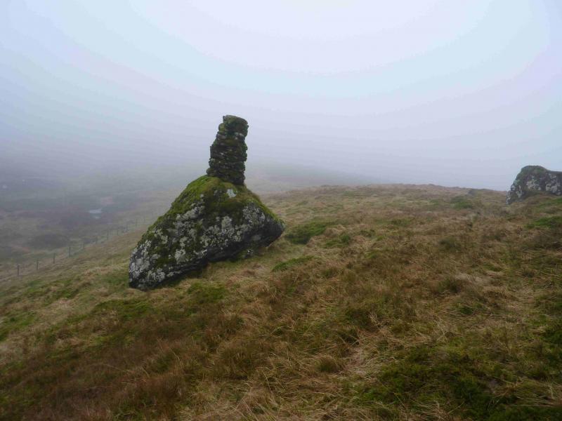
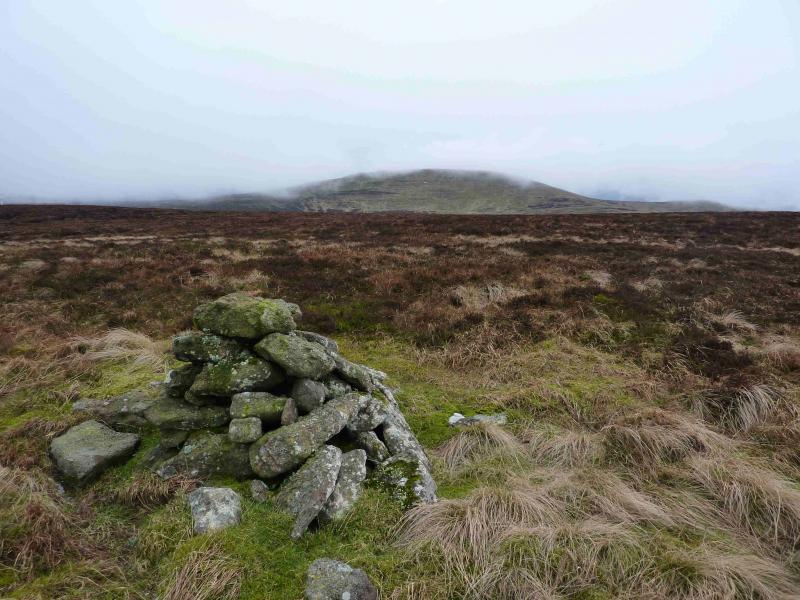
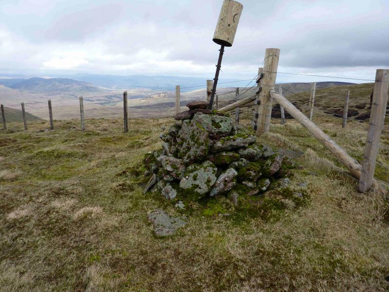
(2) From the boulder, continue following the fence down into a shallow dip. A short detour to the left, E, is advisable to avoid some peat hags but regain the fence line as soon as possible and follow it up to a fence junction where there is a small cairn which marks the summit of Uamh Bheag, 664 m. On 16/3/12, there was an iron post in this cairn with a wooden “helmet” on it decorated with a smiling face.
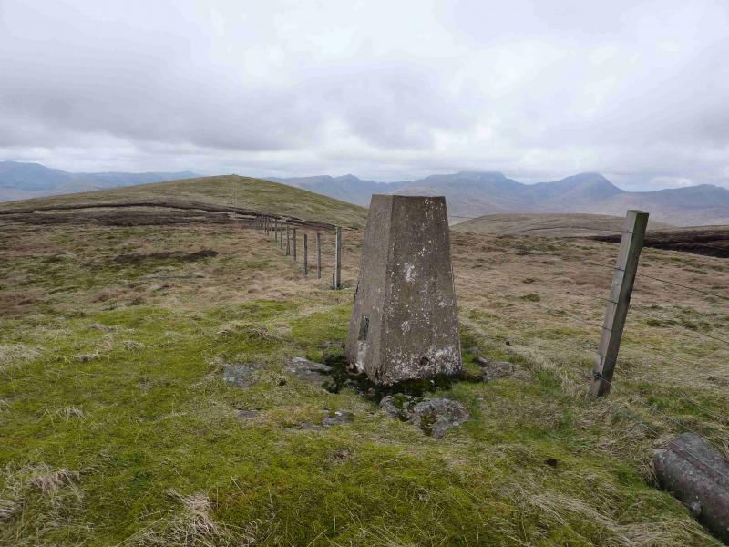
(3) Follow the fence which heads roughly E, crossing a shallow hollow to reach a trig point at a height of 662 m. To include Uamh Bheag's twin, it is necessary to make a short diversion here to the N, across a peaty hollow to a broad plateau. It is difficult to find the highest point on the ground but there is a small group of stones (pile would be an exaggeration) which may, or may not be, the highest point of Uamh Bheag East Top, 664 m.
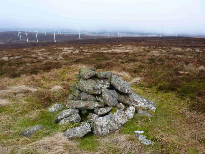
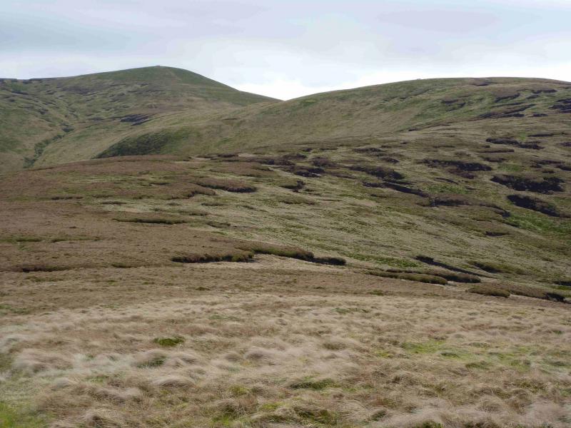
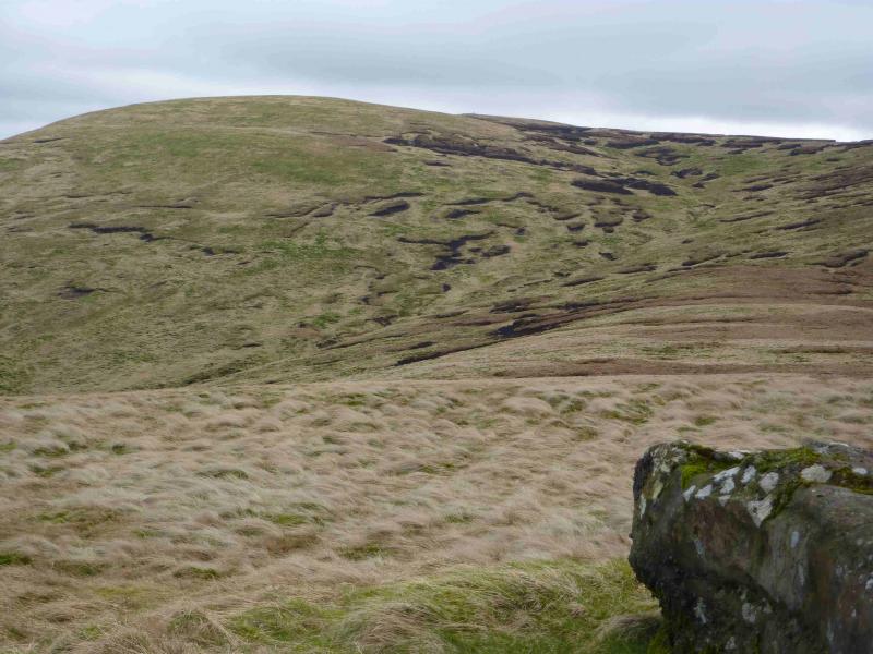
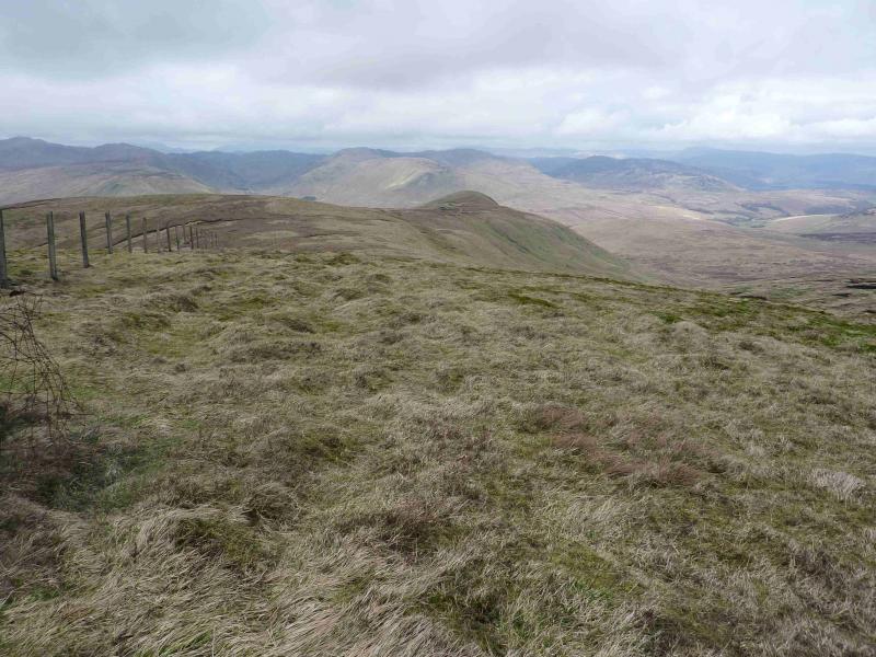
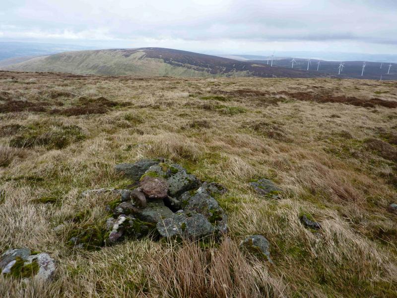
(4) Return to the trig point and continue following the fence as it descends into a deep and very boggy bealach passing a distinctive cairn on the way with another set further back to the S. The fence crosses the bealach – in mid air! The best place to cross seems to be about 50 m to the S. Ascend the other side up a grassy ramp, still following the fence which is now broken and soon peters out. There is a huge wind farm to the S and this almost encroaches on the route. The route swings around to the N to complete the ascent of Beinn Odhar but a large peat hag has to be crossed and there is another higher up which makes for slow going. The top is a small featureless heathery plateau and the highest point is difficult to be sure of. There is a cairn which may, or may not be, the highest point and marks the summit of Beinn Odhar, 626 m.
(5) From the cairn, descend ENE, through another peat hag, to reach a shallow bealach. Ascend the other side through yet another peat hag. Following a grassy channel can ease the going. The top is a featureless peat hag where, again, the highest point is difficult to spot. There is a cairn which may, or may not be, the highest point and marks the summit of Beinn nan Eun, 631 m.
(6) Descend N, through yet another peat hag, on a broad ridge which soon turns NW. There is a faint path higher up which avoids the worst of the ground. Eventually, most of the heather is left behind and the ridge becomes grassy. Follow the ridge down to where the Allt Mor meets the river in the Findhu Glen at NN 724 150. A bridge crosses the river to join the track shown on the map which soon joins the main track coming down the glen and soon meets the road in Glen Artney at a gate on which there is a sign saying no unauthorised personnel and that explosives testing takes place on the land inside the gate. On the 1991 map, the area E of the Findhu Glen is labelled a Danger Area.
Notes
(a) This walk took place on 4th November, 2007, and 16th March, 2012.
(b) This ascent of Am Beannan would be a very serious undertaking in winter conditions and ice axe and crampons would be essential.
Photos - Hover over photo for caption. Click on to enlarge. Click on again to reduce.