Get Lost Mountaineering
You are here: Scotland » 01 South of Oban to Stirling and Fife » Loch Earn to Loch Tay
Creagan na Beinne & Shee of Ardtalnaig
Creagan na Beinne & Shee of Ardtalnaig from Ardtalnaig on S Loch Tay
Start/Finish
The hamlet of Ardtalnaig on the S Loch Tay road which can be accessed from either Killin at the western end of Kenmore at the eastern end. Between the phone box and the bridge over the Allt a' Chilleine, there is an apparent parking area on the loch side of the road.
Distance/Time
20 km About 7 - 8 hours
Peaks
Creagan na Beinne, 888 m, NN 744 368.
Shee of Ardtalnaig, 759 m, NN 729 351. OS sheet 51.
Introduction
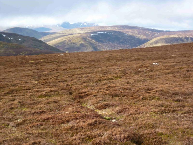
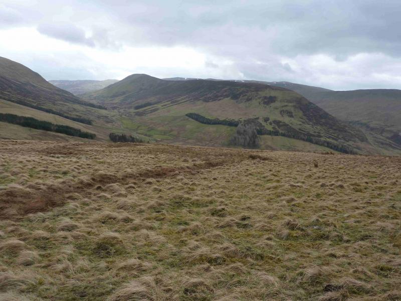
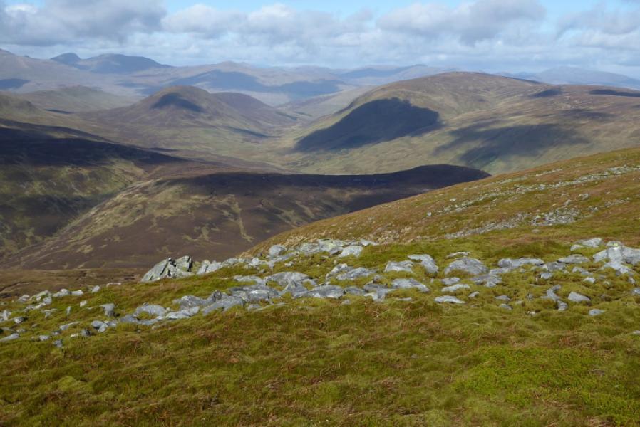
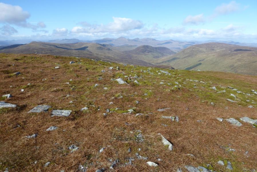
This is a pleasant circuit over a Corbett,which is almost a Munro, and a Graham which is almost a Corbett. In clear weather, there are excellent views across Loch Tay to the Ben Lawers range as well as to Ben Chonzie to the SE. Schiehallion is also visible to the N.
Route
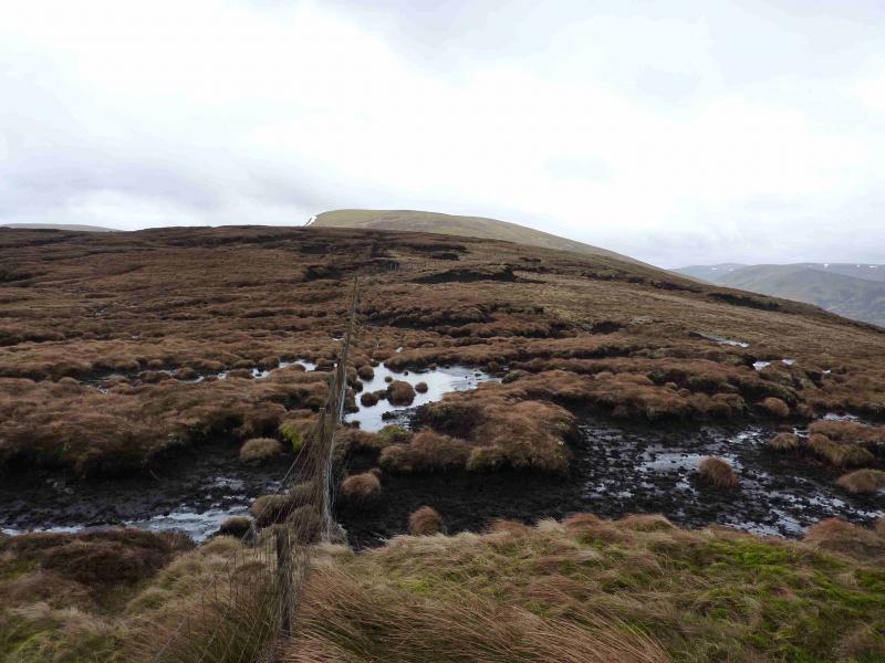
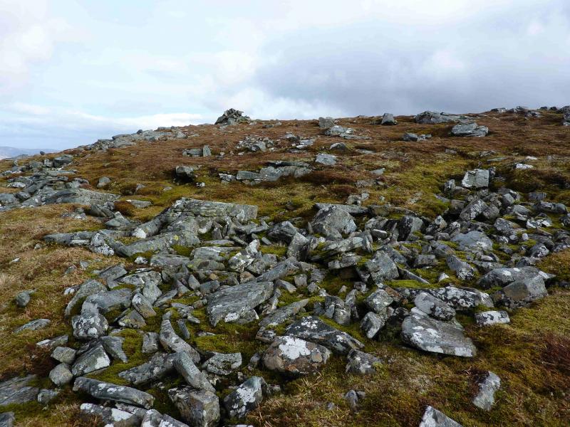
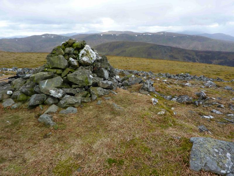
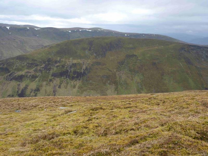
(1) Cross the bridge over the Allt a' Chilleine to the N side and, almost immediately go through a gate to find a faint track. Follow this track, shown on the map, until it passes below a small wood. Care is needed to follow the track as it is quite faint in places . Once past the wood, the track is better defined and, just before the next larger wood, starts to zig zag up hill. Some of the zig-zags are long and take one some way “back” towards Loch Tay. Eventually, the zig-zags end and the track, now very grassy, starts to traverse E across the hill side. After about 1 km of traversing, the track starts to head NE and seems to follow a grassy channel with a path by its side. As the track/path nears the long N – S ridge running over Creagan na Beinne, some peat hags will be seen on a minor top on this ridge. Either leave the track and go around the bottom of the peat hags or stay on the track until it goes through a gate in a fence. Do not pass through the gate but instead follow the fence to the right for a short distance until one can step over it onto good ground on the other side. Continue over the minor top and descend slightly to a shallow dip which has peat hags on its other side. Pick a way through the peat hags and ascend, gradually converging again with the fence returning from the right. In thick mist, the fence could be followed around the peat hags. Follow the fence until it turns right at a gate. A line of old iron fence posts continues from here but is quite intermittent. Continue almost due S over easy but featureless ground on a broad ridge. Care is needed in mist. Some faint paths/animal tracks may be a help in thick weather but some will lead one astray. The first cairn encountered, surrounded by scattered rocks, is small and not the summit so continue until a slightly larger cairn is reached, with steeper ground to its W, which marks the summit of Creagan na Beinne, 888 m.
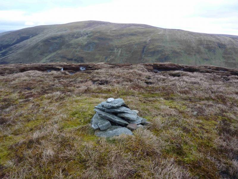
(2) Descend due S, on a broad ridge, on quite featureless ground. In thick weather, an accurate compass bearing will be needed. A peaty area may be crossed. Lower down, the ridge becomes steeper and less well defined. A grassy ATV track may be met in the last part of the descent and can be followed towards Dunan before leaving it when it enters a peaty area and heading roughly NW to meet the track from Dunan to Ardtalnaig. One can either ascend directly up to the nose of the Shee of Ardtalnaig or follow the track N until the track going SSW to the nose is met and followed up. Leave this track at its highest point and ascend NNW up the grassy nose of the hill. The summit is not marked on the 1988 map but is the only cairn on the first high plateau, just after the first peat hags are reached, and this is the summit of the Shee of Ardtalnaig, 759 m.
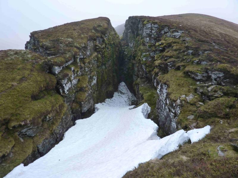
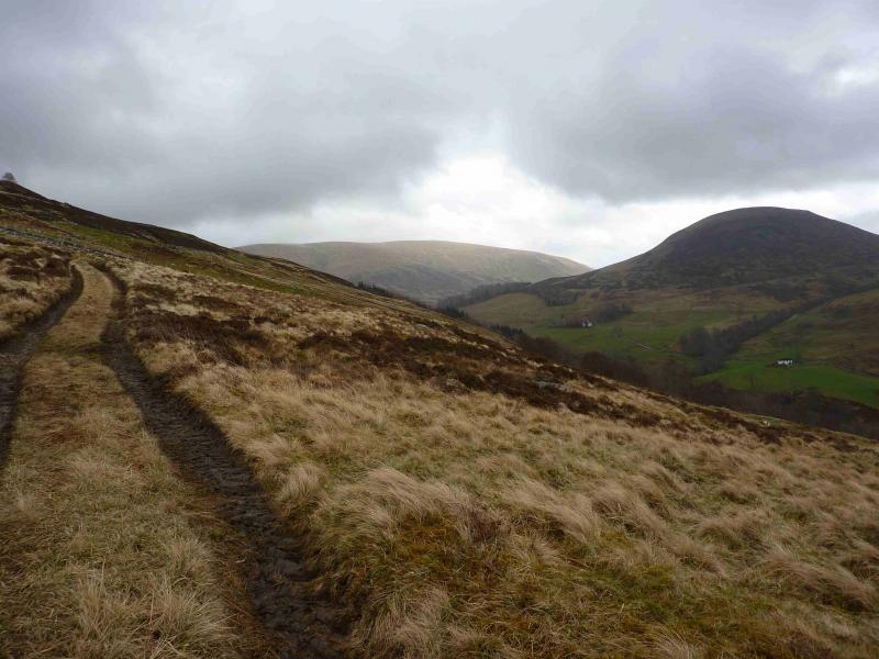
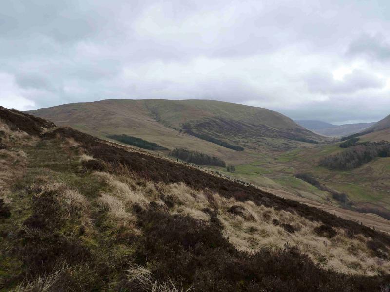
(3) Continue along the gently undulating ridge. There are several peaty areas which are easily passed. The most interesting feature is a large fissure on the eastern side of the crest. Just beyond this is a very shallow dip. One can descend from here by drifting gradually left, NW, on a gently descending traverse to join the track below at about where a branch goes up the side of the Shee of Ardtalnaig. Do not descend all the way to the burn in the bottom as this will result in some reascending on the track. Alternatively, walk off the end of the ridge, down steeper grassy/heathery slopes, to reach the track on the W flank. Follow the track to Claggan to join the main track in Gleann a' Chilleine and follow this back to Ardtalnaig.
Notes
(a) This walk took place on 19th February, 2002, 15th March, 2012 and 20th March, 2012.
Photos - Hover over photo for caption. Click on to enlarge. Click on again to reduce.