Get Lost Mountaineering
You are here: Scotland » 02 River Tay to Rannoch Moor » Ben Lawers Range including Tarmachan Ridge and Meall nam Maigheach
Full Ben Lawers Range Traverse from Bridge of Balgie road
Full Ben Lawers Range Traverse from Bridge of Balgie road
Start/Finish
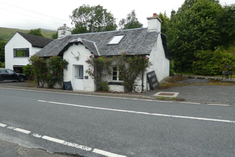
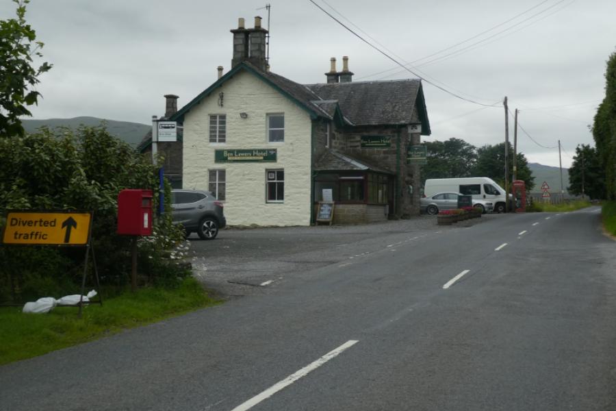
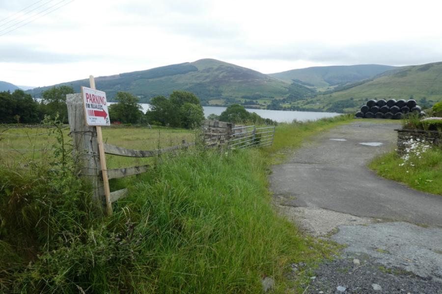
As close as possible to the cairn shown on the OS Map at NN 593 416. This is on the road to the Bridge of Balgie from the A827 Killin to Kenmore road along the north side of Loch Tay. Drive up this road, steep in places, which is not treated in the winter so may not be accessible in the colder months. Higher up there are car parks on the left for Beinn Ghlas and Ben Lawers. Continue past Lochan na Lairige. About 500 m past the northern end of the lochan, the road turns left and the cairn is just above this corner. Parking is very limited, often due to early arrivals not parking sensibly and taking up too much space. Some of the makeshift “lay bys” are deep enough to park at right angles to the road so please park sensibly. Do not park in the signed passing places. Note that this is a two car walk as the finishing point is a long way from and much lower than the start. The second car should be left at the Ben Lawers Hotel car park. The hotel is about half way along the A827 road on the north side of Loch Tay. It can be approached from either Killin, at the west end of Loch Tay, or Kenmore, at the east end. In 2024, there was a separate car park for hillwalkers costing £5 per day. As this provision can change, it is best to check before arriving as there are no other places to park for this walk.
Distance/Time
22 km About 10 – 11 hours
Peaks
Meall a' Choire Leith, 926 m, NN 612 439.
Meall Corranaiach, 1069 m, NN 615 410.
Beinn Ghlas, 1103 m, NN 625 404.
Ben Lawers, 1214 m, 635 414.
Creag an Fhithich, 1047 m, NN 635 422.
An Stuc, 1118 m, NN 639 431.
Meall Garbh, 1118 m, NN 644 436.
Meall Greigh, 1001 m, NN 674 438. OS Sheet 51.
Introduction
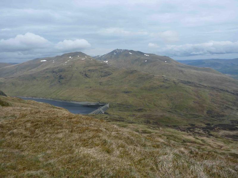
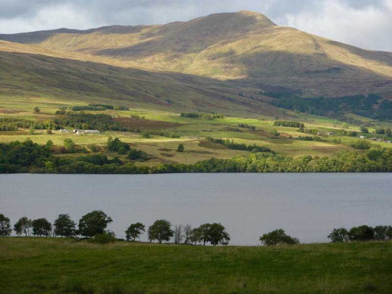
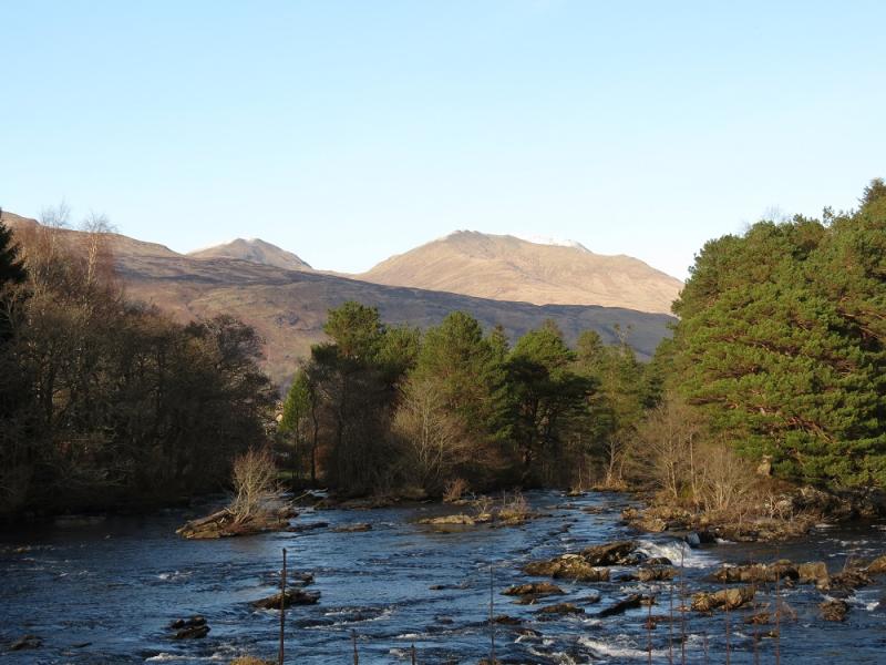
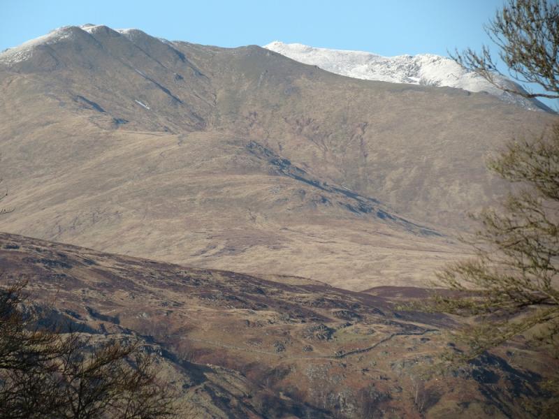
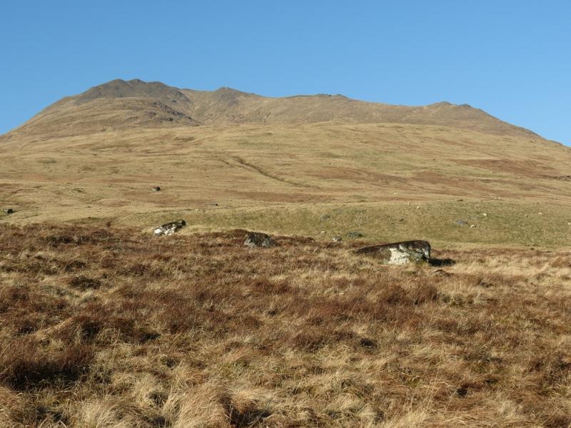
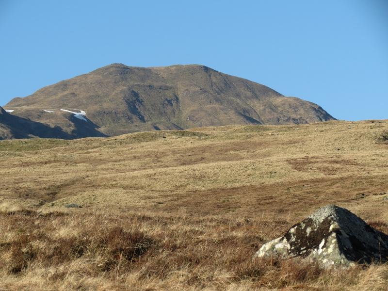
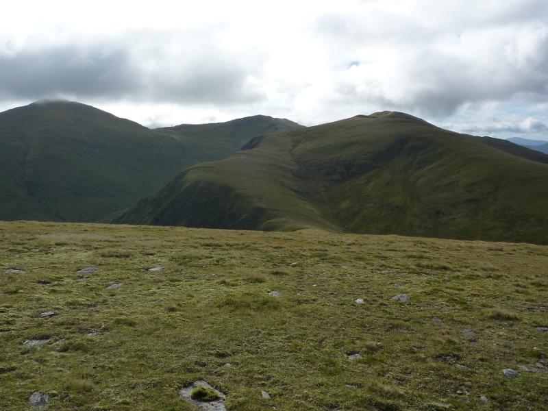
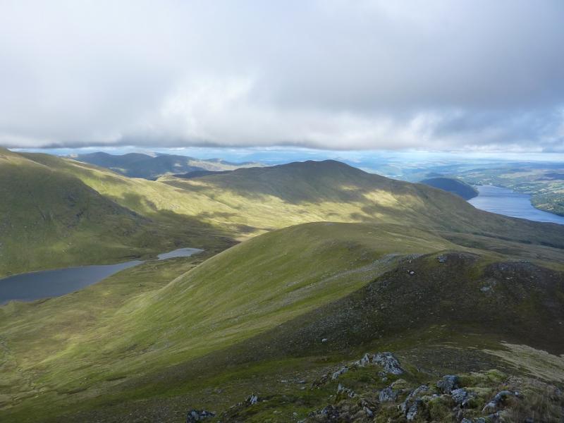
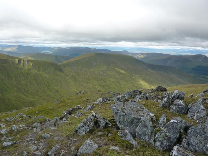
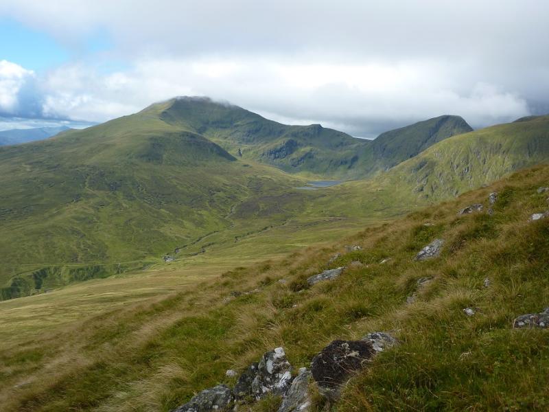
This walk ascends all seven Munro peaks plus one munro top in the Ben Lawers range.This is a fairly easy walk to navigate as there is a good path/track much of the way. However, such are the views that it would be a waste to walk this route in poor visibility and miss the very fine views. These views are to other parts of the Ben Lawers range, the Crianlarich Hills, the Glen Lyon hills, Ben Vorlich and Stuc a’Chroin and the Glen Lochay hills where Meall Ghaordie and Ben Challum are quite prominent but the finest view is to the Tarmachan Ridge across the Bridge of Balgie road.
Route
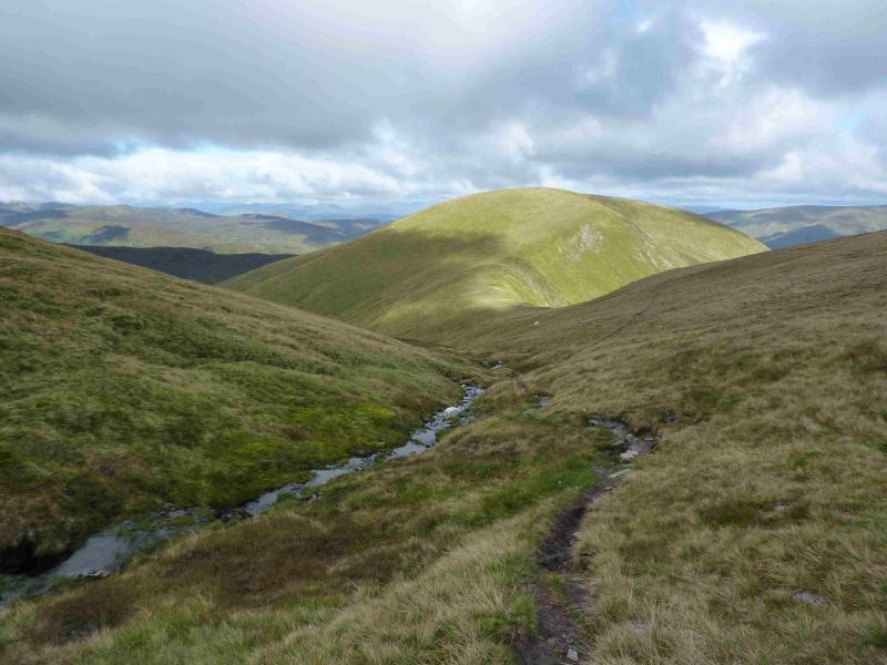
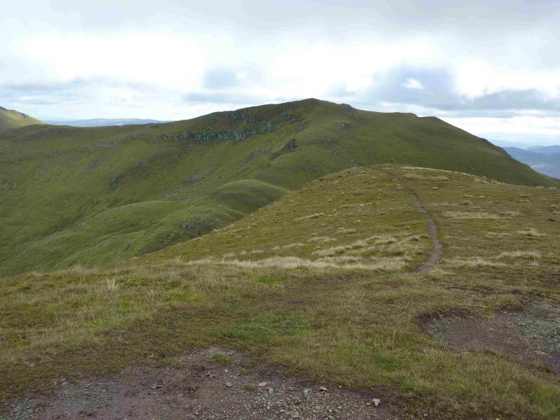
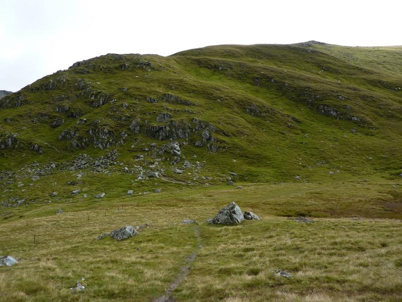
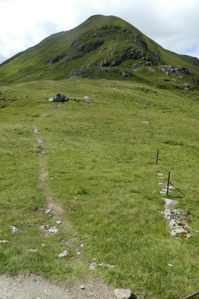
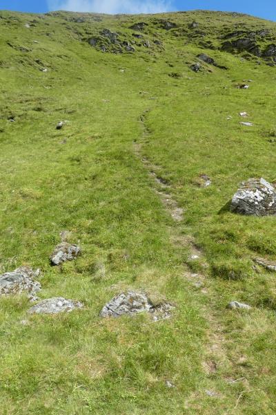
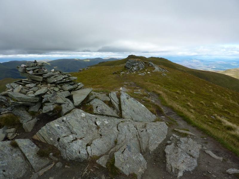
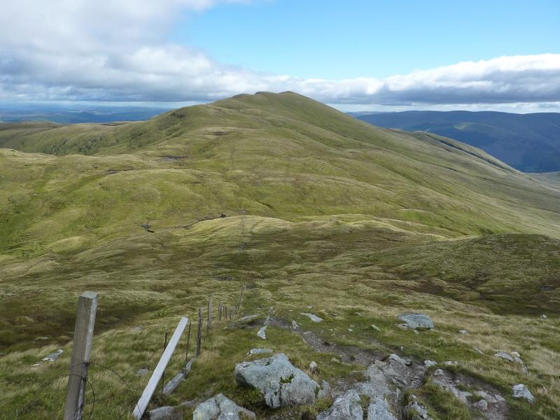
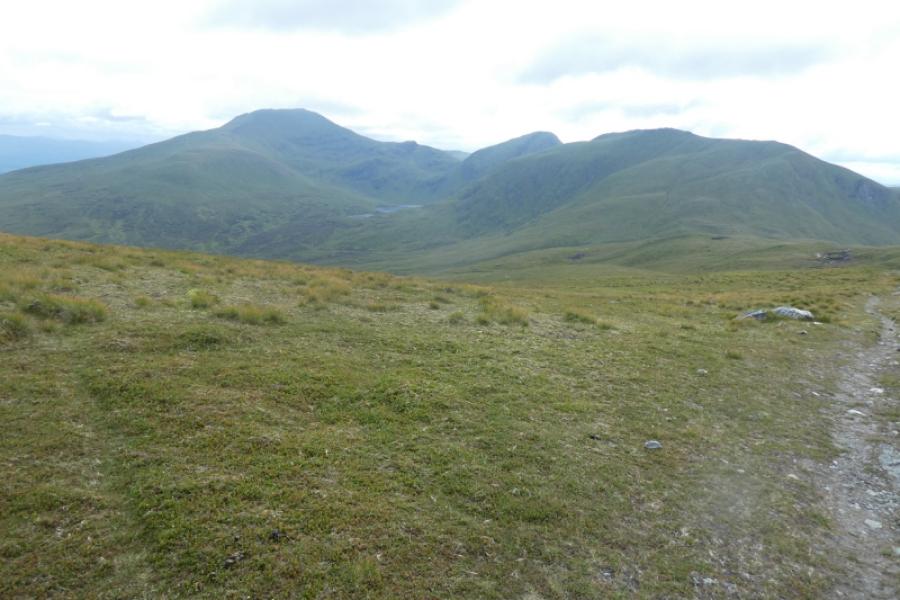
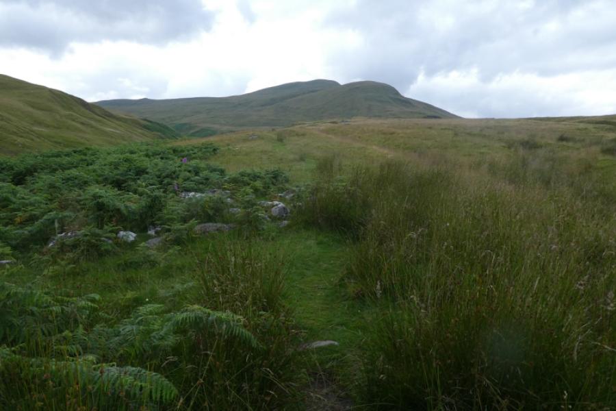
(1) From the road below the cairn, walk back towards the lochan. Almost immediately, reach the start of a rough track on the left. Follow this. It is boggy in places. When it starts to swing to the right, leave it and continue roughly NE, passing below the minor top of Meall nan Eun. There is a path but it is often quite boggy so it is often better to walk off the path. If it is clear, Meall a' Choire Leith should be visible so one can simply aim for it. The first “obstacle” is to cross the Allt Gleann Da-Eig. There is a water intake, which looks like a small dam, and this should be visible and can be aimed for. Normally the burn is easily crossed and is quite narrow so it would take exceptional weather to force a significant detour upstream. From the water intake continue NE then cross the burn flowing up Coire Gorm. Pick a way up the steepish but easy grassy slopes of Meall a' Choire Leith. Higher up, a path will be met which leads to the medium cairn which marks the summit of Meall a' Choire Leith, 926 m. If this looks too steep then look for a path which goes up the the S side of the Coire Gorm burn before crossing over higher up.
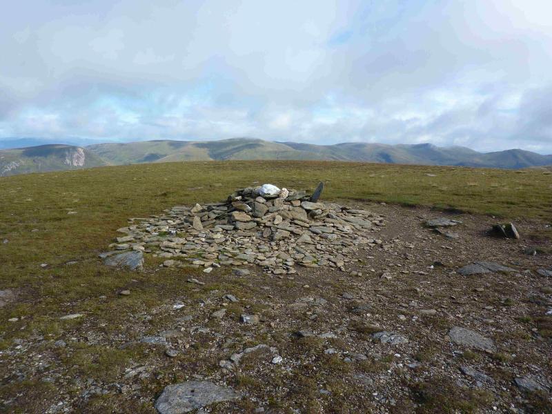
(2) The S ridge of Meall a' Choire Leith is short grass and many simply walk straight down it to join the path, well seen from above, in the bealach. To join this path higher up, walk E from the summit to the obvious edge then follow the path down. From the bealach, an obvious path, which goes all the way to the summit, follows the line of the Coire Gorm burn lower down. This is slightly to the W of the crest which could easily be followed instead. Higher up, the grassy ridge goes slightly W of S and narrows and passes over a few minor tops before reaching the medium cairn which marks the summit of Meall Corranaich, 1069 m.
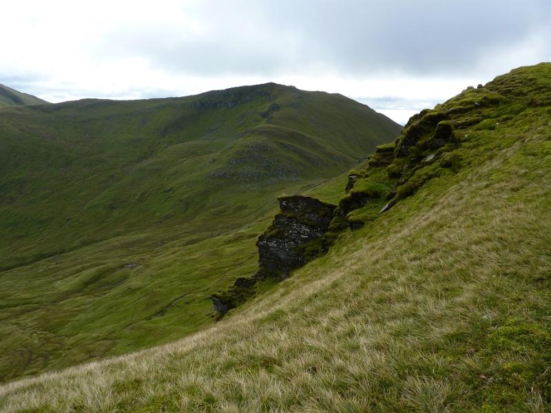
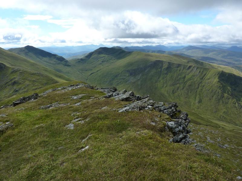
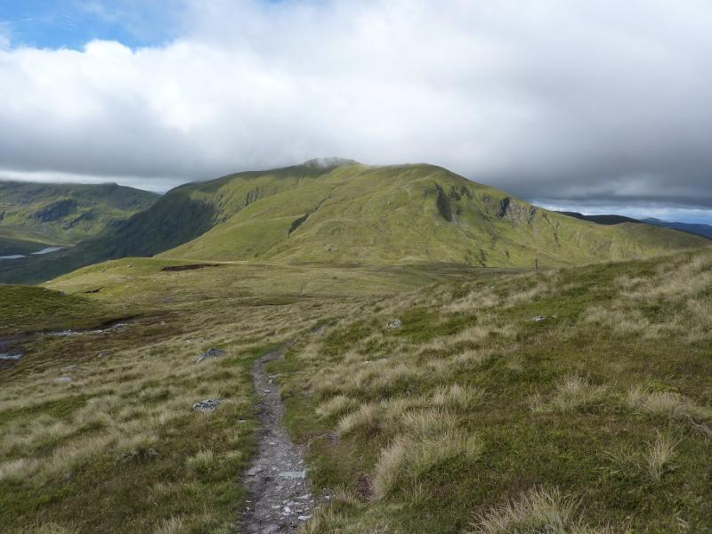
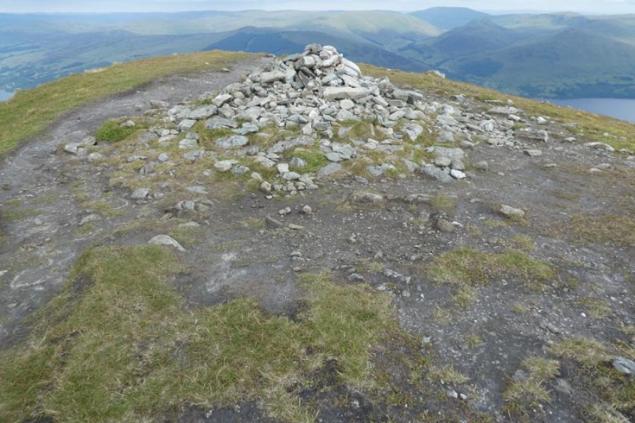
(3) Descend roughly E then SE down a very distinctive path which weaves its way down to the bealach below Beinn Ghlas. A few old fence posts shadow the path in places. If clear the path coming from the Beinn Ghlas car parks will be very obvious from above. This is the path which by passes Beinn Ghlas and climbs up on to the bealach between Beinn Ghlas and Ben Lawers; it will be used in the descent from Ben Lawers. Just before this path is reached fork right about 20 m and pick up a faint grassy path which starts ascending Beinn Ghlas. Follow this up. Lower down, it is faint in places, but higher up is very distinctive. It joins the main path up the SW ridge of Beinn Ghlas at a small cairn on a slabby outcrop which marks the summit of Beinn Ghlas, 1103 m. It is a little surprising that there is not a larger cairn.
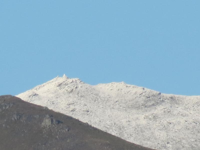
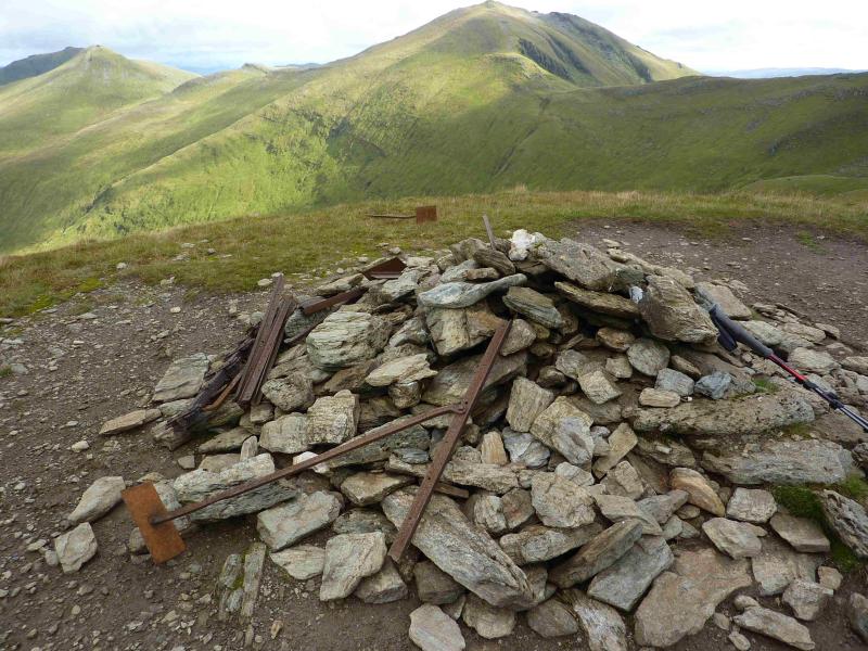
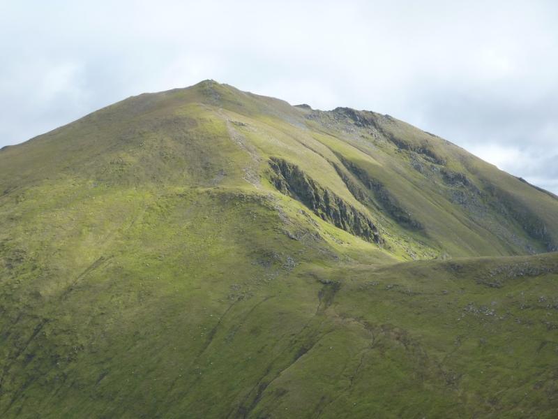
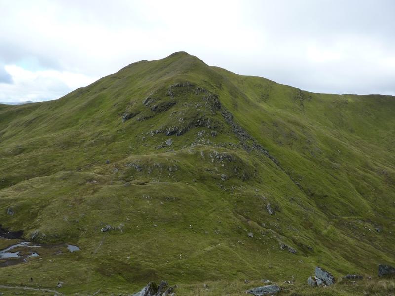
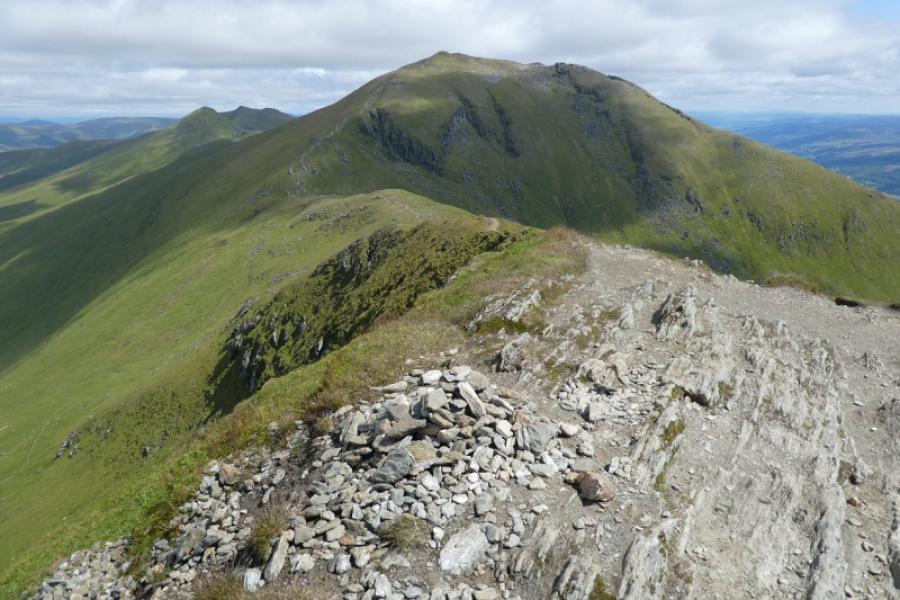
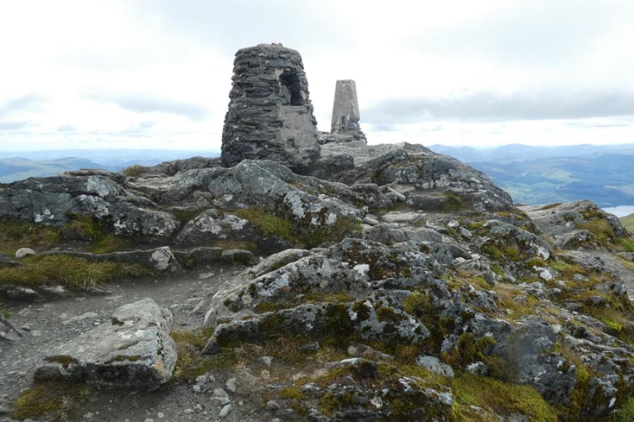
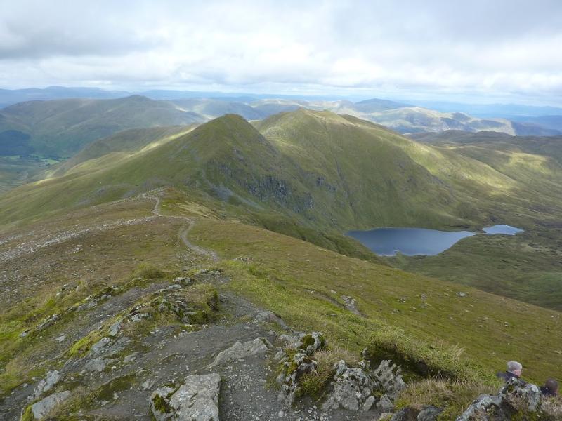
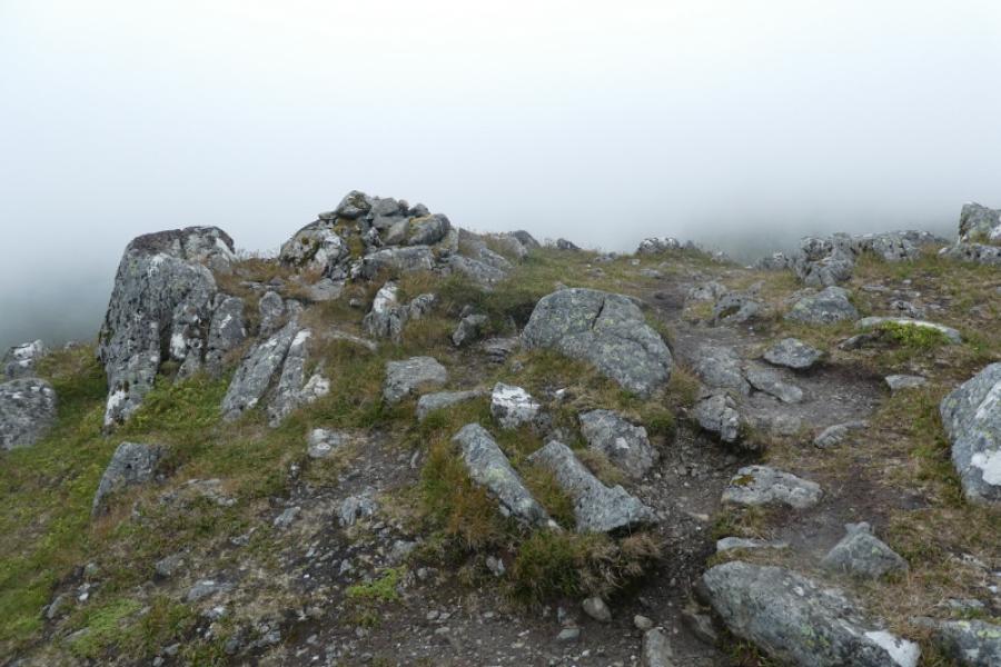
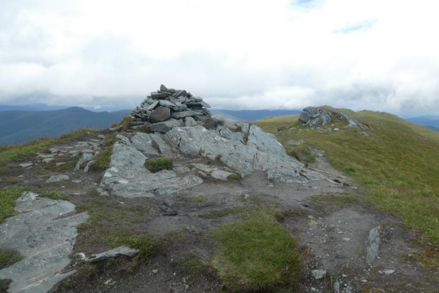
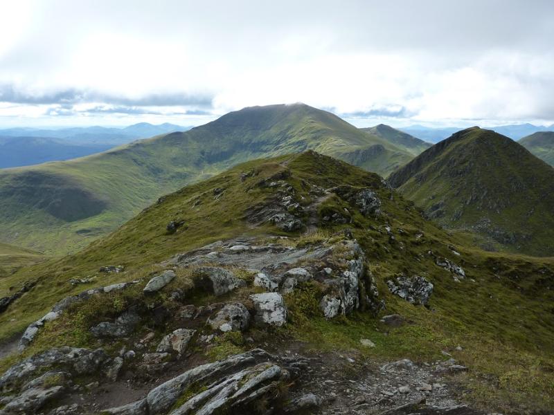
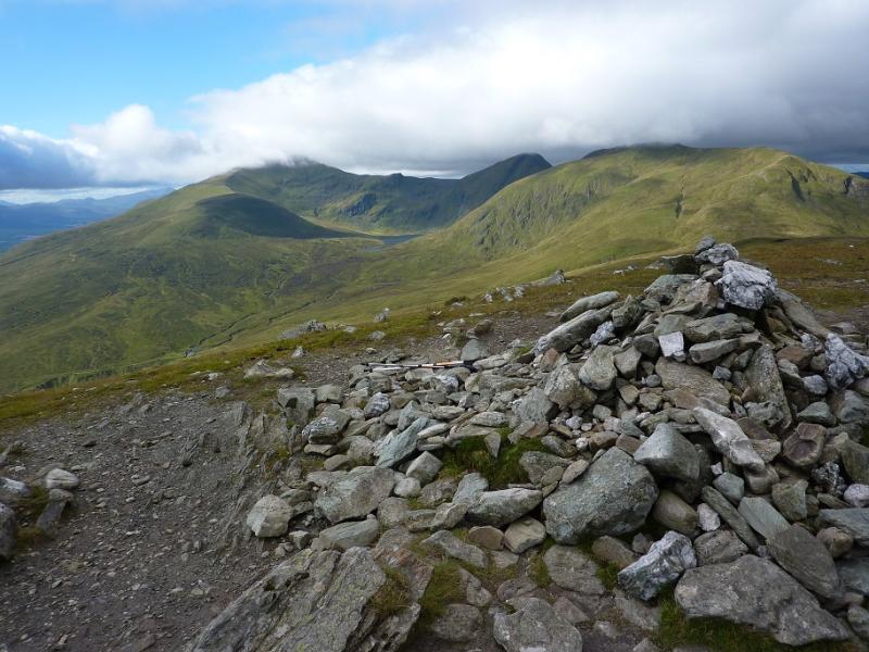
(4) The continuation to Beinn Lawers is very obvious. Follow the path which descends NE from Beinn Ghlas, along a well defined ridge to a ridge bealach, then ascend NNE then ENE up the obvious path to reach the trig point and adjacent rounded cairn which mark the summit of Ben Lawers, 1214 m. The path up Ben Lawers is eroded in places and has had much work in previous years but the volume of walkers takes its toll. There is no summit cairn in the form of a pile of stones as there is no room on what is quite a small summit. Looking E, there are some interesting rock formations not far from the summit which might be worth exploring. A well defined ridge runs E and an even more defined one runs N to the bealach below An Stuc.
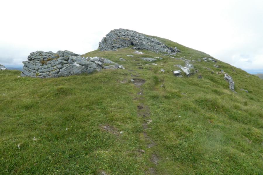
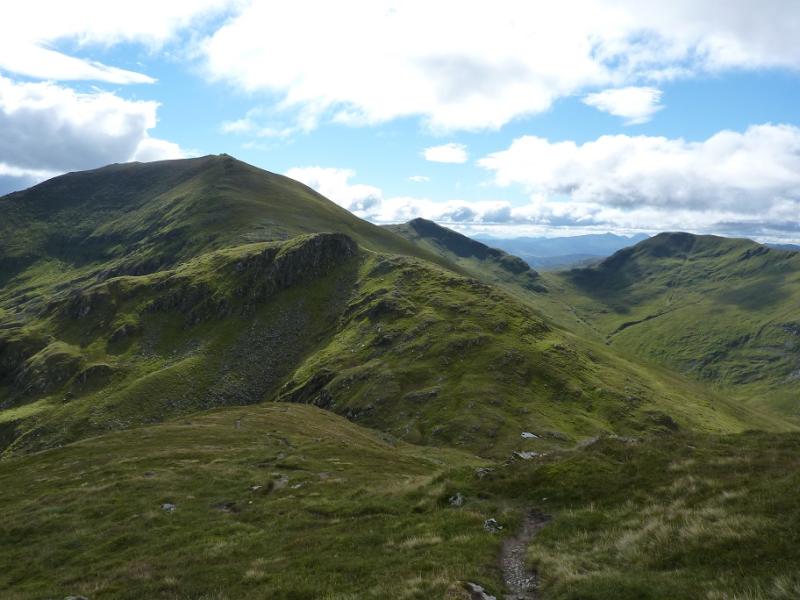
(5) Take the path descending north from the summit and follow it down, steeply in places, and continue down the ridge until the path ascends to reach a small cairn marking the summit of Creag an Fhithich, 1047 m. It may not have looked much of a summit on approach but it certainly looks like one when descending th eother side.
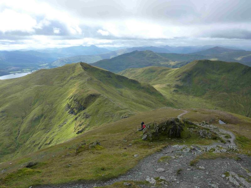
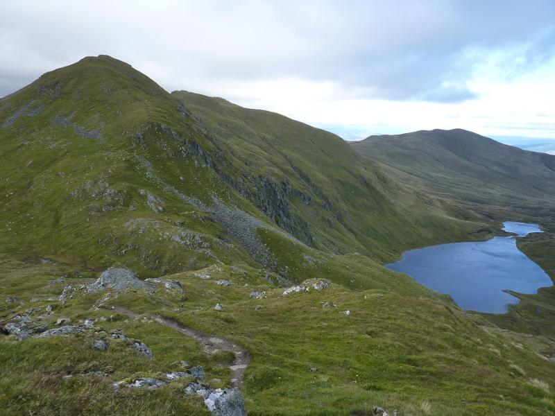
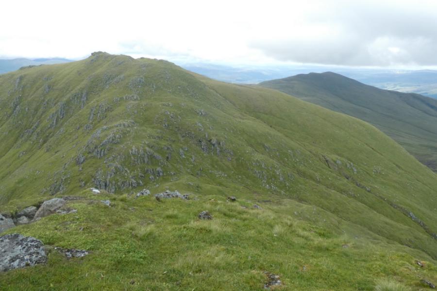
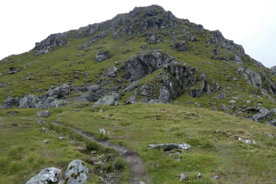
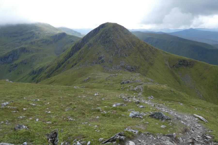
(6) Continue on the path, descending quite some way to the dip below An Stuc. Ascend the obvious path to reach the cairn which marks the summit of An Stuc, 1118 m.
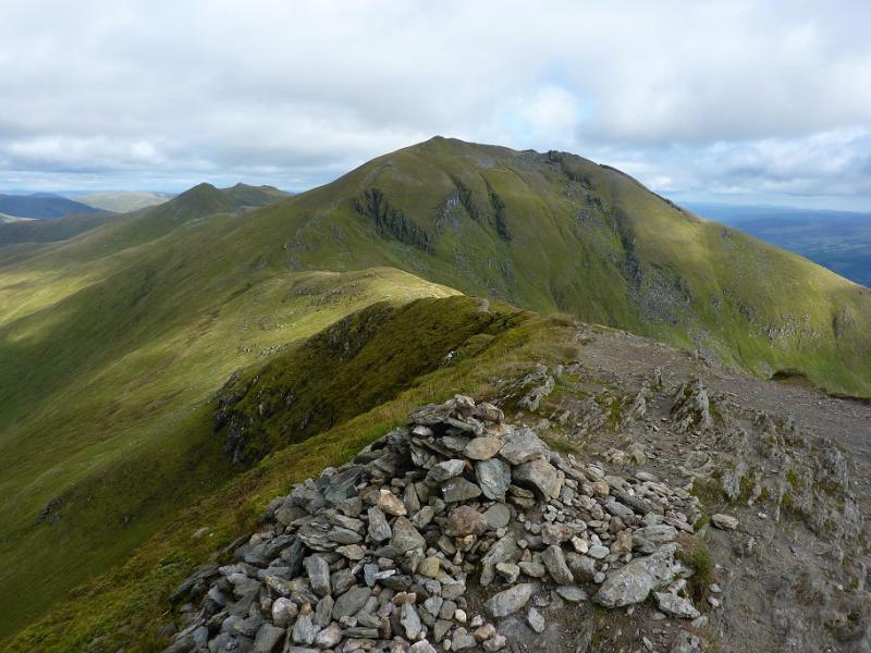
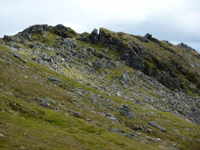
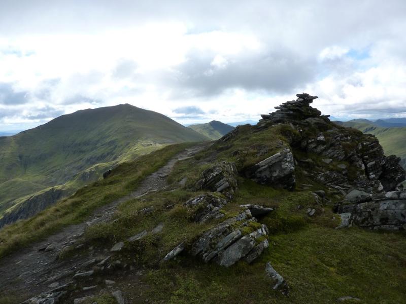
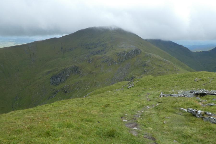
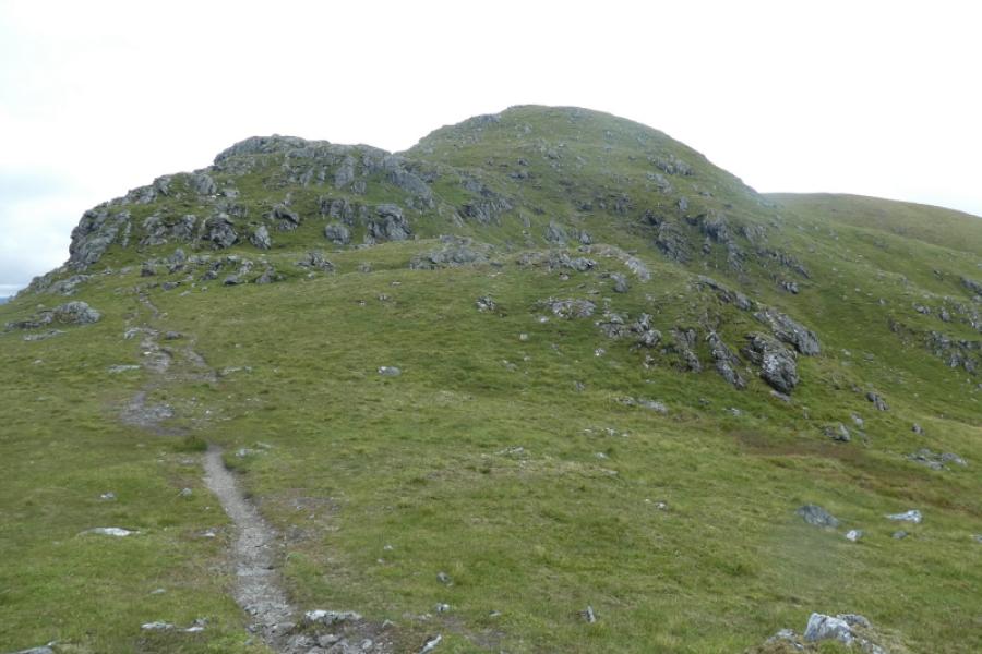
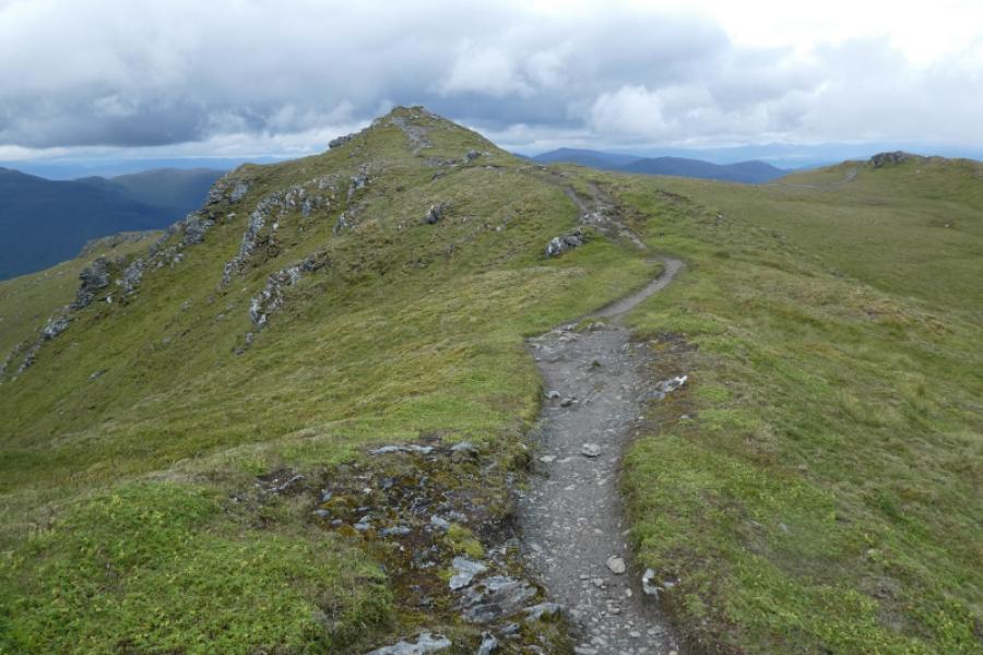
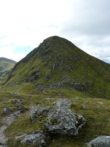
(7) The descent of An Stuc needs some considerable care as part of the path is steep, loose and twisting as it descends a rocky slope. It isn't a climb nor even a scramble but you will need to use the rocks as a handrail in places. A slip could easily result in broken bones. Once down, a good path leads up from the dip to reach the cairn which marks the summit of Meall Garbh, 1118 m.
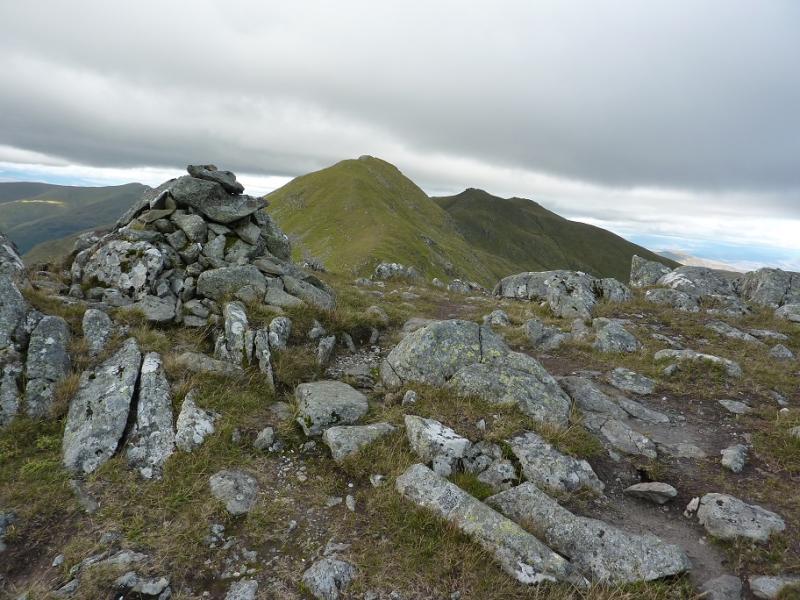
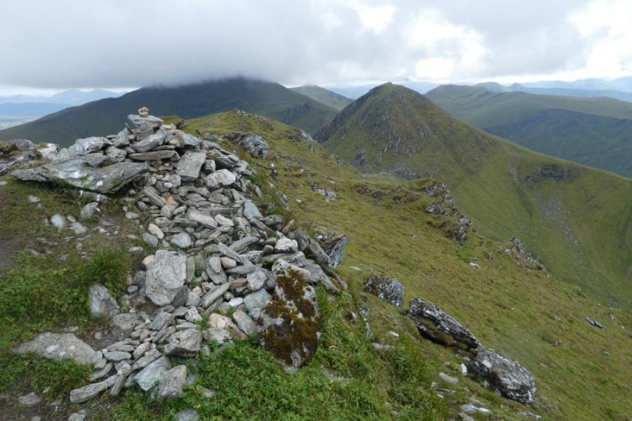
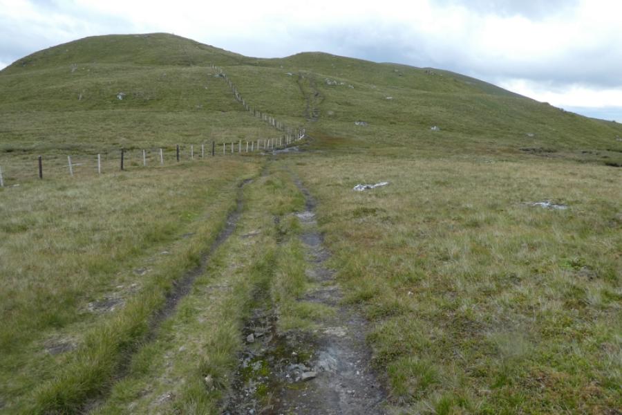
(8) The continuation is fairly obvious on a distinctive path which shadows a fence. The ground now gradually becomes less rocky and more grassy which can mean wet and boggy patches especially in the bealach (col). Continue up on a fairly distinct path still shadowing the fence part of the way. A cairn is reached which is the north top. Continue further to reach the larger cairn which is the summit of Meall Greigh, 1001 m.
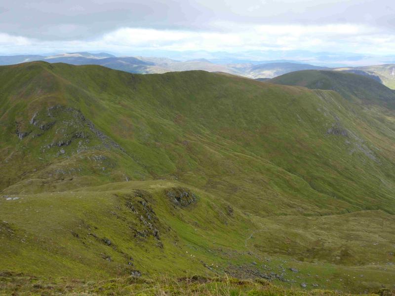
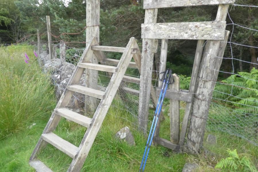
(9) The descent path is as obvious as the ascent path. It eventually leads down to a shallow boggy gap where it seems to disappear. It has actually gone right just before the boggy gap then crossed the end of it before continuing on the edge of the hill. It does not go down the grassy gully at the end of the boggy patch. The path is now quite easy to follow as it makes a descending traverse down towards the Lawers Burn where it joins another path on the bank above the burn. Turn left and soon reach a stile into the wood where the path lead down through the wood to become a track which leads down to the road at the Horncarvers in Lawers village. Turn left and walk slightly uphill for less than a kilometre to reach the Ben Lawers Hotel.
Notes
(a) This walk actually took place in the 1980s and 1990s but digital cameras did not exist then nor did the internet and websites so this posting has been pieced together from photographs taken on later walks.
Photos - Hover over photo for caption. Click on to enlarge. Click on again to reduce.