Get Lost Mountaineering
You are here: Ireland » South West » Dingle Peninsula
Brandon Mountain, Brandon Peak & Gearhane from Faha via Pilgrims' Path
Brandon Mountain, Brandon Peak & Gearhane
by the Pilgrims’ Path from Faha
Start/Finish
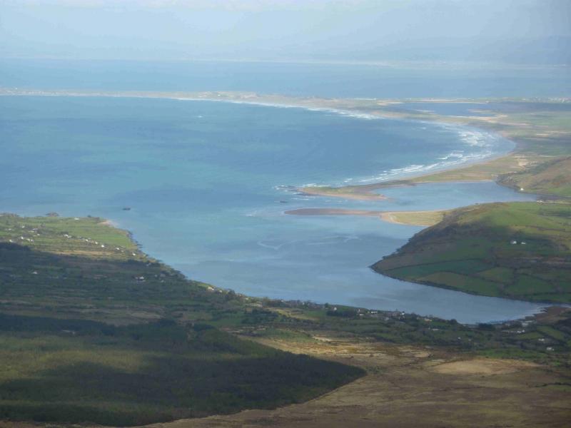
Brandon Mountain (or Mount Brandon as some call it) is the only “Munro” on the Dingle Peninsula. Approaching Dingle from the E, turn right at the roundabout, on the outskirts of the town, and go over the Connor Pass. At the bottom, go left through the village of Cloghane and continue for about 1.5 miles to a crossroads where you turn left. Signpost does not say “Faha” but may say Brandon Mountain. Drive to end of road which is called Faha (there is no sign to confirm this!) and where there is parking for about 12 cars.
Distance/Time
14 km Approx 8 hours
Peaks
Brandon Mountain, 952 m, Q 461 116 (Irish National Grid System)
Brandon Peak, 841 m, Q 472 095
Gearhane, 803 m, Q 468 088 Irish OS Discovery Series Map 70 (1:50000)
Introduction
This is an easy ascent of Brandon Mountain with a good and obvious path which is way marked some of the way. You should be able to easily reset your GPS to the Irish National Grid System. Brandon Mountain is notorious for mist and has more misty days than even Ben Nevis so feel privileged if you have good weather. The continuation to Brandon Peak is a very scenic ridge walk but most of the route has to be retraced back over Brandon Mountain. The extension to Gearhane crosses a narrrow grassy arete; it is possible to traverse Brandon Peak on the return.
Route
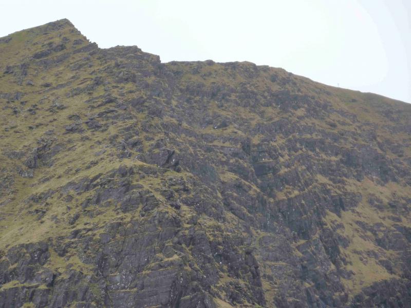
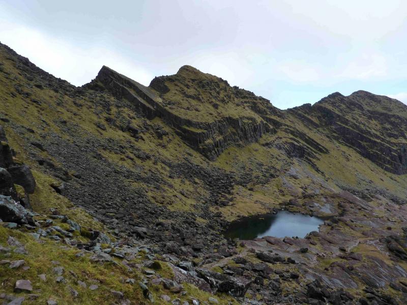
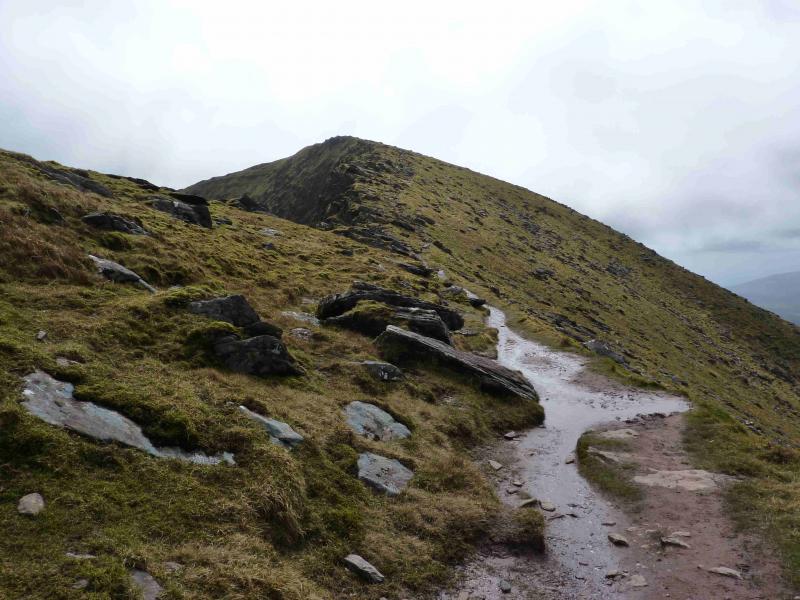
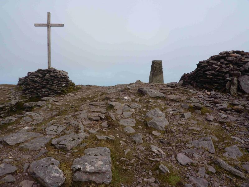
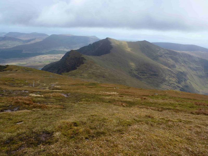
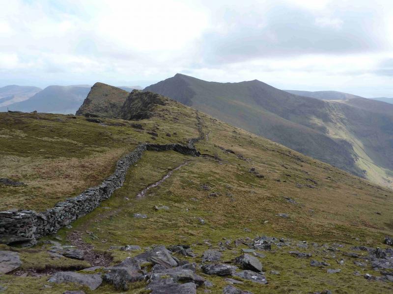
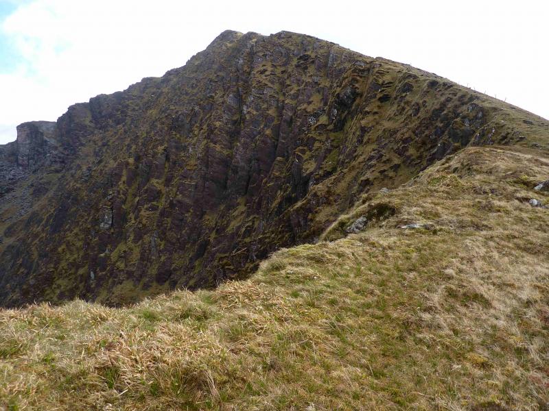
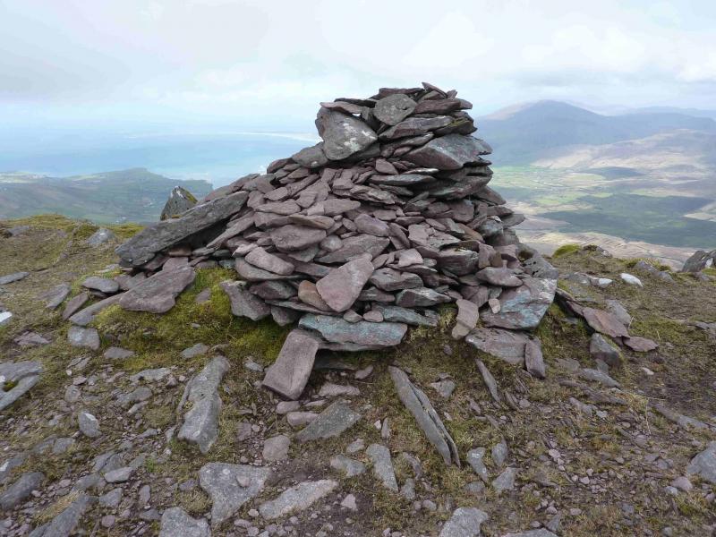
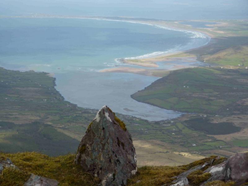
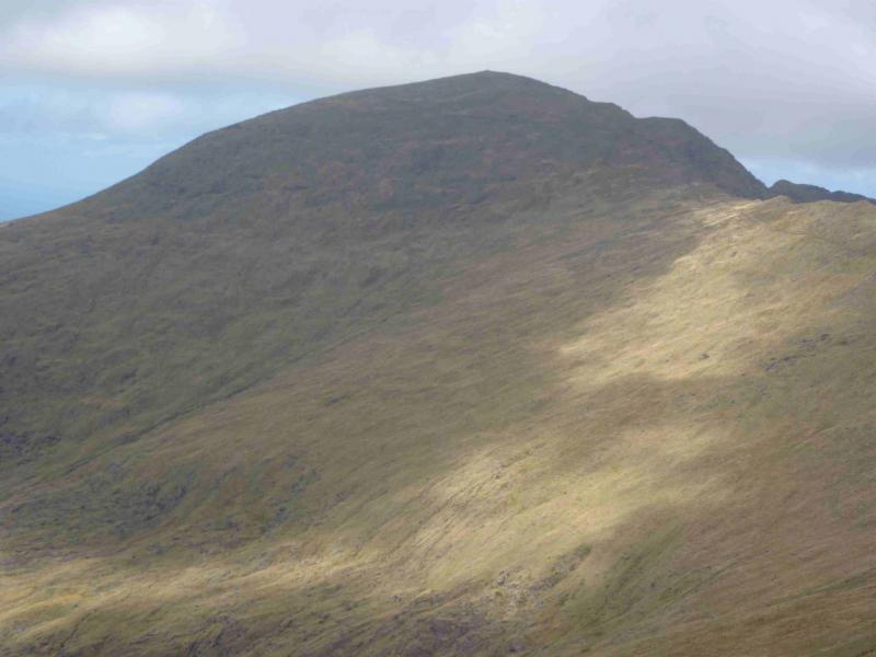
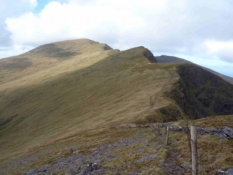
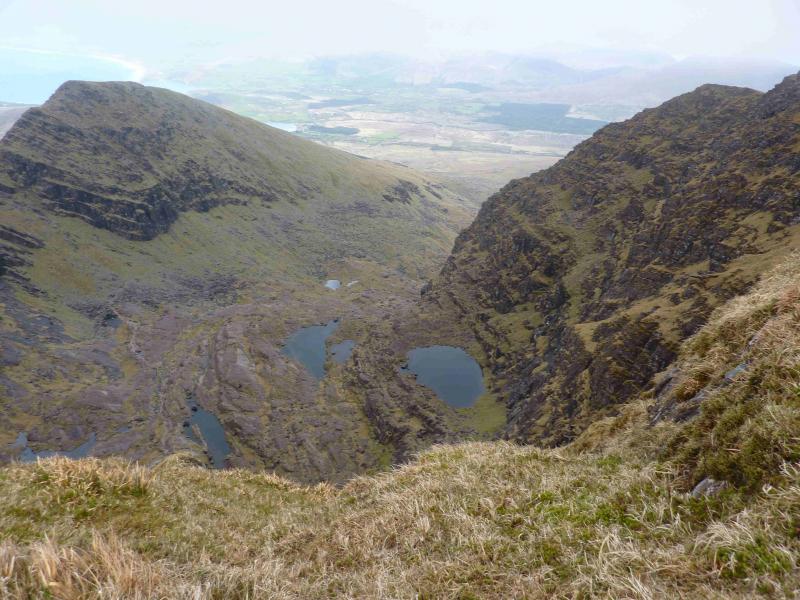
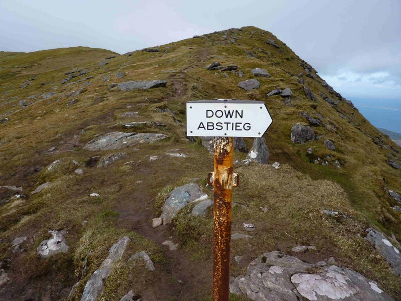
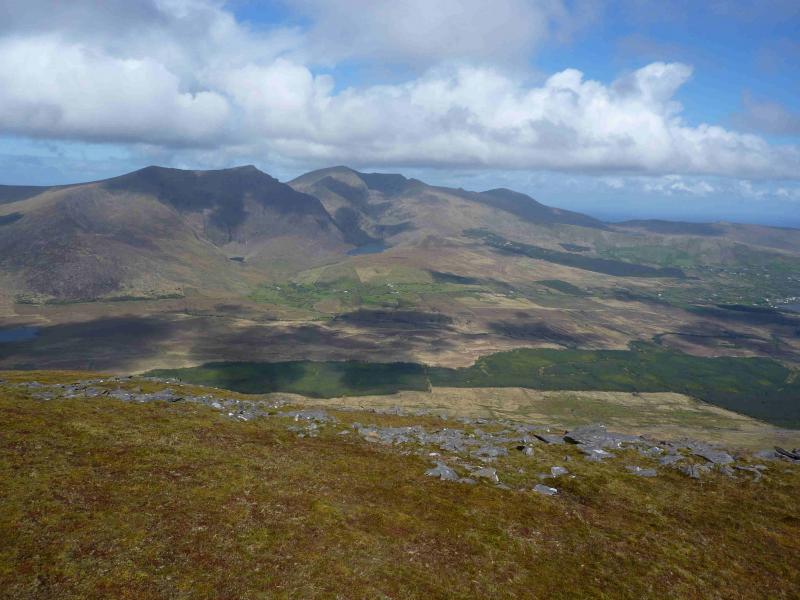
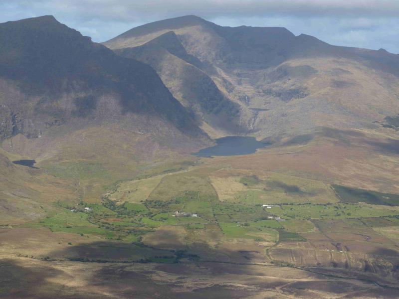
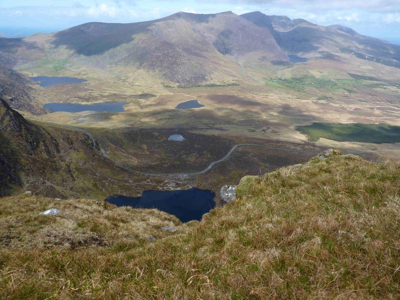
(1) Take the path at the top of the car park which is initially a track and goes behind the fairly new house to a gate then goes roughly NW to a large grotto. From there, an obvious path slants up towards the ridge on the right, N, but never quite reaches it. Soon white posts appear which mark a significant part of the route. The path gradually climbs into a corrie past a series of lovely little lakes known as the “Pater Noster (our father) Lakes” then climbs more steeply to the right of a buttress. A few parts of this section of path are showing signs of erosion so care is needed on the steeper sections. The steep path emerges on the summit ridge about 500 m N of the summit. Ascend the gently sloping summit ridge, with large drops on the left, E, to reach the top. The summit of Brandon Mountain, 952 m, has a large cross set in a large cairn with a rectangular hollow on one side, a trig point and another large cairn. Three ridges meet at the summit: the ascent ridge, the Saint's Path from the SW which is marked by a line of white posts which are fairly close to each other and the third ridge goes SE then SSE and is the continuation of the ascent route along the cliff edge which is marked by old wooden fence posts.
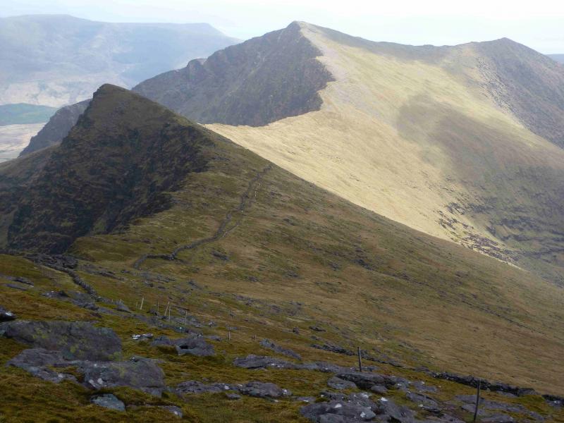
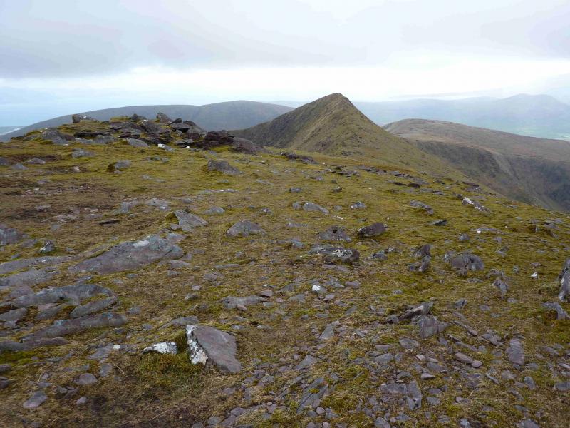
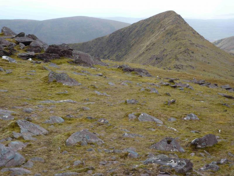
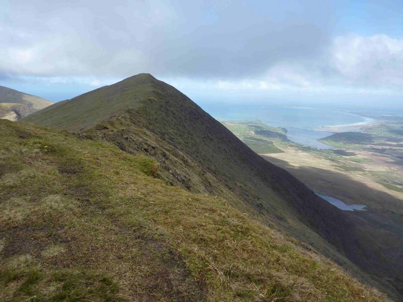
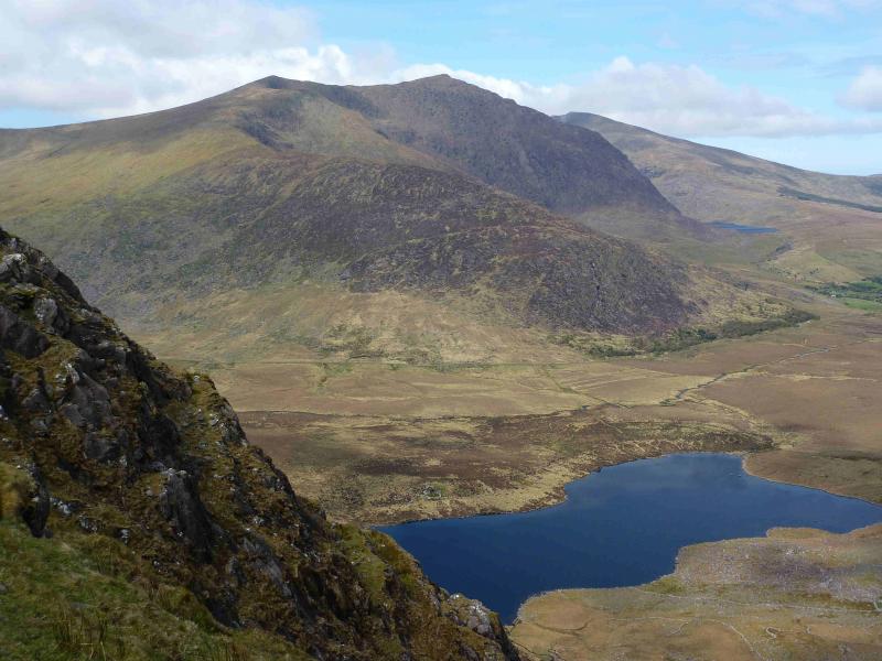
(2) Descend SE the SSE, following the cliff edge (on one's left) and the line of old wooden fence posts. There is an obvious path by the fence posts or another nearer the edge. Lower down a wall joins the fence posts. The wall and fence continue to the col below Brandon Peak where the wall goes off to the right and the fence continues up the rocky edge before soon petering out. Continue upwards, on a path, to reach a medium cairn which marks the summit of Brandon Peak, 841 m.
(3) From the summit, descend roughly SSW on easy ground to reach a shallow col. Continue, with the crest narrowing to an arete with steep drops either side to reach a small grassy top with no cairn which is the summit of Gearhane, 803 m. Shortly after the summit is a fence with a gate.
(4) Retrace towards Brandon Peak but from the col, traverse across easy slopes on its W flank. The wall which was followed earlier follows most of this traverse, but not initially from the col, and is a good guide in mist. Once Brandon Peak has been traversed follow the wall and fence back up Brandon Mountain. Remember that only the fence/fence posts go to the summit, the wall goes off W before the summit. From Brandon Mountain summit, retrace the outward route to Faha.
Notes
(a) This walk took place on 22nd April, 2012.
(b) An alternative and more sporting ascent of Brandon Mountain from Faha is to gain the crest of the ridge on the right referred to above. This becomes increasingly rocky with a knife edge crest at one point. The rock gets very slippery in the wet. Some may wish to drop below the knife edge crest on the right but the local topography can be confusing in mist when one tries to regain the ridge and it is easy to go astray. In good weather it is easy to continue around the corrie rim and pick up the route described above.
(c) This walk is ideal for those parties with two cars. Leave one car at the end of the long minor road from Cloghane. The end of this road is at Q 470 068. There is limited parking for about three cars. Start the walk at Faha as described above but when Gearhane is reached, descend SW, on easy grassy slopes, heading for Pt 623 at Q 459 078. When the ground levels off, look for a stony track (not shown on the map) which zig zags down to join the path (Pilgrims' Route) just before the farmhouse. Alternatively, continue further and descend the Pilgrims' Route itself to the farmhouse. Another attractive possibility is to leave the second car at the top of the Connor Pass where there is a large car park. The walk would then continue from Gearhane, over Pt 623, across the col and Pilgrims' Route at Q 448 066 then up on to Ballysitteragh, 624 m. From here, it is an undulating grassy ridge walk over Beenabrack and An Bhinn Dubh to reach the top of the pass.
(d) There is a very good camp and caravan site, near the village of Castlegregory, called the Anchor Caravan Site.. It is very well laid out with good facilities for campers including hot showers for a small extra charge. There is a good campers’ kitchen with tables and sinks if you have your own cooking equipment and pans as well as a fridge and freezer. There is also a sitting room with a TV. Castlegregory is on the N side of the Dingle Peninsula. From Dingle, go over the Connor Pass, then follow the coast road towards Tralee, past Castlegregory (excellent Spar shop here) until signs appear. If you reach a large petrol station/stores on the right, you have gone too far. At the bottom of this site is a gate from where a short path goes over a sand dune to the beach and Atlantic Ocean. Well equipped trailer vans are also available for hire.
Photos - Hover over photo for caption. Click on to enlarge. Click on again to reduce.