Get Lost Mountaineering
You are here: England » Peak District » Bleaklow, Higher Shelf Stones & Cock Hill from Old Glossop & Snake Pass
James's Thorn, Ferny Hole & Shelf Benches from Old Glossop
James's Thorn, Ferny Hole & Shelf Benches from Old Glossop
Start/Finish
The turning circle at the end of Shepley Street in Old Glossop. From Glossop, take the Snake Pass road. Go through the first roundabout then take the next left at the Commercial Inn which goes up Manor Park Road. Higher up, the road seems to go right which is Shepley Street (there is a street sign). Follow this to its end at a turning circle just after a large factory on the left. Do not park in the turning circle but park sensibly close by.
Distance/Time
9 km. About 3 – 4 hours.
Peaks
James's Thorn, 572 m, SK 081 950.
OS Outdoor Leisure 1: Dark Peak. OS 1 : 50 000 Sheet 110.
Introduction
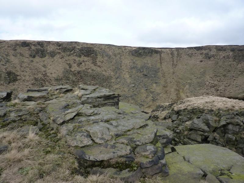
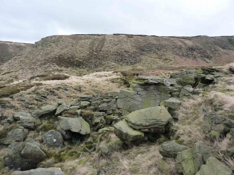
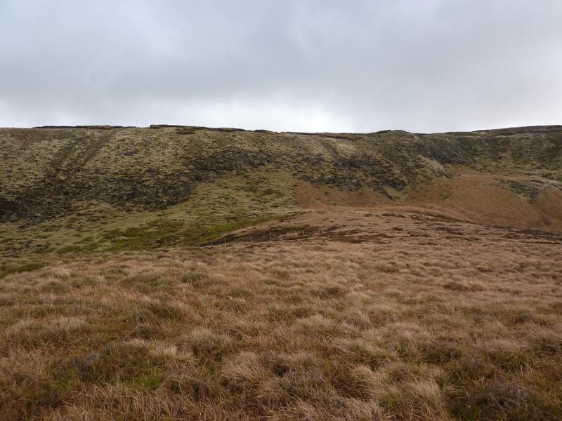
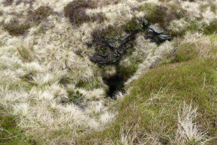
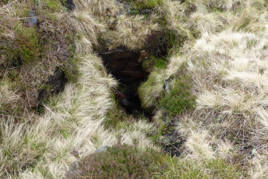
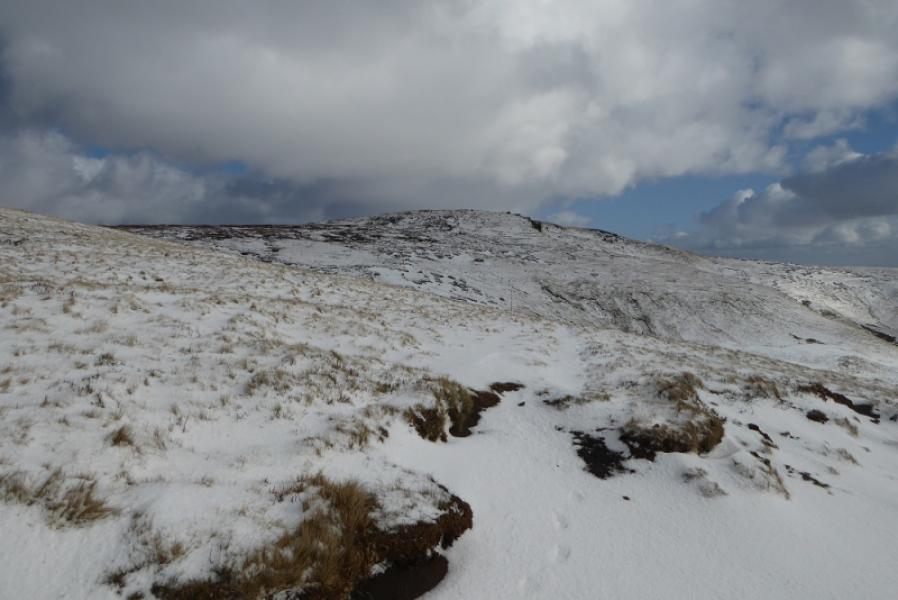
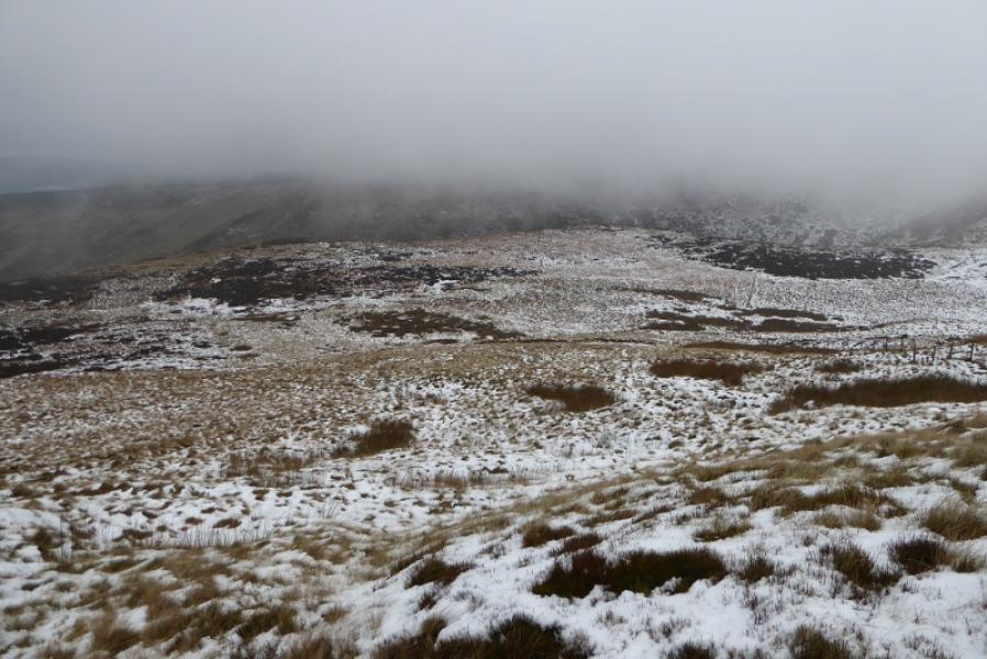
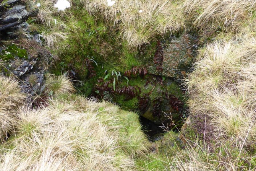
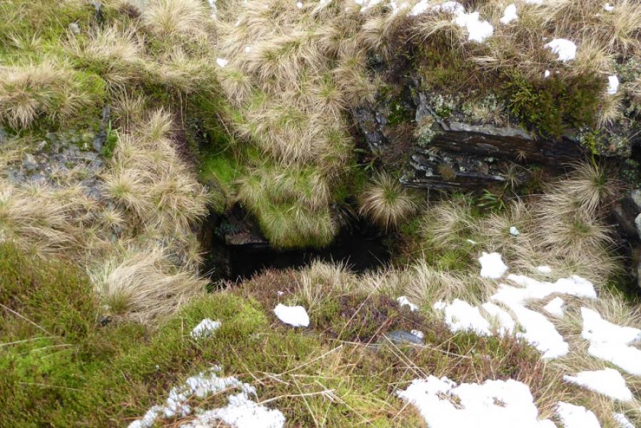
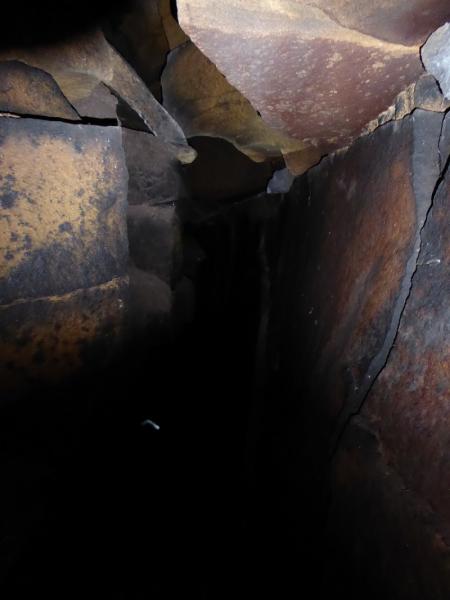
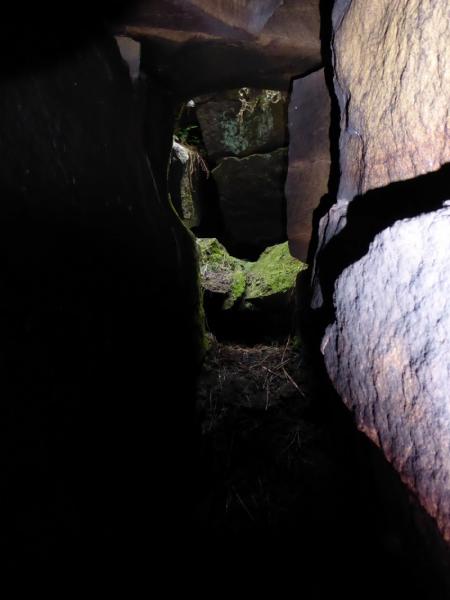
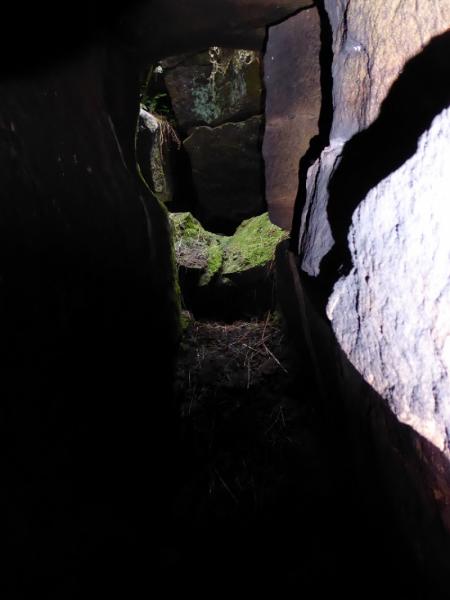
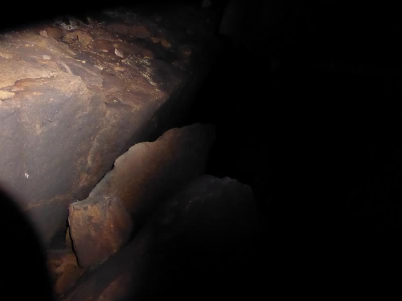
This is a short but fine walk in the Dark Peak which, in good weather has good views of the surrounding countryside including Bleaklow and Kinder. Some of the going is boggy, even in a dry spell, and gaiters are recommended. This walk can easily be accomplished on a short winter's day. Because of the nature of the terrain, this walk is best undertaken in clear weather. In mist, the higher terrain can be very confusing and it will be difficult to locate the highest point on James's Thorn which is unmarked. The return via Shelf Benches is underneath a rocky edge but there are no difficulties for the average walker. There seems to be some confusion as to what Ferny Hole actually is. Some think it is a pothole which leads to a cave whilst others take it to be the “scoop” above Wigan Clough. After some local research, it seems that the former is correct and that Ferny Hole is not where it is named on the OS map (to the south of the upper section of the stream in Wigan Clough) but is at SK 07620 95397 on the plateau of Pt 467 to the north of Shelf Benches. The drop into the pothole is about 3 m and needs care although it is not that technical and should be within the scope of the average scrambler; the rock can be slippery at times.
Route
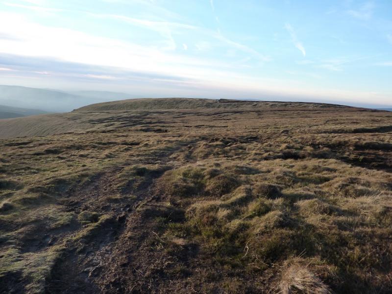
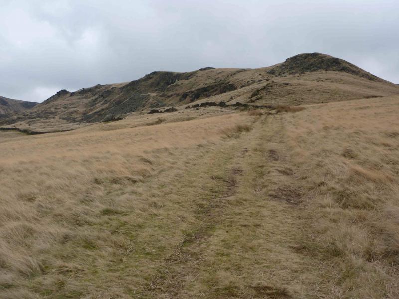
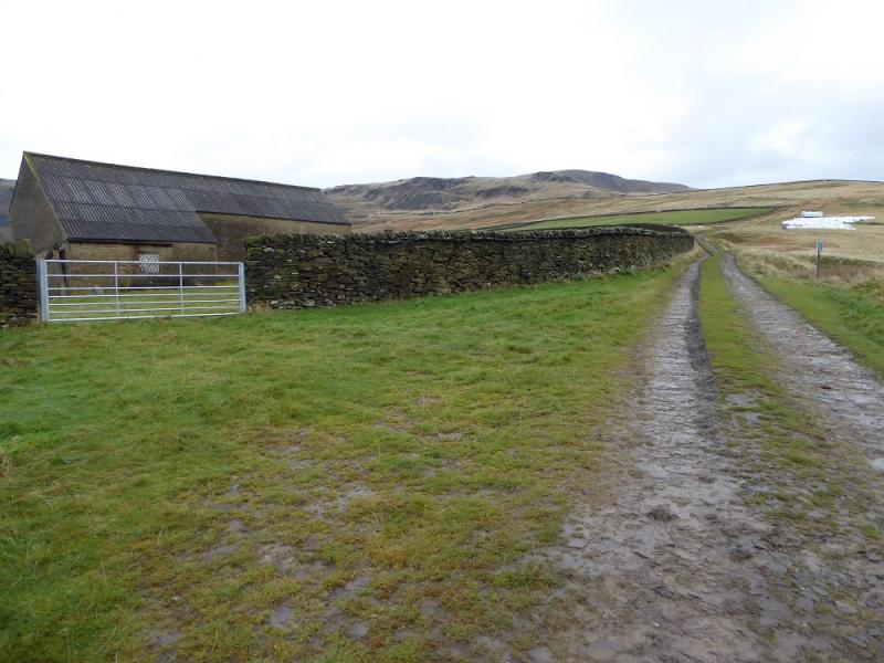
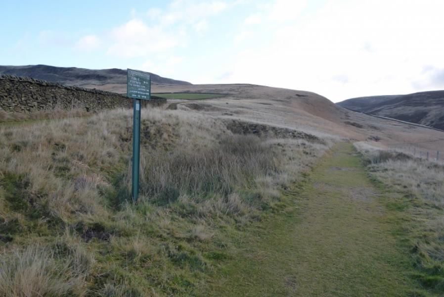
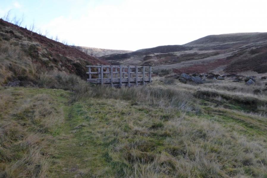
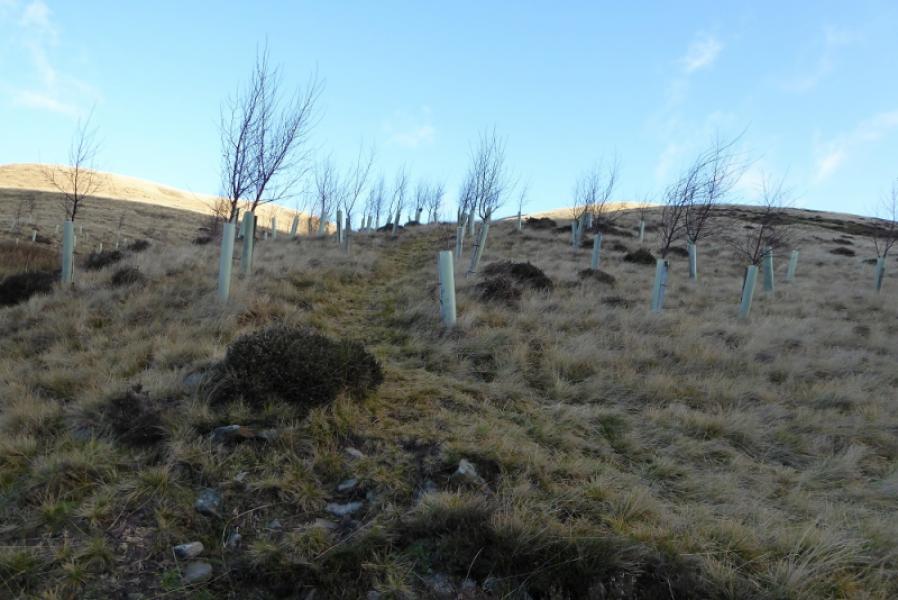
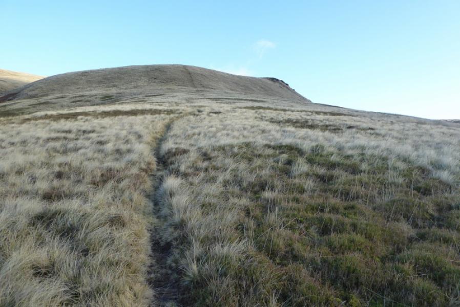
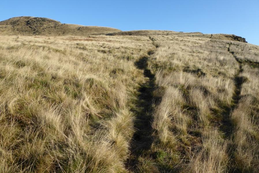
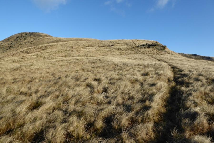
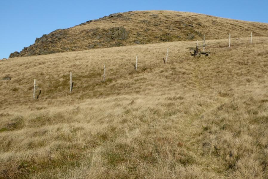
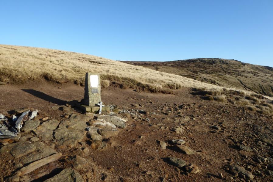
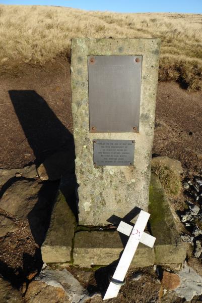
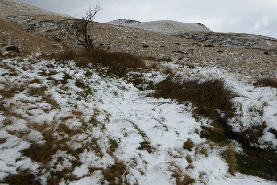
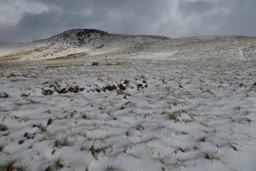
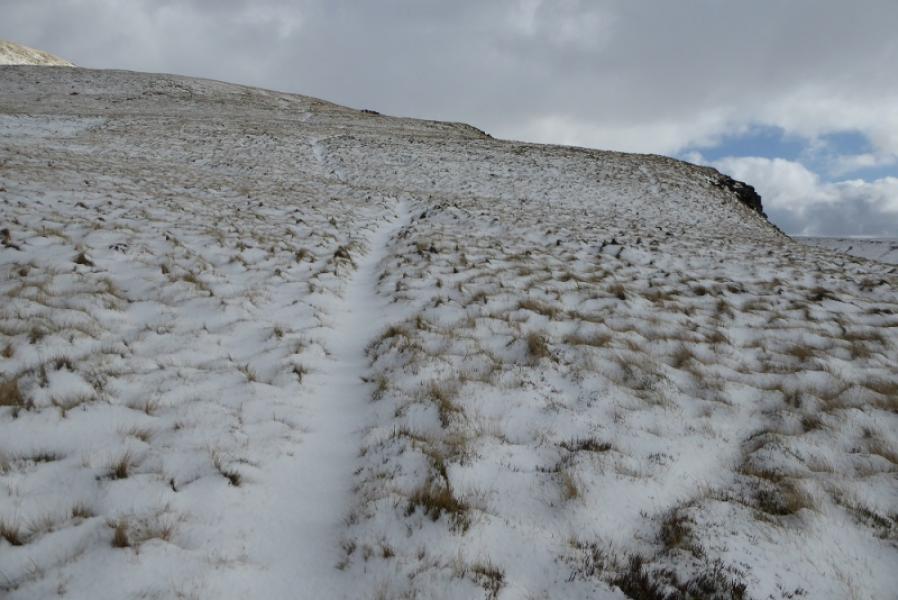
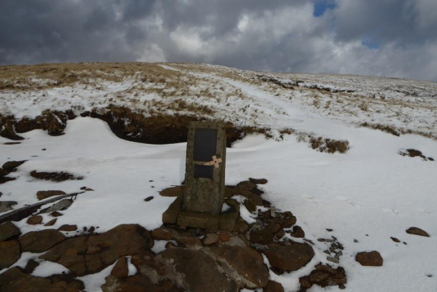
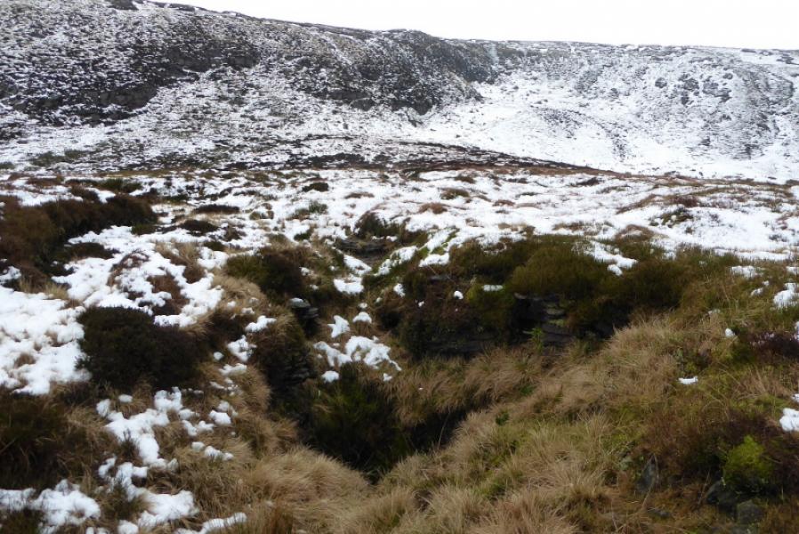
(1) Walk up the track alongside Shelf Brook which is the continuation of Shepley Street beyond the turning circle. After about 800 m and just after crossing the bottom of Small Clough ( the bottom of Small Clough is named as Shittern Clough on 1 : 25 000 maps), there is a gate across the track with a small gate to the left. Do not take the path through the small gate as it leads up the Yellow Slacks ridge (this route is posted separately), instead stay on the main track. Further on, near a large barn, a signed grassy path forks right for Doctor's Gate which is the route to be taken. Follow the track/path for about 1 km to reach the foot of a ridge ascending roughly NE. This is just after Little Clough and about 300 m before the footbridge over Shelf Brook. On 9/12/19, some saplings had been planted at the foot of this ridge with the path up the ridge going through them. Follow the path up; it is steeper in a few places but mainly grassy and easy to follow. In places, there is a choice of paths and either can be followed. Higher up, cross a stile below a rocky top and continue up. Reach an air crash memorial with a small amount of wreckage nearby. Continue up and cross a more obvious path which is the main path from Old Glossop to Higher Shelf Stones. Those wishing to detour to Higher Shelf Stones could turn right here, go to the summit trig point, passing Lower Shelf Stones, then return to the same point. After crossing the main path, the path soon fades away and clear weather is need to find the highest point as the ground is fairly featureless but if found, it is James's Thorn, 572 m; there is nothing to mark this point.
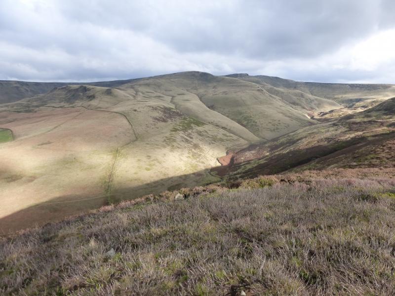
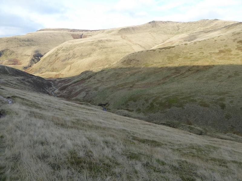
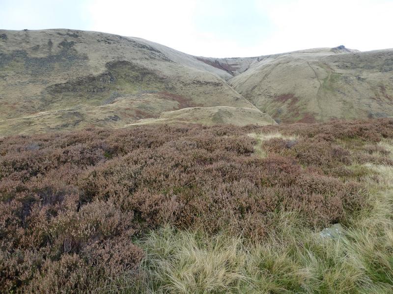
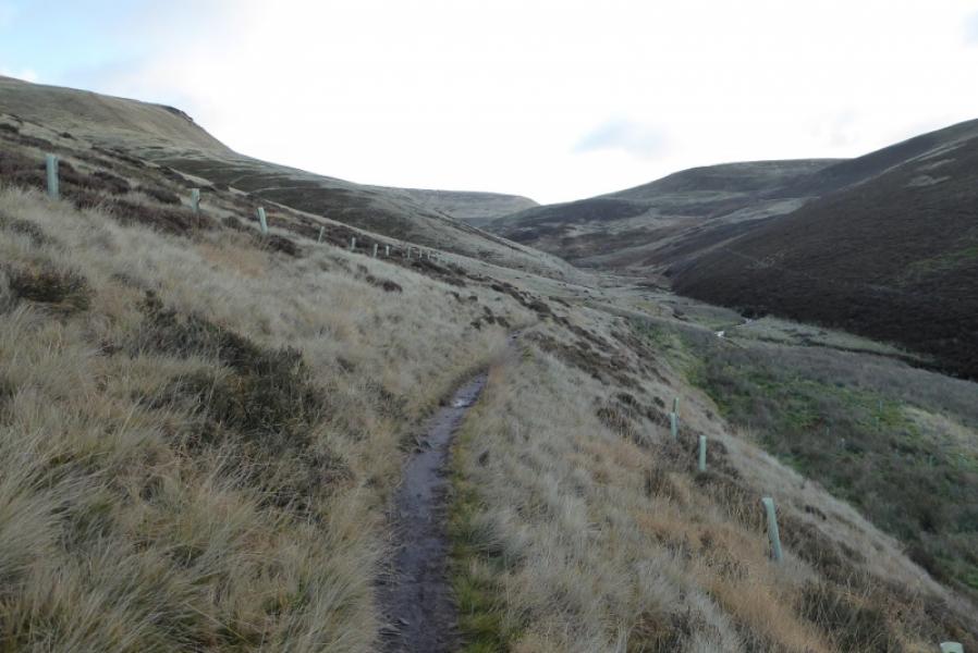
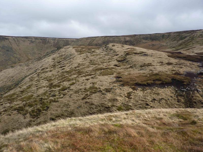
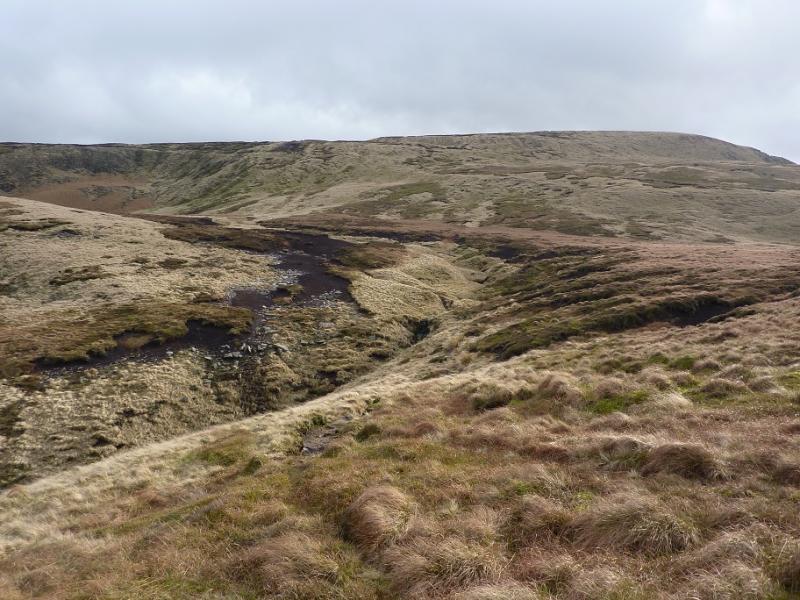
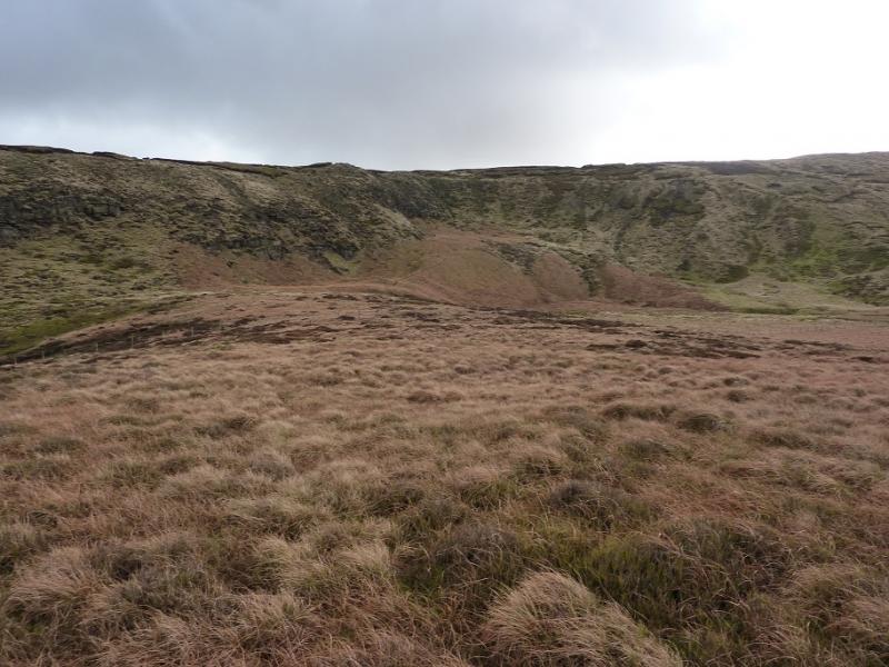
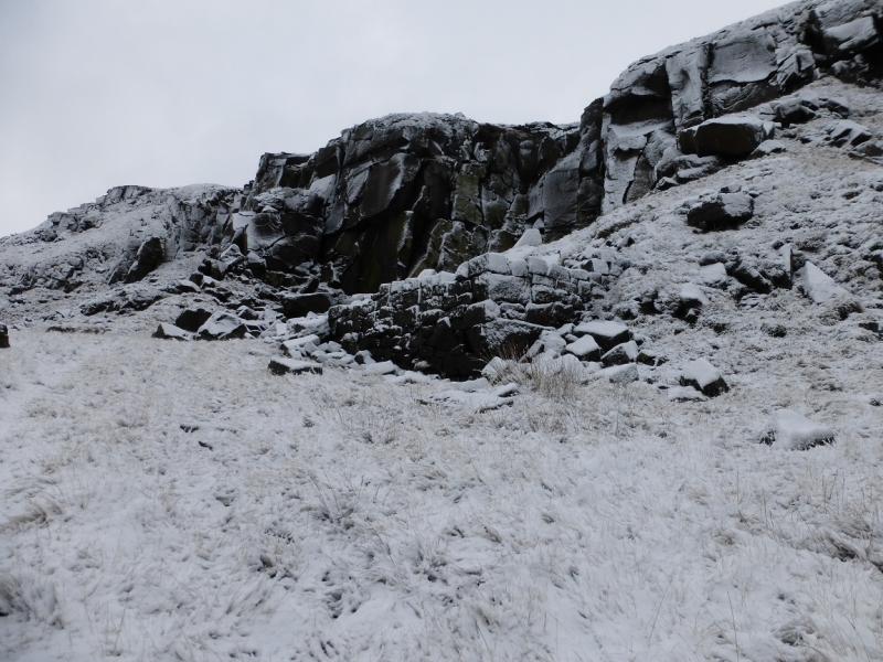
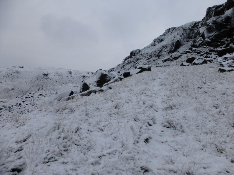
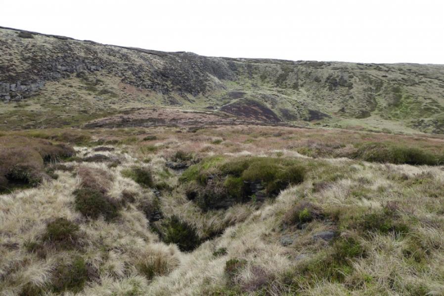
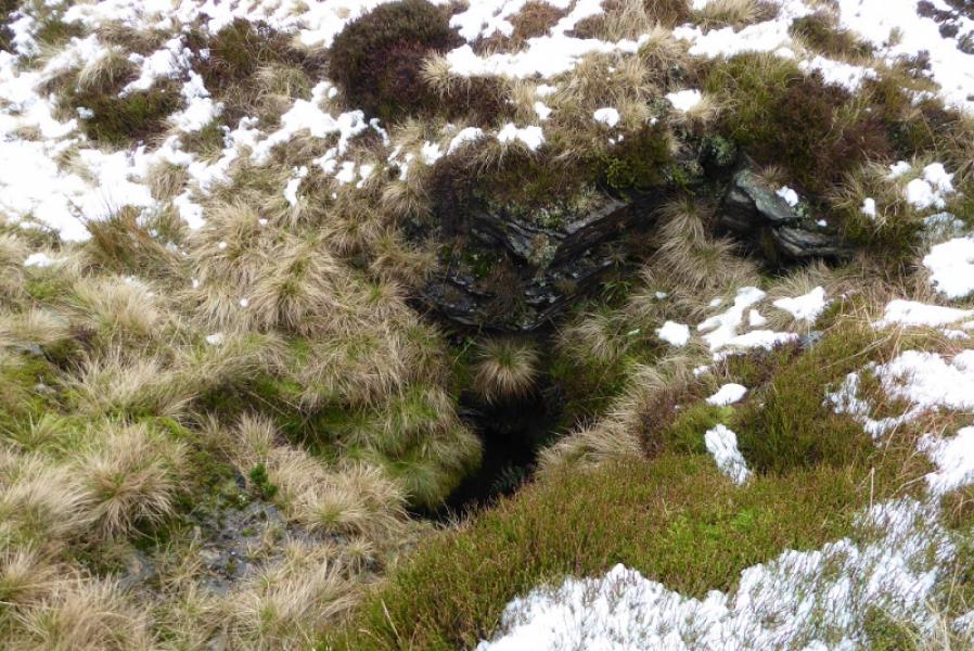
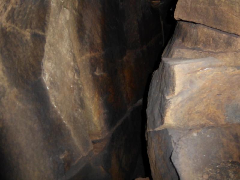
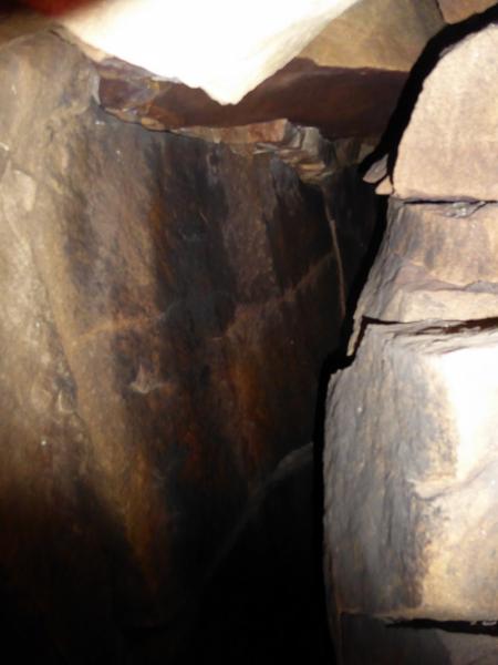
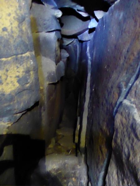
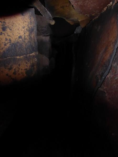
(2) The next section is somewhat indeterminate as there is no really distinctive path. Head roughly WNW and descend down a mixture of grass and outcrops, crossing a fence, to reach flatter ground shown on the map as Wigan Clough. The stream in the clough goes around the north end of Shelf Benches but you need to head to the plateau of Pt 467 which is likely to be about NW. Stay on the top of the plateau/ridge where there is a faint path and head towards the obvious fence crossed earlier. About 100 m before the fence, go left and look for some hollows in the grass. The first one is likely to be just a hollow but just after is Ferny Hole. If you reach some outcrops, you have gone too far. Be careful near the hole as it is not fenced off. It is possible to carefully descend into the hole from the shallow slope side but it can be slippery and soon becomes pitch black so a strong torch is needed. It is about 3 metres down then there is a short and quite narrow cave (2 people cannot pass each other) with a straightforward drop to step over to reach its end. At the end of the first section, a very awkward flake blocks further progress to a lower level. It seems more like an underground cleft than a proper cave. Unusually, the cave and hole are not fed by a stream on the surface but may be fed by one underground. By the way, this is not limestone country where one might expect such features; the rock is millstone grit as on many of the famous climbing edges in the Peak District. The outcrops, towards Yellowslacks Brook, roughly NW of Ferny Hole, are worth a look and another cave is reputed to be amongst them somewhere.
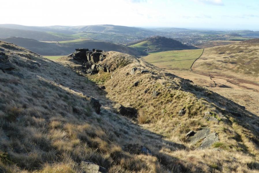
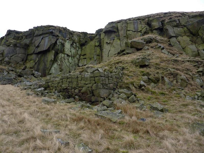
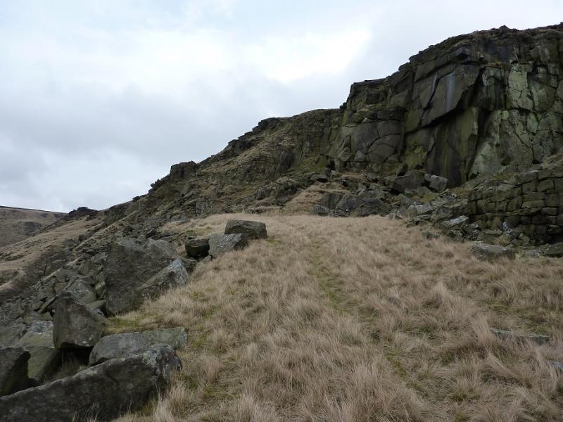
(3) Retrace to the path along the plateau and follow it south. Cross the stream in Wigan Clough then up onto the northern end of Shelf Benches and either follow the grassy path above Shelf Benches until it meets the main path from Higher Shelf Stones to Old Glossop or, more scenically, drop down and follow a path below the cliffs of Shelf Benches to come out at roughly the same point. Once on the main path, follow it past the barn and back to Old Glossop.
Notes
(a) This walk took place on 13th February, 2020.
Photos - Hover over photo for caption. Click on to enlarge. Click on again to reduce.